Wells Peak

Trip Date: Sept 1, 2013

Participants: Alex Le, Nikta, Ed Zenger, Brittany Zenger, Geoff Zenger

Difficulty: 2/3

Report: Although only 16 days after quite invasive surgery, a great Sunday forecast gave me the energy to try and do something other than rest and recover and instead to get out in the mountains for the first time in a few weeks.  Wanting to find something within my diminished energy levels, I hit on the idea of going to Wells Peak, the southern neighbour of Hope Mountain (which I climbed last October).

We met at my place in New Westminster and set out towards Hope just before 9am, and after a quick stop in Hope, headed up the Mount Hope FSR.  The road leading up to the final junction is in slightly worse condition than it was last fall, but shouldn’t give anyone with a high clearance 4×4 any trouble.  It is a bit loose in places, and some small rocks needed to be cleared out of the way, but the water bars are all well constructed and easily passable.  Last fall, the last 500m of road, from the final junction to the trailhead was badly overgrown with alder, but someone has done a great job clearing the road, and we were able to drive the last section of road with nary a scratch on the Jeep.  Many thanks to whoever cleared out the road and repainted the trailhead signs!

We started on the trail just past 11:30, and were pleasantly surprised that although the first part of the trail through the cut block is quite overgrown, it is overgrown with soft bushes and grasses, unlike the Hope Mountain trail, which is overgrown with small conifers through the cut block.  Once the old growth is reached after around 20 minutes of hiking, the trail is well built and easy to follow as it rises steeply up towards the beautiful meadows below Wells Peak.

Up in the meadows, the trail peters out and we stopped for lunch.  Having forgotten our trail description back at the trailhead, we set out towards the notch just NW of the main summit of Wells Peak (climbers right of the summit, 103 hikes recommends crossing the meadows and heading up the ridge climbers left).  Although it looked steep from a distance, reaching the notch was only class 2, and from there we turned left and headed up on the ridge crest towards the main summit of Wells Peak (note that the summit NW of the notch has a large cairn on top, but is not the highest summit).  The NW ridge has some exposure and one 3m class 3 step that must be negotiated before reaching the main summit, but everyone made it up, and by 2pm we were all on the summit.

The summit of Wells Peak has great views all around with clear views of the Chehalis, Judge Howay, Slesse, Rexford, Outram, Tulameen, Coquihalla, and the Silvertip group.  We sat down for another snack and to lounge about on the summit only to find that the summit was infested by a swarm of annoying (non-biting) flies.  Nonetheless, we spent 30 minutes enjoying the views before heading down towards the SE to see if that ridge provided an easier route to and from the summit.

The SE ridge of Wells Peak does descend down to the meadows without any rock scrambling, but is covered in slippery vegetation, and so in the end, I’m not sure whether it’s really any easier than the NW notch route.  Regardless, we all made it down to the meadows without injury, found the trail once again, and in what felt like no time at all, were back down at the Jeep by 4:30.  Total trip time: 5 hours.

As a final thought, which trail do I prefer?  Wells Peak or Hope Mountain?  Wells Peak is a more direct route, and less bushy, but I still prefer Hope Mountain slightly due to the route up the ridge being more enjoyable, more varied and having a much nicer summit.  Too bad someone doesn’t go and brush out the first 1km of the Hope Mountain trail…

Continue ReadingWells Peak

Matriarch, Macabre Tower, Grimface Traverse

Trip Date: Aug 11-13, 2013

Participants: Brittany Zenger, Geoff Zenger, Kris Wild (guide)

Difficulty: 5 (Mandatory climbing to 5.6, optional to 5.10a)

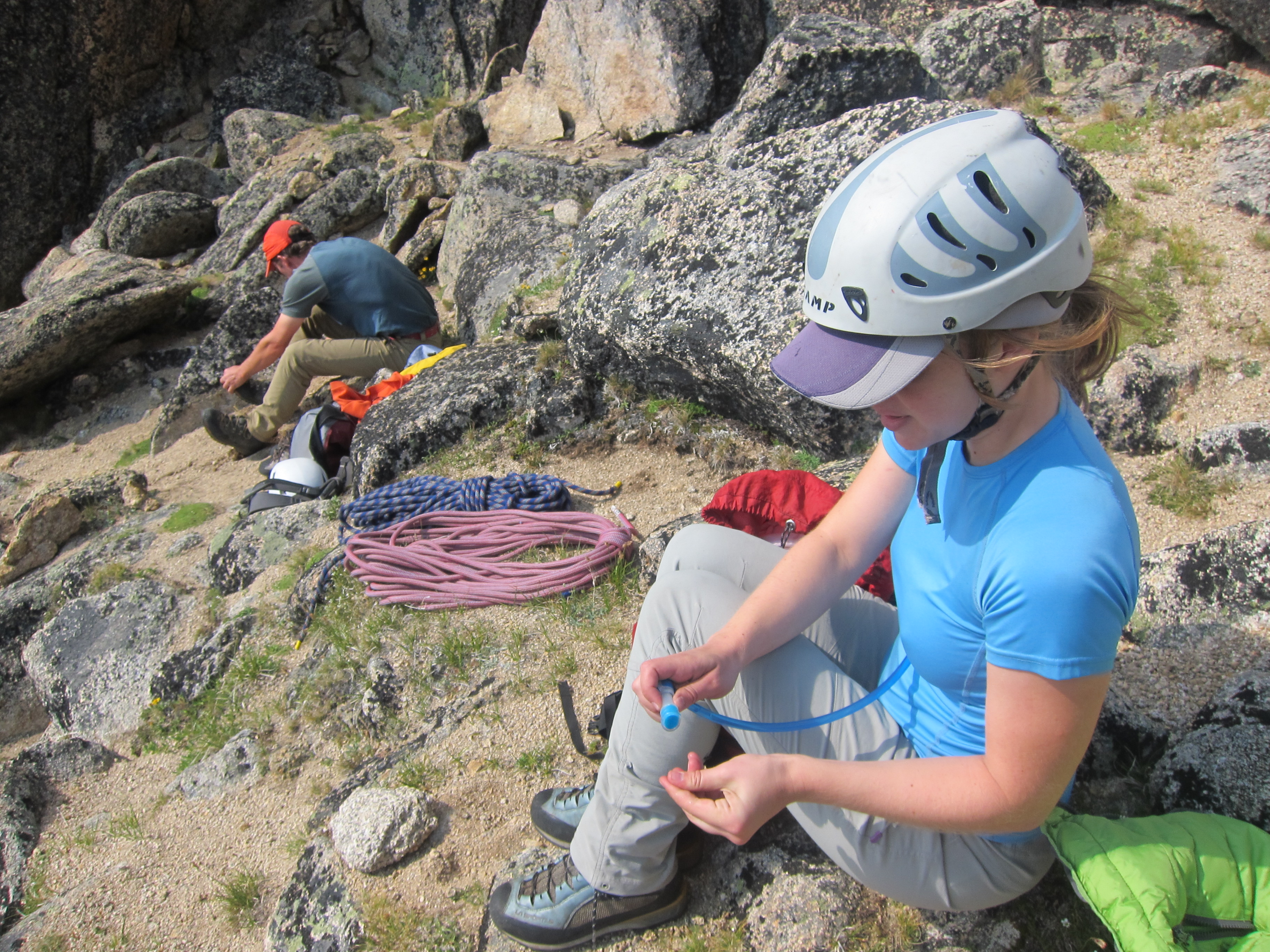
Gear: We climbed on two 30m ropes, and a small rack of small to mid-sized cams with a couple nuts.

Report: Ever since encountering a description and topo for the Matriarch, Macabre Tower, Grimface (MMG) traverse in Beckey’s Cascade Alpine Guide a couple years ago, it’s been near the top of my list of routes that I’d like to do.  Described as a classic traverse of three peaks over an exposed ridge on solid granite, requiring numerous climbing techniques, but never becoming excessively difficult, it appeared to be a great way to get a taste of alpine rock.  In order to have a good chance of success, for our anniversary this year I decided to arrange for a guide to come with us into the southern parts of Cathedral Provincial Park to attempt the route.  The route did not disappoint.

Brittany and I drove out to Keremeos Saturday evening (Aug 10) and camped in one of the pleasant forest service campgrounds along the Ashnola Creek FSR while an intense thunderstorm raged overhead.  We woke up early Sunday morning to wet ground but clear skies, and travelled back to Keremeos where we met our guide Kris at the Ranch restaurant for breakfast just before 7 am.  After a quick bite and filling out the requisite paperwork we headed back up the Ashnola road for approximately 48 km (to just past the 38 km marker) to the Centennial trail trailhead from which we departed a bit past 9 am.  The road would be drivable by a low-clearance 2wd vehicle, but as the road is rough in places, the drive would go a fair bit quicker in a high clearance vehicle.

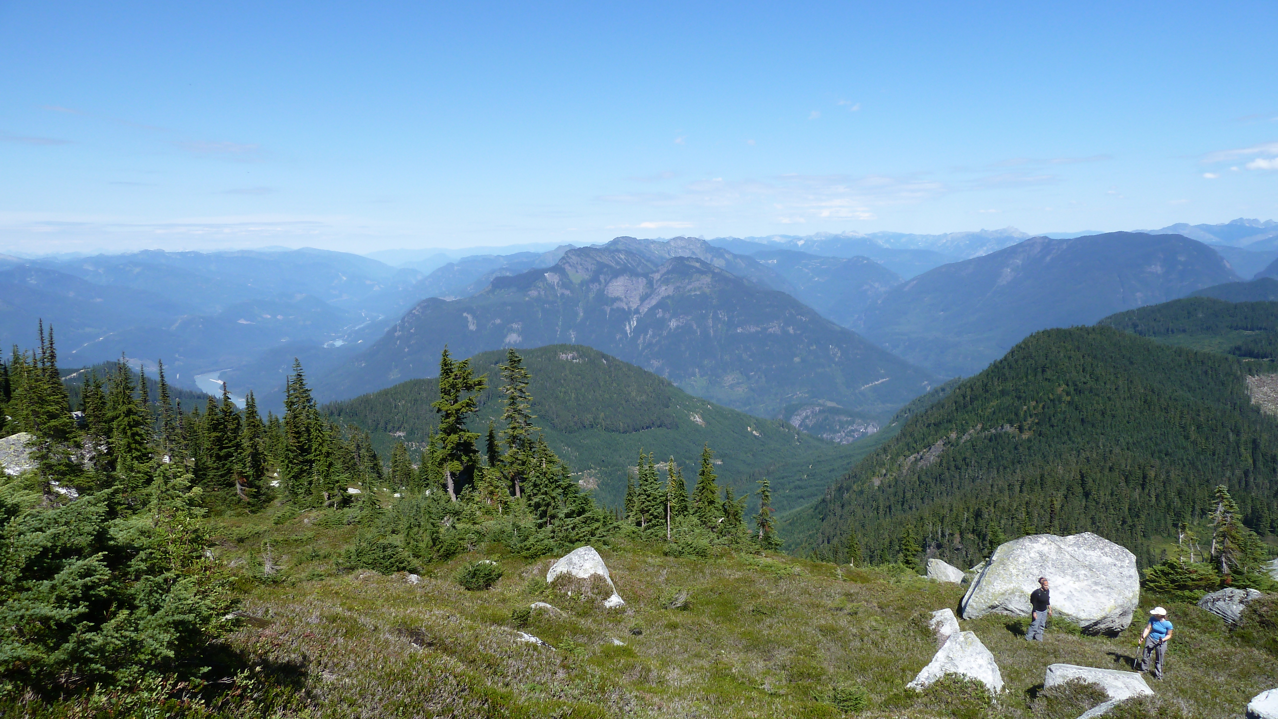
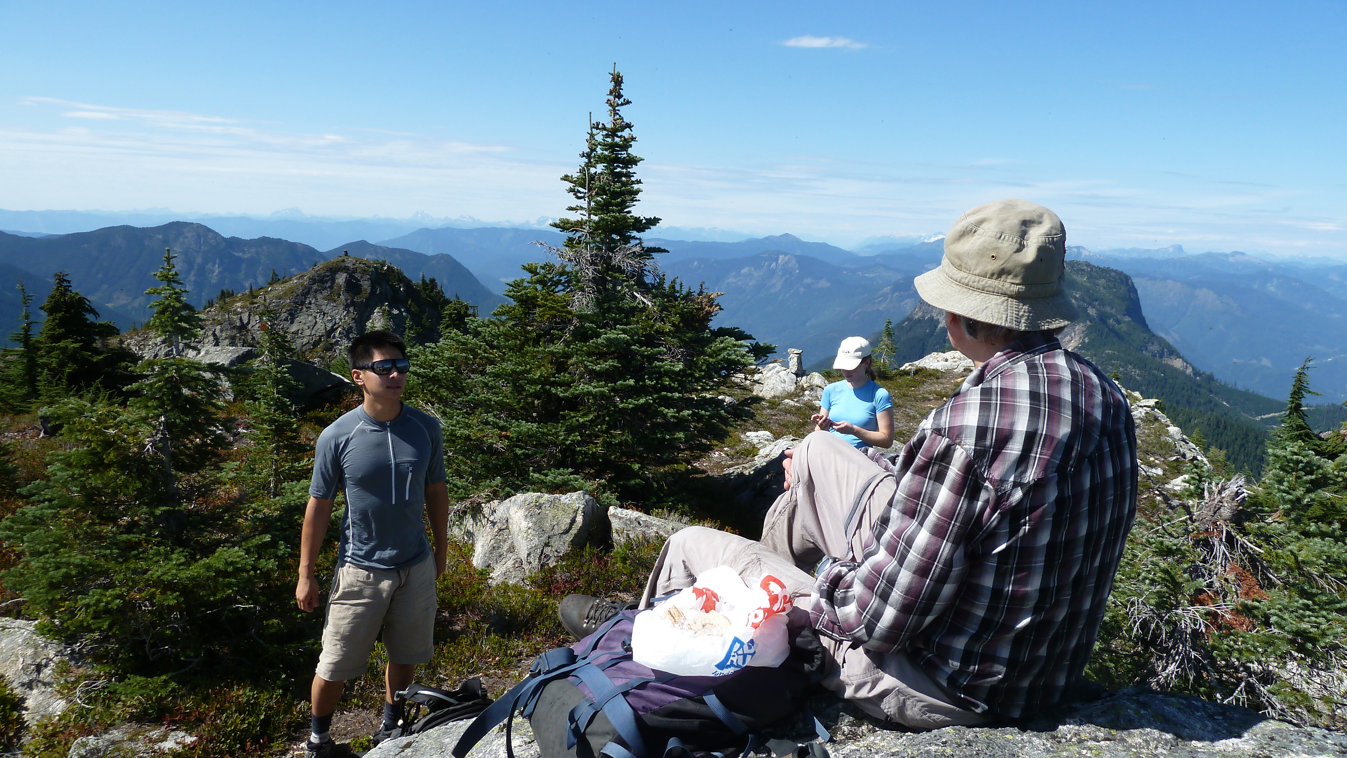
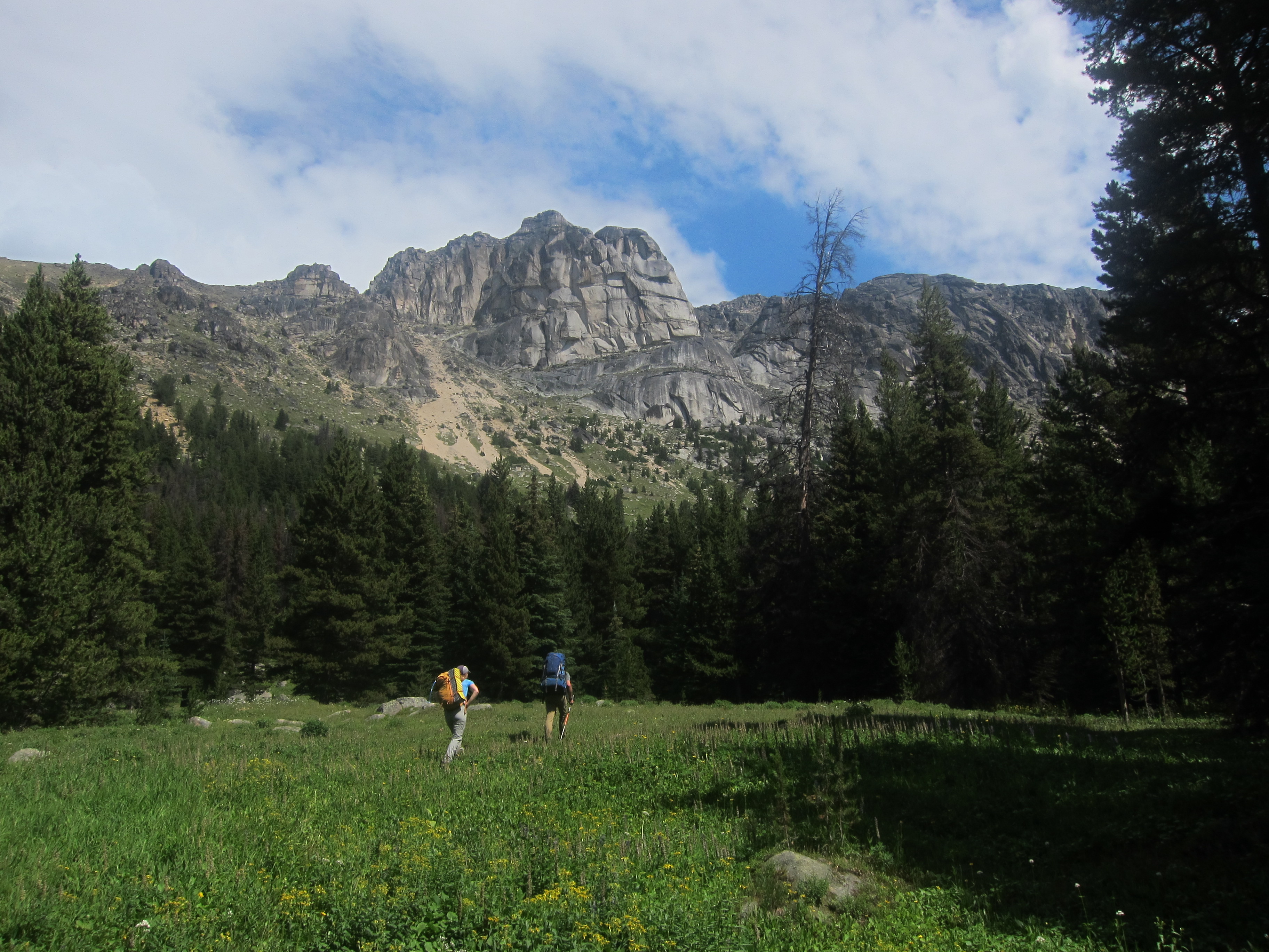
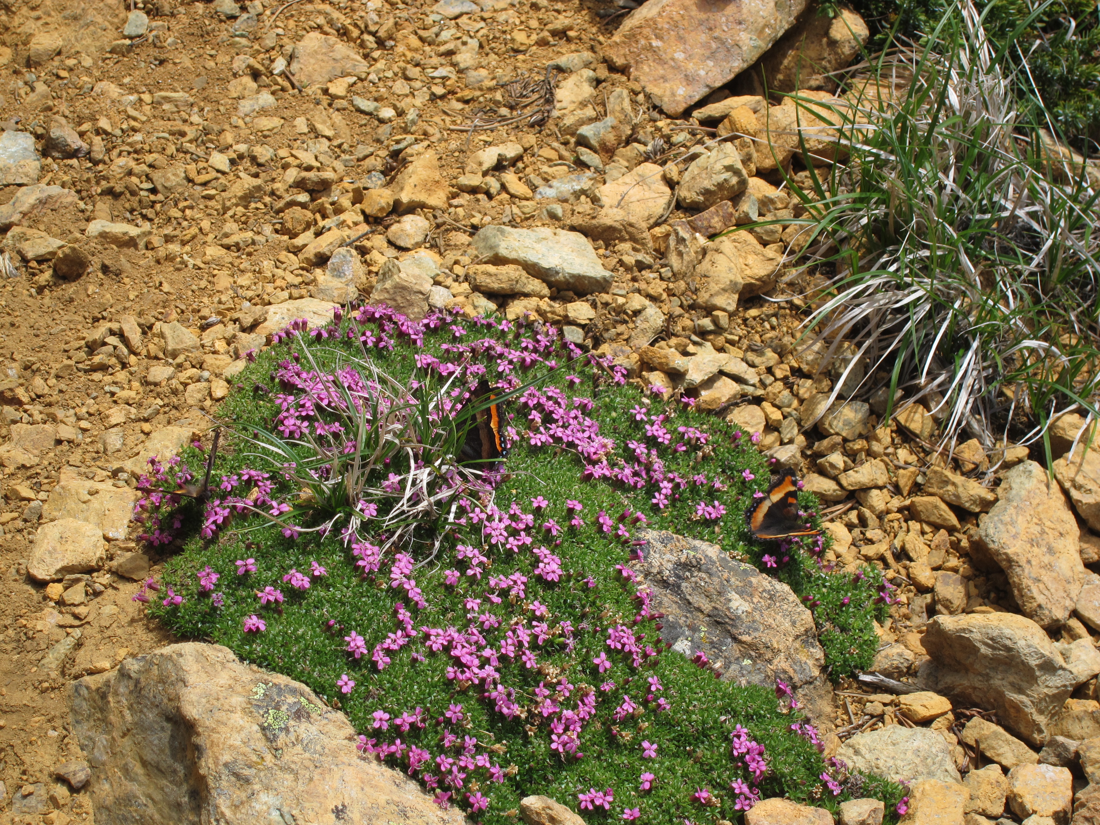
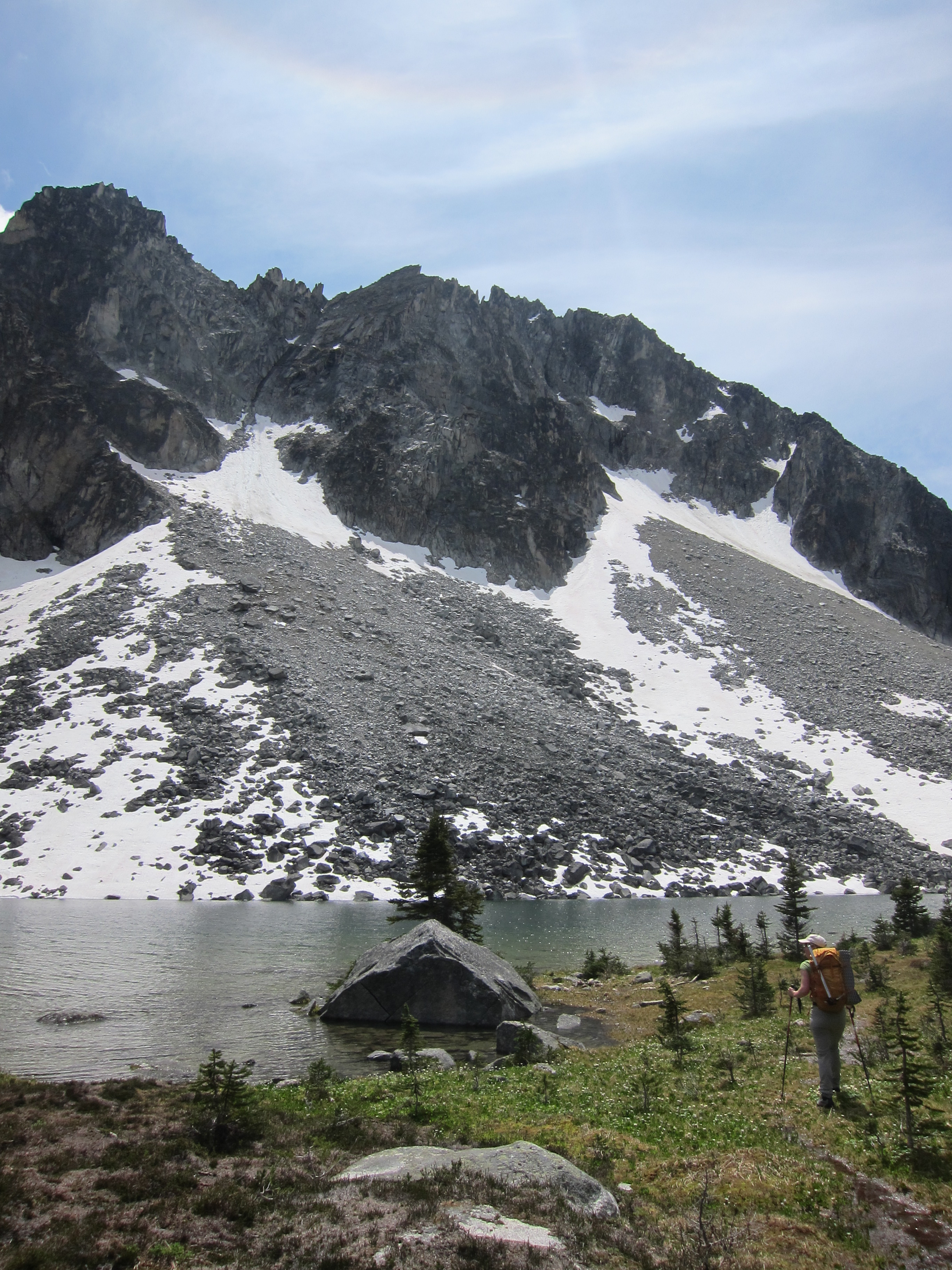
The first ~5km of the route into Wall Creek are on the Centennial trail, which was in great condition as it had recently been prepared for the upcoming Fat Dog trail race.  After approximately 5km the trail branches, with the left branch clearly labelled as heading to Cathedral Lodge / Quinscoe Lake.  To head up Wall Creek, take the right fork.  The trail has a lot of deadfall in places, which led us at one point to end up off the trail for about 30 minutes, but for the most part it is easy enough to follow and as long as you stay on the north side of Wall Creek you will eventually return to the trail and to the beautiful camping meadows.  We reached our camp site after just over 4 hours of hiking and sat down to prepare some soup and enjoy the sun, but the sun wasn’t to last and within the hour a thunderstorm came in to get us wet again.   Luckily we found a tarp stashed nearby that we set up to keep ourselves dry as we ate our dinner, and after the storm died down, Kris and I headed up the slopes towards Grimface to explore the ledges below its south face, and made it back before the storm came back in again.   We went to bed wondering whether the weather would be good enough in the morning for us to attempt the traverse.

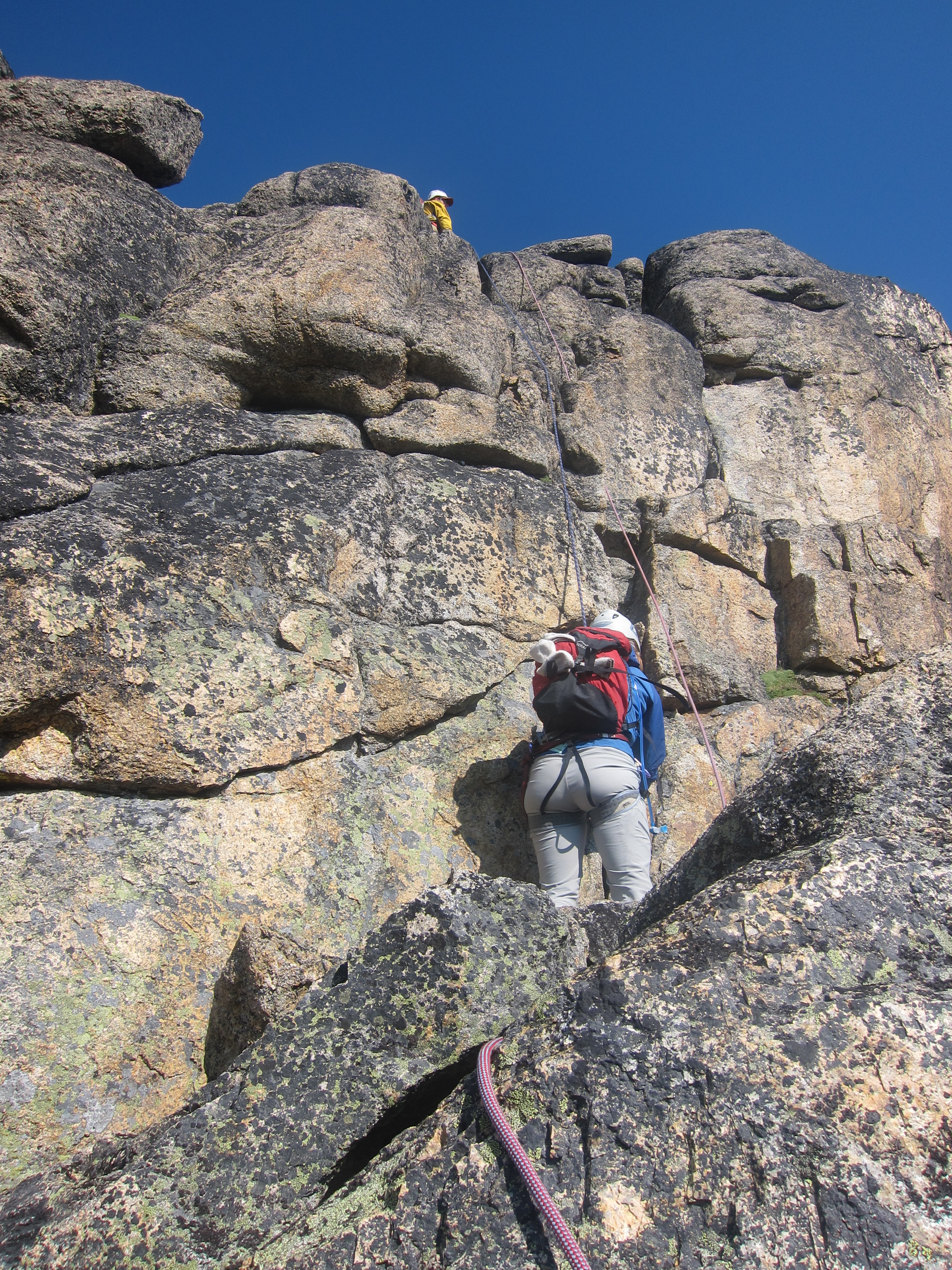
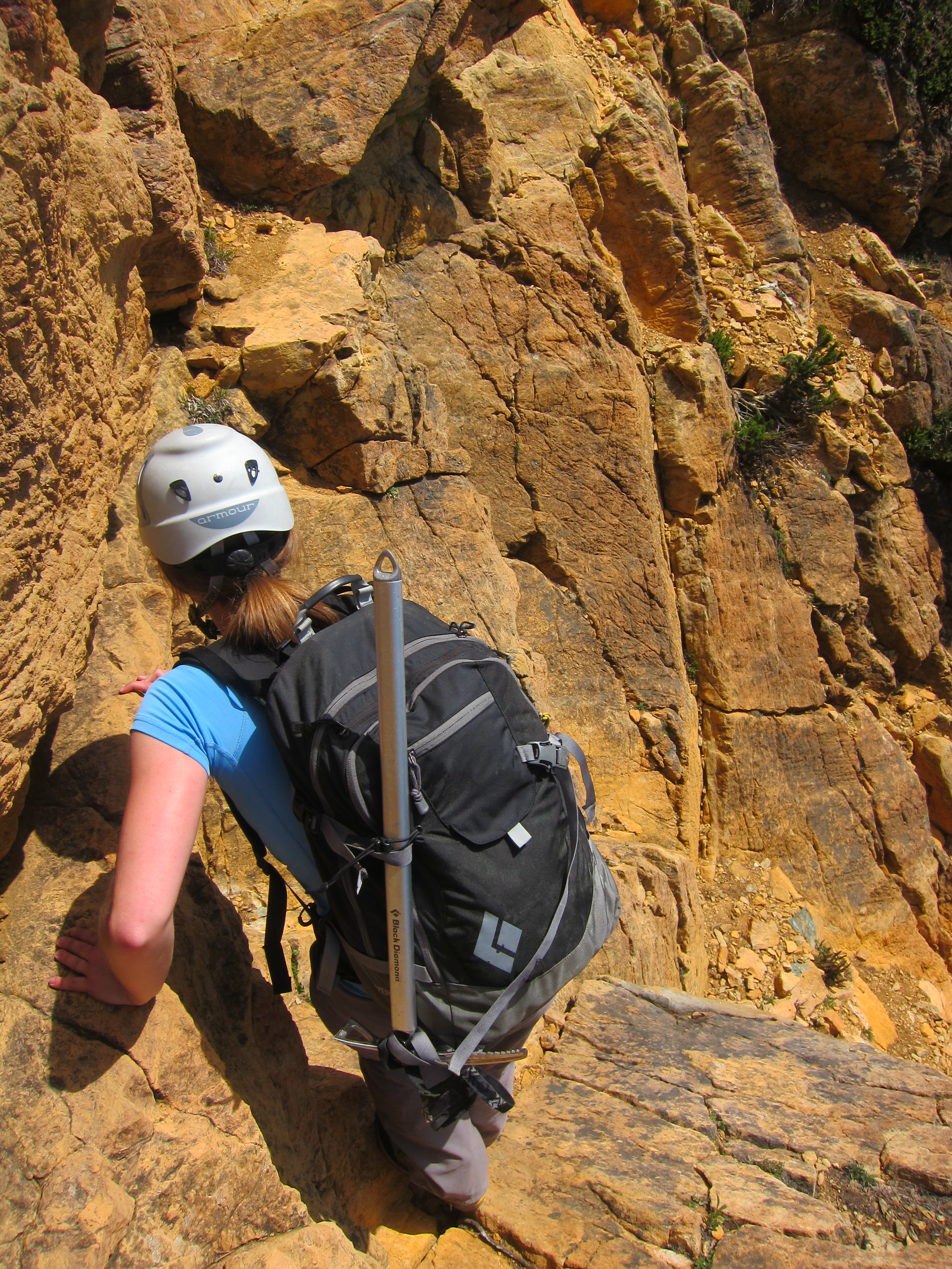
We woke up early on Monday morning to clear blue skies, and set out quickly, beginning our march towards the Wall Creek-Ewart Creek col at about 6:45am.  It took us about 40 minutes up to the col, from where we began our fun scramble up to the notch between Matriarch Mountain and Denture Ridge (including encountering a relaxing mountain goat on the route).  It took us approximately 30 minutes up to the notch, and from there we roped up, put on our rock shoes (wear comfy ones!), and started on the technical part of the route around 8:30.

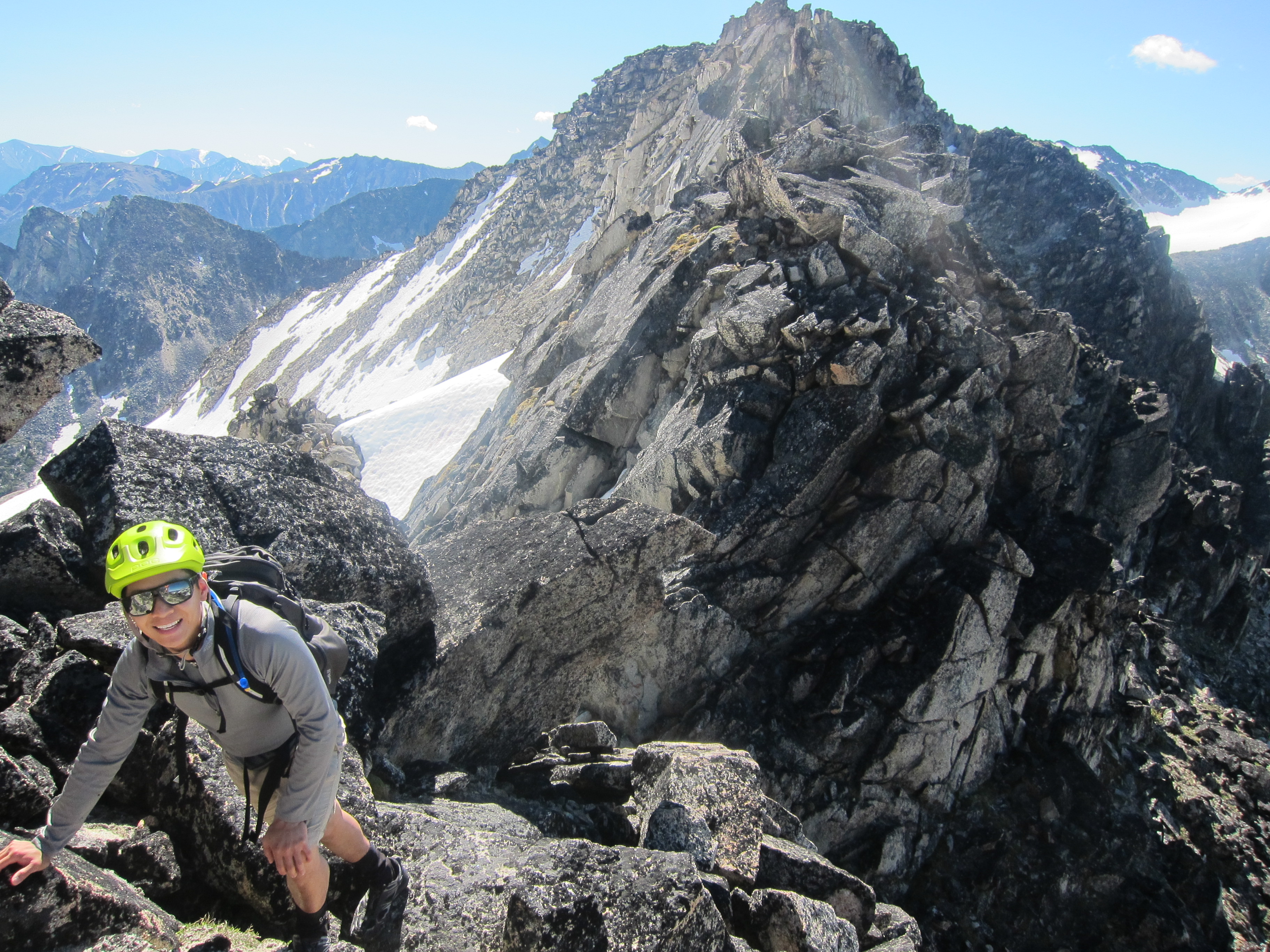
The climb to Matriarch mountain begins with a short pitch of low-5th up a gully, and then hits you quickly thereafter with a wild short exposed pitch of 5.6.  Once on the ridge proper, it rambles along towards Matriarch through a series of short low-5th notches, eventually reaching a short wall just below the summit that has a 5.3 chimney on the left and 5.8 crack straight up the middle.  We took the 5.8 crack up the middle, and reached the summit at about 9:45.  From here, there is an exposed rappel into the first major notch, where there is a short bolted au cheval over the chockstone at the bottom.  From here we went up and over another bump, followed by a longer rappel to a nice sandy ledge, and then a longer pitch up to a large flat and sandy ledge right below the blank wall / bolt ladder pitch.  We reached the ledge just past 11 o’clock and ate and relaxed for 30 minutes as Kris worked to reassemble a wood & webbing ladder that he had constructed years earlier to make it easier to second the bolt ladder.

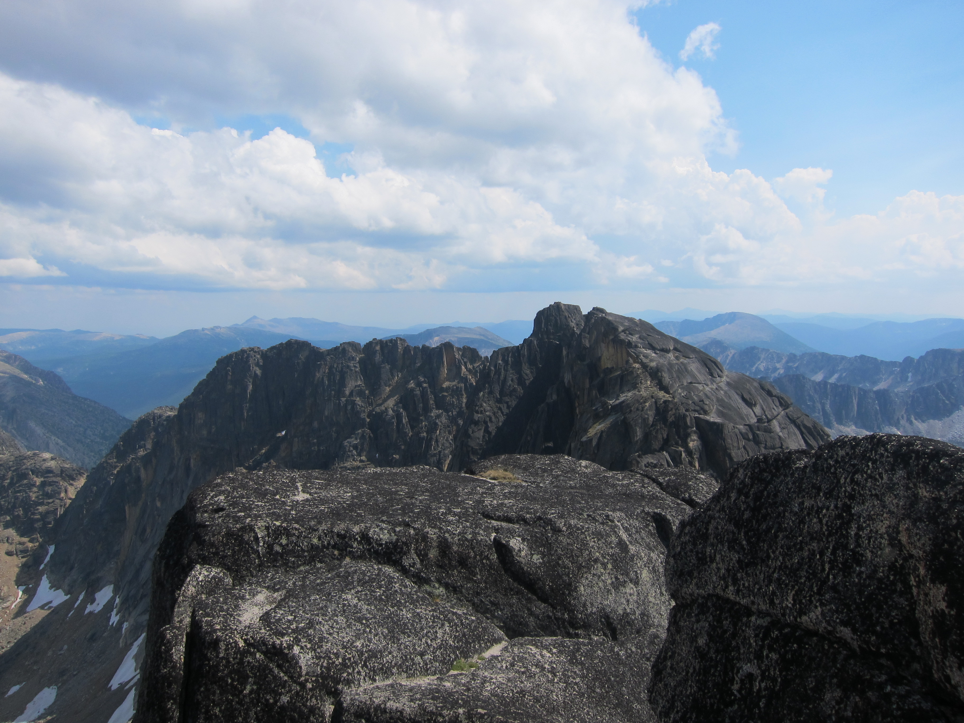
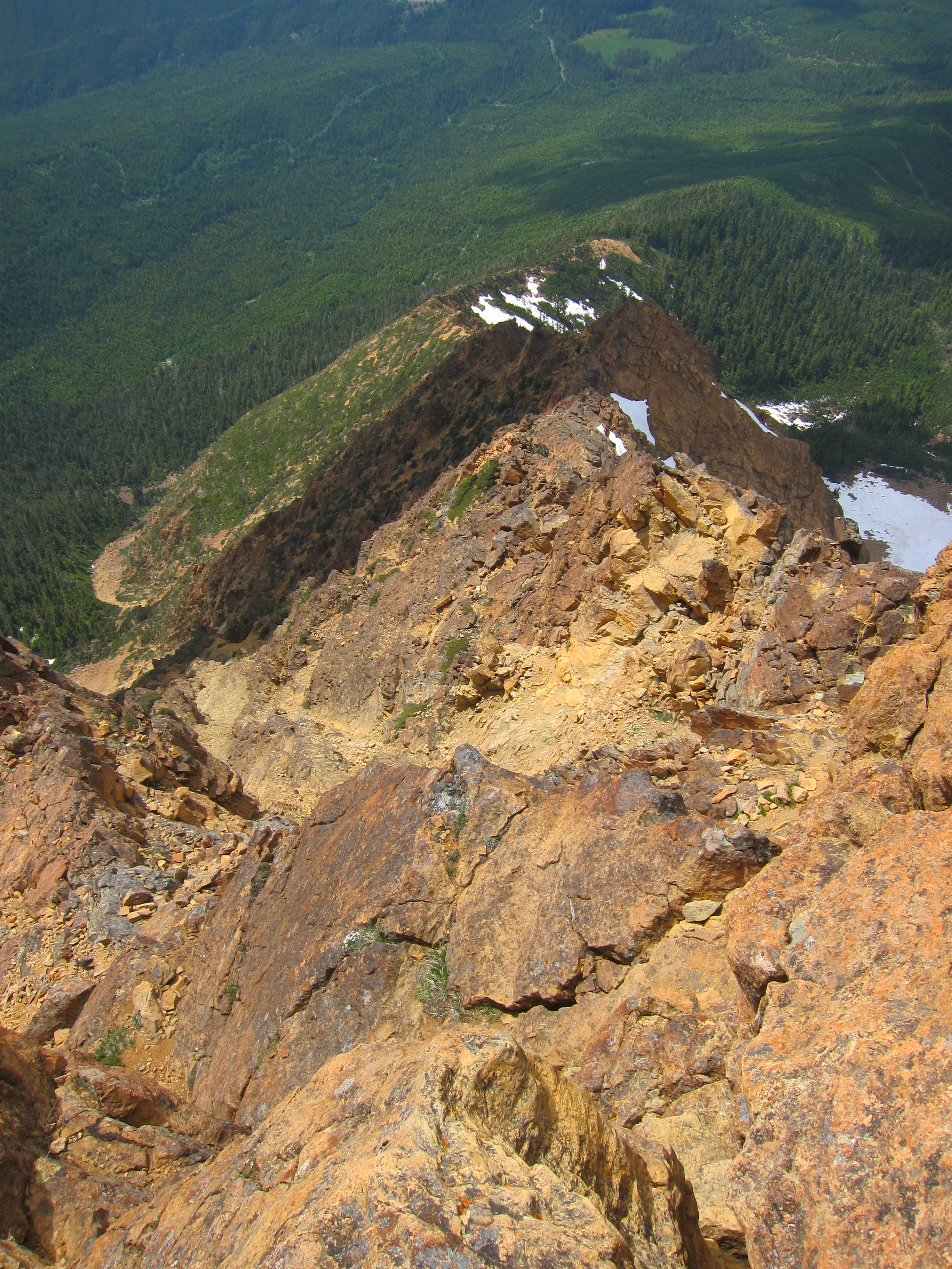
We got climbing again a bit past 11:30 with Kris leading the bolt ladder and setting up the newly repaired ladder for us to follow (the ladder is now properly stashed away at the top of the pitch.  Please do not leave the ladder hanging off of the top bolt and in the wind after you use it!).  Another short pitch brought us to the top of Macabre tower, and we shortly found ourselves rappelling / being lowered into the third major notch, this time having to climb over an exposed chockstone before reaching safety at a bolt on the far side.  One move of 5.6 brings you up to a long scrambling section that eventually leads to a long rappel down a chimney, leading a ledge from which we downclimbed to the top of a large sand and scree gully that led back down to Wall Creek.  Yet another few pitches of low-5th, scrambling, and lowering brought us up and over the final rib to the base of Grimface mountain, which we reached at about 1:40pm.

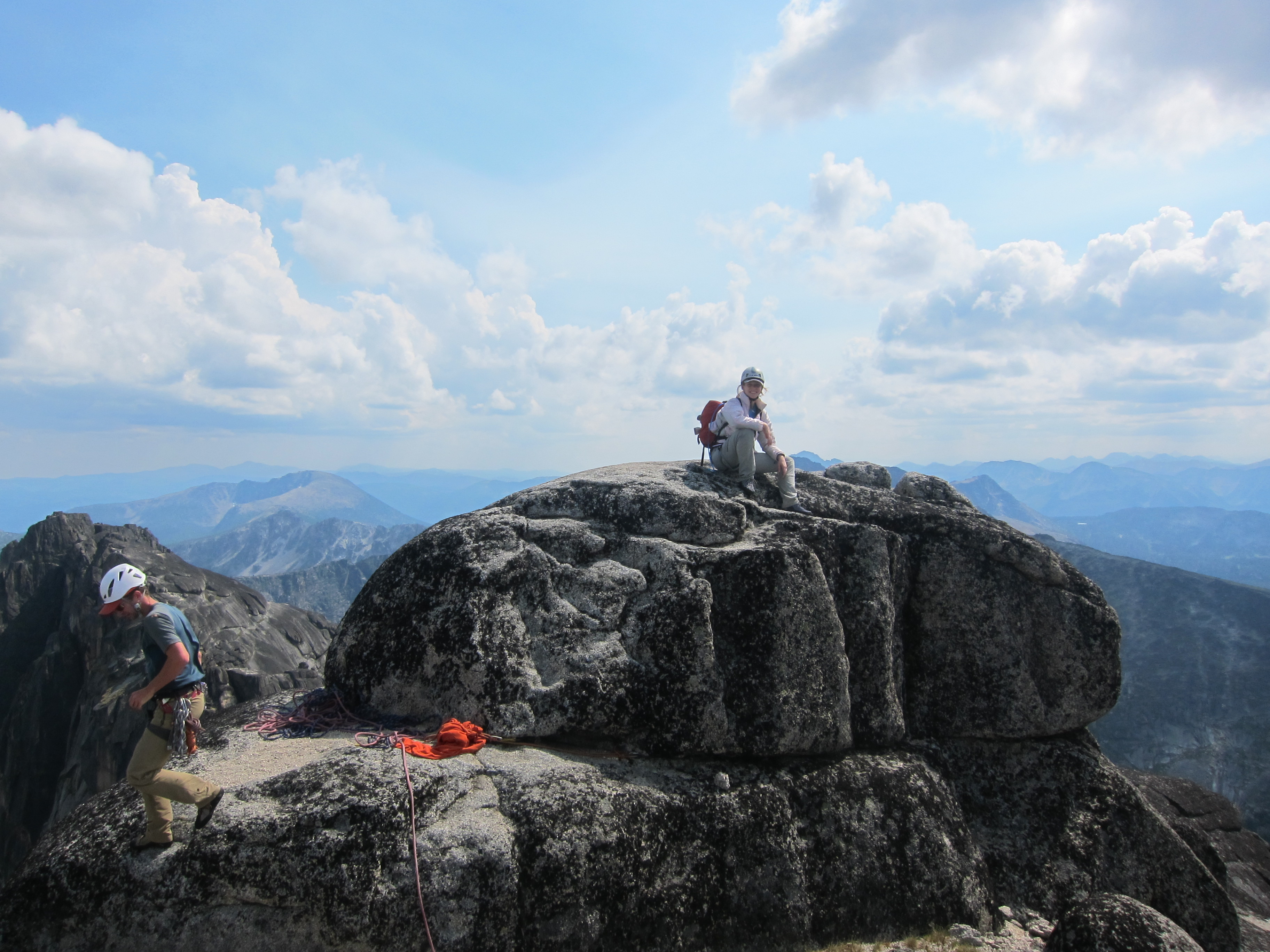
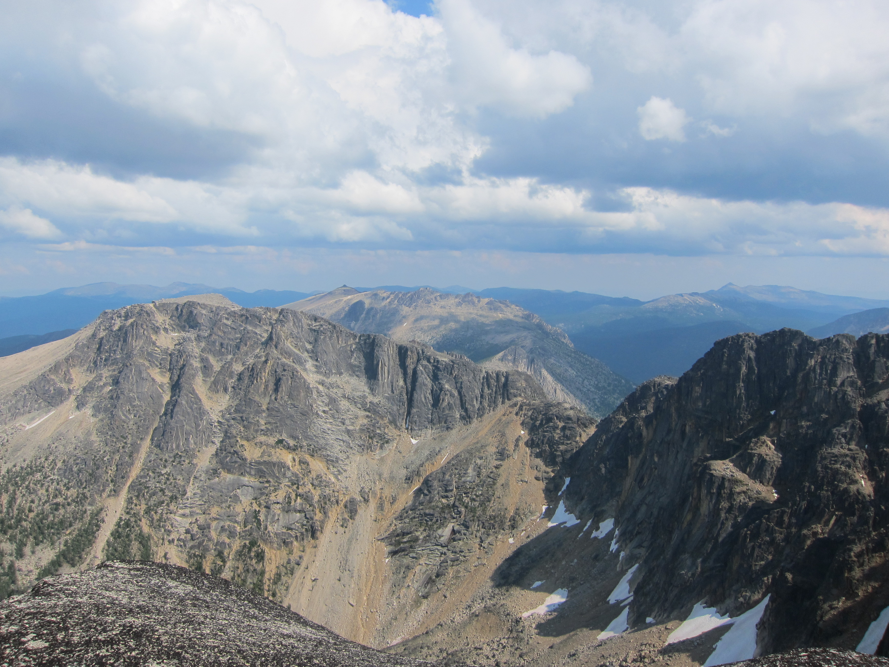
From here we climbed the route listed in Beckey’s book as the “Southeast Notch” route.  Although it appears steep and exposed from below, the route in fact works its way up a series of quite unexposed mid-5th chimneys towards the summit of Grimface.  For the final pitch, I elected to take a 5.9/5.10a slab variation straight up as I was on top-rope (the standard route cuts left, then right on ledges to keep the climbing to mid-5th), and we were on the summit at 2:40pm.  Somehow, despite hearing thunder at times during the traverse, none of the storm clouds ever passed over us, and we had great (albeit very windy) weather for the entire route.  We relaxed on the summit and took in the views back at our route and also down at the part of Cathedral Park to the north that’s far more visited than where we were staying.

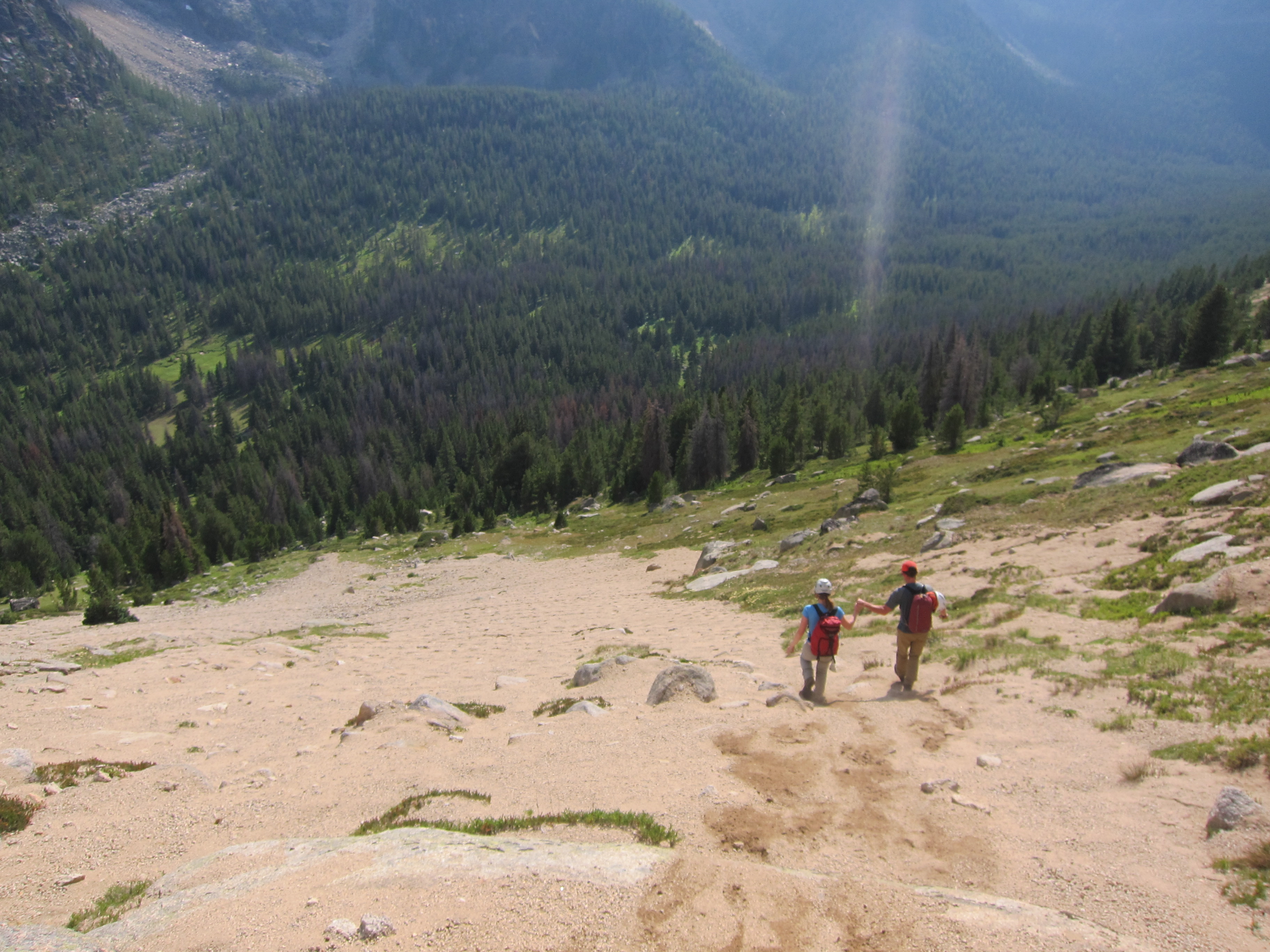
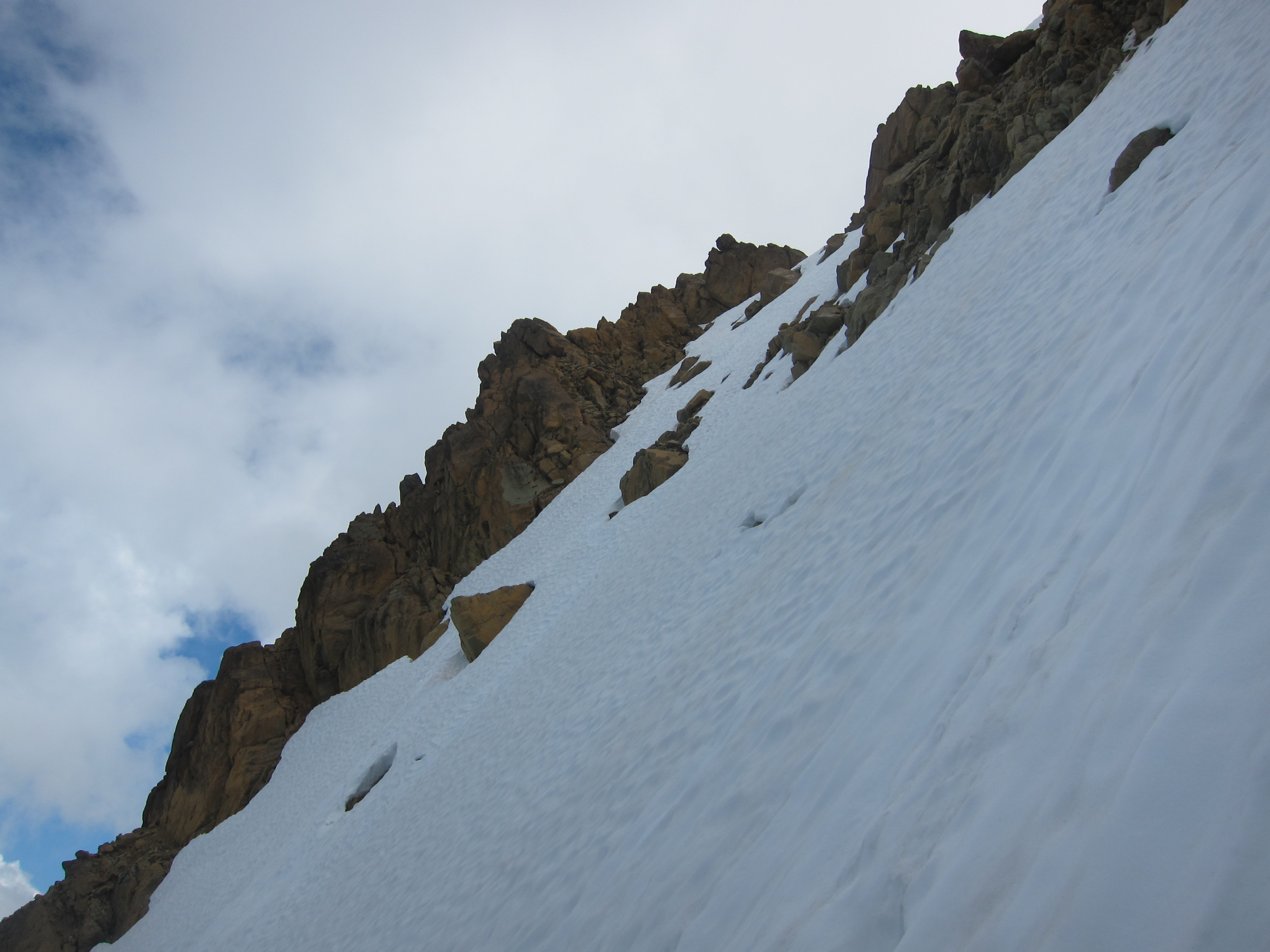
From the summit, we headed down the NW ridge of Grimface (the route described in Gunn’s “Scrambles” book) to the first notch, where we removed our rock shoes, put our mountaineering boots back on, and headed down the easy sand slopes straight back to camp, reaching camp just before 5 o’clock, surprisingly exhausted.  We relaxed for the evening and went to bed early.

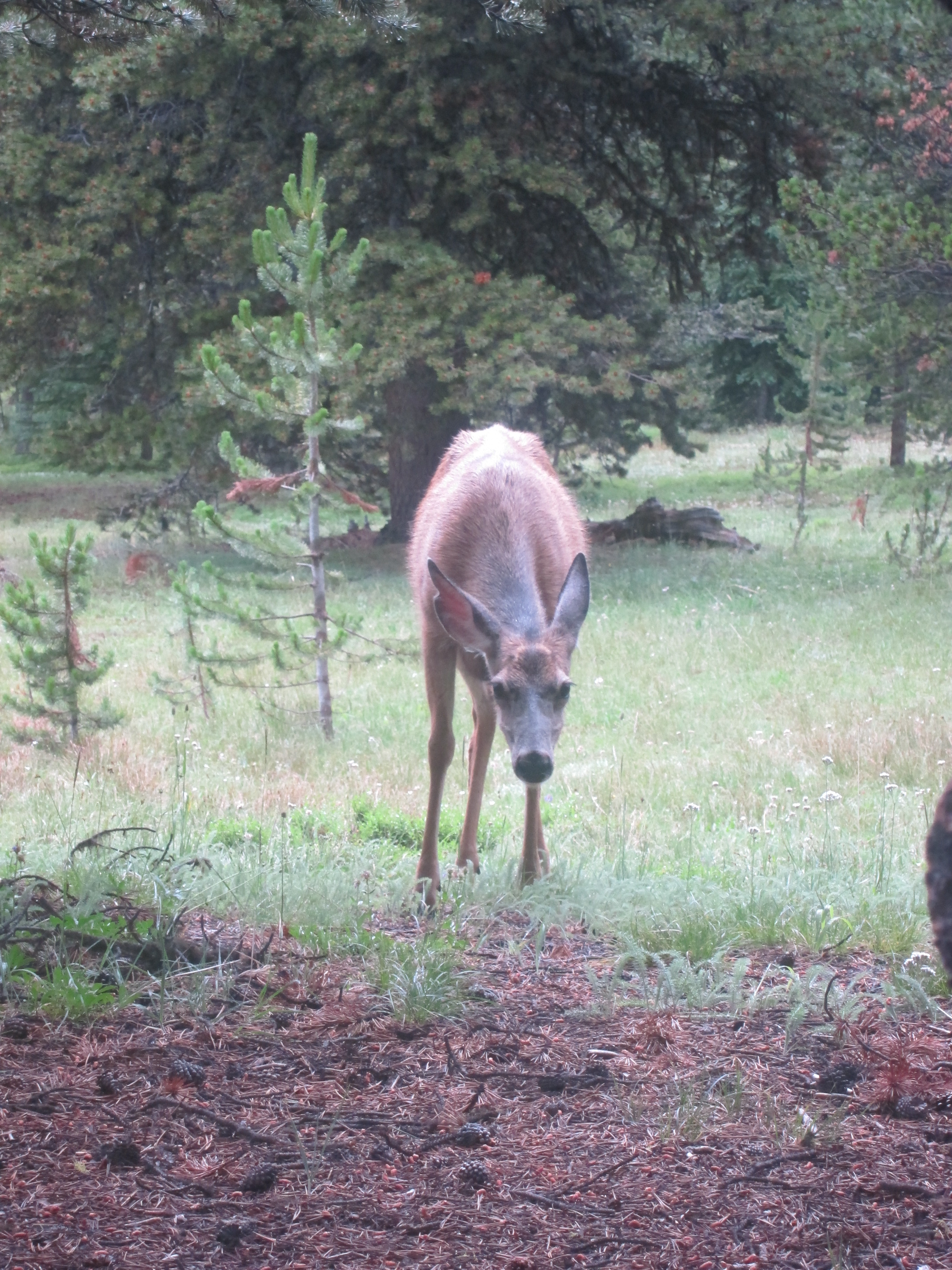
We woke up around 7:30 on Tuesday, packed up camp, said goodbye to the salt-loving deer that had hung out at our camp since we arrived, and started on our 14km hike back to the cars.  We managed to stay on the trail for the whole route out (it would be great if whoever goes in there next brings flagging ribbon to mark the trail better for future parties heading in), but didn’t move terribly quick, and it took us just as long to hike out as it took us to hike in.  Nonetheless, by a quarter to 1 we were down at the cars and washing our limbs in Ashnola creek.

In conclusion, it was a fantastic trip.  The route itself was phenomenal with good rock, exciting exposure, and plenty of interesting but not difficult climbing, the camping location is beautiful, and our guide (Kris) was great as well.  I would highly recommend him to anyone looking for a great day to have fun and push their limits in the mountains.  In all, this was a great introduction to alpine rock climbing.


Continue ReadingMatriarch, Macabre Tower, Grimface Traverse

Mt. Arrowsmith (Judges Route)

Trip Date: July 23, 2013

Participants: Brittany Zenger, Geoff Zenger

Difficulty: 3 (easy scrambling, mild exposure, very steep in places)

Report: Two years ago Brittany and I made an attempt on the Judge’s route up Mt. Arrowsmith on Vancouver Island but were turned around by bad weather just above treeline, and so we decided to make another attempt on the peak on our way back from Hornby Island this year.  We caught an early ferry off the island and headed to the trailhead, which is still no problem reaching in our 2wd car, and started off on the trail around 10:30 am.

The trail is easy to follow, but becomes steep and dirty near treeline.  Once above treeline, mixed in with steep gravel and dirt, there is some rock scrambling involved, although never above an easy 3rd class with only mild exposure simply due to the continuous steepness of the slope.  Nearer the summit the trail briefly becomes a bit nicer again, and we reached the summit in amazing weather at about 12:45 pm, only 2 hours and 15 minutes from when we left the car.  From the summit, there are fantastic views of Tantalus, the southern reaches of Strathcona Park, Hornby and Denman islands, many other peaks such as Garibaldi and Mamquam in the distance, and the large yellow haze that is Vancouver.

The descent took us slightly longer than the ascent due to wanting to travel carefully down the loose trail, but we made it down in time to grab some fish & chips at Bare Bones in Port Alberni before making our way back to Nanaimo to come home.  In all, this is a quick and easy route up a prominent peak with great views that can be done in 4-5 hours car-to-car.  However, I won’t be headed back any time soon… the trail itself is just too unpleasant due to its looseness, steepness, and lack of views until near the summit, to make me want to repeat it again for a long time.

Continue ReadingMt. Arrowsmith (Judges Route)

North Twin Sister (W Ridge)

Trip Date: July 6, 2013

Participants: Brittany Zenger, Geoff Zenger

Difficulty: 4 (possibly 3 if we stayed on route)

Report: Feeling like a longer route, Brittany and I headed across the US border and down to the Twin Sisters trailhead late Friday evening to car camp and get an early start on the Saturday.  We woke up reasonably early and set off on our bikes a bit past 7 the following morning.  We took our time heading up, but managed to make it to the end of the North Twin Sister spur of the logging road before it got too hot, and after a quick snack, headed up to the ridge.

The west ridge of the North Twin Sister is very impressive from below as it rises continuously for almost 500m vertical.  Low down the ridge is straightforward on fantastic rock, not exceeding a moderate 3rd class and we had no trouble making it up to the “drop-off crag” labelled in Beckey’s topo.  However, from here, we went off route.  Rather than quickly regaining the ridge crest just past the free standing obelisk (as is recommended in Gunn’s book and implied in Beckey’s book), we followed a long series of cairns out onto the south face of the peak, far below the ridge crest we were supposed to be following.  We wasted a lot of time here heading back and forth trying to look for better routes through the ledges and wondering whether we should continue, but continue we did, always finding more little cairns ahead of us.  Eventually the cairns lead to the headwall due south of the false summit, and well, there’s nowhere to go but up (this is roughly where a ‘steep rock rib’ is labelled in Beckey’s topo).

With no real alternative, Brittany and I scrambled up a couple hundred metres of solid 4th class terrain on less than stellar rock, eventually reaching the ridge crest just below the overhang at the false summit.  From here we could see the easy route as recommended in Gunn’s book (and by another party we met up there), but that meant traversing and descending a short bit, and in our tired state, we chose to go straight up and over the false summit.  This is described as “steep 4th class” in Beckey’s book, but other than two somewhat awkward bulges to surmount wasn’t too bad.  Finally on the false summit, we made our way across to the true summit, finally reaching it a bit past 3pm, a full 7 hours from when we started.

The views were great, but we could see a nasty cloud about to move in and didn’t wait long before scrambling down onto the snow slopes on the north face, which we followed down and around the mountain, eventually regaining the west ridge just 20 minutes above where we left our bikes earlier in the day.  The north face is steep at the top (approximately 45 degrees), and so an ice axe is essential, but it eases off fairly quickly.  It was at this point that the true value of the bikes became clear.  Rather than slogging down mile after mile of logging road, there is almost no pedalling at all required to make it down the road on a mountain bike and in just over half an hour we were back at our car.  Total round trip time was approximately 11 hours, which would probably have been ~1 hour shorter had we been smarter with our routefinding.

Continue ReadingNorth Twin Sister (W Ridge)

Mt. Sedgwick

Trip Date: July 13-14, 2013

Participants: Thomas Bissig, Ed Fischer, Helen Habgood, Darrell Harrington, David Overall, Ilze Rupners, Pavel Sorokin, Christina Williams, Brittany Zenger, Geoff Zenger (organizer and reporter)

Difficulty: 2 (some scrambling, much bushwhacking)

Report: I’ve stared at Mt. Sedgwick from highway 99 countless times over pretty much my entire life, but I never took advantage of the easy access to Woodfibre prior to the closure of the mill and ferry in early 2006.  Access today involves obtaining permission to dock at Woodfibre from its owners as well as arranging for a water taxi to take you over and pick you up, which can be costly.  Luckily for me, there are many others in the same situation and I was able to round up a group of 10 BCMC and ACC members to split the cost of the water taxi and head over for a long two days to the now rarely visited peak.

We began by catching a water taxi from Squamish at 9am on the Saturday that got us over to Woodfibre where we were met by one of the on-site weekend staff members (the site is still used for electricity generation) who took our contact info, showed us which road to start walking up, and sent us on our way.  The road behind the town switchbacks up steeply for just over 3km (ignore all new logging spurs) to a water intake facility, where the correct route takes the right hand branch just prior to the facility.  From here, it continues up Woodfibre creek for another 3km or so before reaching a footbridge over the creek and the start of the trail up to Henriette Lake.  Note that while the bridge is somewhat damaged it is still easy to cross and the creek is small enough anyways that it would be easy to cross without a bridge.

Across the bridge, the trail up to Henriette Lake is pleasant and in very good condition and we were up at the lake at noon, just 2.5 hours from when we started.  The hut is still in decent condition, albeit mouse infested.  The helipad at the lake made a great platform to relax and eat lunch before we headed off to see if the trail up to the ridge above Sylvia Lake was still in passable condition (which was considered perhaps the biggest unknown of the trip a priori).  Well… the trail is still followable (just continue on the obvious path past the helipad), and still well marked (some flagging, many markers on trees), but is badly overgrown in many places leading up to the ridge (my guess is that in another 5 years it will be getting hard to follow in places).  Nonetheless, everyone whacked through the bush in good spirits and we made our way up to the point on the ridge directly above Sylvia Lake.

In exchange for permission to dock at Woodfibre, we had agreed to help out the owners by taking photos of the outlet of Sylvia Lake, and Thomas, Ed, and myself went down to find the outlet.  Going down to the lake took only a few minutes, but it didn’t take long heading around the lake to find a small cliff blocking our progress around the lake.  Stubbornly refusing to walk back the way we went down and take the easy way around the cliff, Thomas led us straight up through the bush.  60 degree bush, occasionally wet, this was most definitely the crux of the trip for us, our struggles completely unbeknownst to the rest of our party who were sunbathing and waiting back on the ridge.  From here it was straightforward down to the outlet of the lake where photos were taken and we hustled back to meet everyone else and continue our way towards Mt. Roderick.

The ridge has some substantial up and down as it contours around Woodfibre Lake, but the footbed was well defined and the trail easy to follow at least 90% of the time.  The ridge is open enough that whenever we lost the trail it was always quickly stumbled upon again, and just as we started to tire we found ourselves at a beautiful camping spot on the ridge, approximately 1km SW of the summit of Mt. Roderick, a bit over 13km from where we started hiking.  The weather and views were incredible all evening, and a great time relaxing was had by all.

The next morning we woke up at 5am, with the goal of getting moving by 6.  The route from here to the summit of Mt. Sedgwick was straightforward, but long (still over 5km to go), and not always quick (some lower parts bushy, some higher parts bouldery), but everyone was on the summit of Mt. Sedgwick by 9:45.  Success at last!

On the summit we enjoyed great views of the Tantalus range to the north, of the Sky Pilot area to the east, and the rarely visited areas around Phantom Mountain and Tzoonie Mountain to the west.  Of course, we also filled our names into the summit register, and brought down an old summit register (including humourous complaints about awful weather dating back to the 1940s) to be donated to the BCMC or ACC archives.  Shortly after 10 we departed, knowing that we still had over 18km of walking ahead of us to make it back to Woodfibre.

We were back in camp before 1, and on the trail again with our packs fully loaded shortly after 1:30.  From here the going was easy as we knew the route from before and made it down to Henriette Lake at about 4 o’clock for a much needed break.  Some of us rested on the helipad, others swam in the lake, and others explored the cabin, but half an hour later it was time to make a call to the water taxi (there is cell reception near the dam) to arrange to be picked up, and we started on our way down.  The road was agony, the worst part of the trip, but it eventually ended, and everyone was down and waiting by the dock by the time the boat came to pick us up at 7:00.  Sitting in the water taxi and gazing back at Mt. Sedgwick as we headed back to Squamish I was exhausted, but filled with the satisfaction of having conquered the peak at last with a fantastic group of people.  Thank you everyone for the great weekend!

Continue ReadingMt. Sedgwick

Gott Peak (Blowdown Pass)

Trip Date: July 1, 2013

Participants: Ed Zenger, Brittany Zenger, Geoff Zenger

Difficulty: 1/2

Report: After returning back to the Duffey Lake Road Sunday evening so that Mr. Le could make it back home that evening to work on the holiday Monday, the rest of us headed into Lillooet for dinner and to look through our maps and guidebooks to find somewhere we could go for a short trip on Monday and still get us back in town with time to run a bunch of errands.  We decided to head up towards Blowdown Pass and hopefully make it up Gott Peak.  Given that the road heads up a north facing valley (snow?) and didn’t know the road conditions, we weren’t sure whether we’d be able to drive anywhere near the pass, but we started up the road around 7:30 just to see how far we’d get.

The road towards Blowdown pass is in good shape for the first 10km (where we could see some trucks had parked, a few waterbars just before the parking pullout), but then becomes much rougher.  We had no problems until around the 11.4km mark, where there was a nasty little section of road: a small creek crossing followed by a steep, rutted out few metres that despite two attempts, we weren’t able to bounce up.  We didn’t know what followed and so backtracked about 100m down the road to a very pleasant pullout for camping.  The next day we would learn that once past this nasty section, the road is in decent condition for another few km, and so anyone who does make it past this would have been able to drive to within about 50m below the pass, where the road became snow covered.

We woke up on the Monday at 5:30, and took our time to pack up camp and eat breakfast, and set off on foot up the road towards Blowdown Pass around 6:45, making it to Blowdown pass at about 7:45 where we stopped to enjoy the incredible morning views and eat a more substantial meal.  From here, it was about 10 minutes of walking up easy snow before the ridge became snow free, and from thereon it was easy pleasant walking over the broad heather covered slopes to Gott’s false summit, which we reached at about 8:45.  Once again we stopped to take in the incredible views and then rambled for another 20 minutes along the ridge over to Gott’s true summit (reaching it at about 9:20), from which the mid-morning views were incredible.  Gott Peak is the tallest mountain for quite a distance and so the views were fantastic over to Matier and Joffre, Silent Hub, Skihist, Stein, and so on.

Rather than head back down to Blowdown Pass and down the road, we decided to head straight down the meadows below the peak to hit the road right above where it splits to go to the lake, and this proved to be no problem.  The meadows were lush with blooming flowers from top to bottom, and we were quickly down on the road and back to the car.  Total round trip time was around 5 hours moving at a very relaxed pace.  I will definitely be back someday to explore the ridges on the other side of the pass, and to hopefully make the traverse over from Gotcha to Notgott peak.  Recommended for an easy day in beautiful country.

Continue ReadingGott Peak (Blowdown Pass)

Downton Creek Scrambling

Trip Date: June 29-30, 2013

Participants: Alex Le, Ed Zenger, Brittany Zenger, Geoff Zenger

Difficulty: 2 (Statimcets), 3 (Linus)

Report: After the trip to Mt. Sedgwick that I had been planning on going on fell apart late in the week, I hastily arranged to put together a “mellow” but enjoyable trip for the Canada Day long weekend.  Alex had to be back in town to work on the Monday, so the plan was made to head into Downton Creek for the Saturday and Sunday, and then the rest of us would find somewhere else to wander about on the Monday (when we ended up climbing Gott Peak).

Knowing that access should be quick into the Downton Creek drainage, we met up at the Mt. Currie Coffee Company in Pemberton at 10 o’clock, had breakfast, and headed out towards Lillooet on the Duffey Lake Road.  The forecast was for increasing temperatures over the weekend, and some predicted that the Lillooet / Lytton area would record the highest temperatures ever recorded in Canada by the Tuesday, but on Saturday morning the temperatures were still very reasonable.  We reached the Downton Creek turnoff at around 11:30, and everyone piled into my Jeep for the ride up to the Holly Lake trailhead.  Some reports indicate that the road in is 2wd, and that is generally true.  The roadbed itself (dirt and gravel) is in very good condition, but there are a couple places where having an extra inch or two of clearance makes the going a bit easier.  Nonetheless, a standard 2wd should be able to make it to the trailhead with a bit of patience.

We got everything sorted out at the trailhead and departed on the Holly Lake trail at about 12:30.  The trail is in fantastic condition and whoever is maintaining it has earned himself big kudos.  We reached Holly Lake after a bit less than an hour of hiking, and as nobody else was around, we considered setting up camp there, but decided instead to head up to the Alpine.  This was a great decision on our part because that night a stag party set up at Holly Lake (including a keg brought in by helicopter!) and the following day a few more parties came in to set up camp at the lake.  Up in the alpine, however, below Schroeder and Linus peaks there is a huge plateau at around 2100m with a couple small tarns on it, great views all around, and many good tent spots.  Also, being in the rain shadow, this area was snow free even though it was only the end of June.  Up there we were alone all weekend.  Total hiking time to this plateau (with overnight packs) was well under 2 hours.

After setting up camp and taking some quick naps, we decided at around 4:15 to head up Statimcets Peak (Downton Creek 8700 in Gunn’s Scrambles book).  We traversed around Faulty Tower and headed up a moderate snowslope to the South Ridge of Statimcets which we followed to the summit, reaching the summit a bit past 5:30.  With the long days and warm weather, there were fantastic views all around.  After lounging about for a while, we took the East Ridge down easy snow and scree (the route indicated in Gunn’s book) and were back in camp by 7 o’clock to cook dinner and enjoy the long daylight.

On the Sunday, we got up around 7 just as the temperature in our tent was approaching the level of “sauna”.  We set off after breakfast to head up the ridge to Linus peak, ascending moderately steep snow (35-40 degrees) to the low point on the ridge between Schroeder and Linus peaks, and turning onto the ridge to ascend Linus.  The ridge is quite loose and exposed in places, but largely class 2, with a handful of class 3 sections, such as an au cheval not far along (avoidable on an exposed ledge on the right, it’s easier to just go over it).  This was Mr. Le’s first scrambling experience and from this I learned that the ridge is quite scary and exposed for beginners.  Nonetheless, we all made it to the summit in one piece and enjoyed the crisp morning views.  Total ascent time from camp was approximately 2 hours.  A group vote was taken, and rather than continue on the ridge to Statimcets (my vote), we reversed our route back down, returning to our camp in the early afternoon, and from there, down to our vehicle (just over an hour total descent time), and a nice drive out to Lillooet for a meal at the main hotel.

The Downton Creek area is a fantastic basin for scrambling.  We only climbed two peaks, but I’d love to head back in a couple years with a quick party to do the full Soprano to Statimcets traverse.  It is definitely one of the easiest alpine areas to access in SW BC, and at present, almost nobody ventures above Holly Lake!  Highly recommended.

Continue ReadingDownton Creek Scrambling

Spring Reading

Suffering from an undiagnosed illness and kept away from the mountains this spring I’ve had the opportunity to read a good number of books in addition to wasting too many hours playing DOTA 2.  Here are some micro reviews:

God is not Great, by Christopher Hitchens: A Christmas gift from a relative, the late Hitchens’ tear down of religion (all religion, not just Christianity, mind you) was my first reading after plowing through the first four A Song of Ice and Fire (Game of Thrones) books.  Written in classic polemic style, it is concise, easy to read, and absolutely one sided.  Even-handed this is not.  Yet that is the point of a polemic: to make the case that your argument is so strong that there is no other argument to consider, no valid opposing point of view.  Although his vitriol is tiring on occasion, that his arguments should be considered by believers and atheists alike cannot be denied.

The Strangest Man: The Hidden Life of Paul Dirac, Mystic of the Atom, by Graham Farmelo:  Most laymen with an interest in modern physics or its development are familiar with many of Paul Dirac’s results and innovations: the Dirac equation, the Dirac delta function, bra-ket notation, the prediction of the anti-electron (positron), and so on, and yet most of us have little awareness or understanding of Dirac’s life and personality.  In this book, Farmelo does a great job showing Dirac’s troubled upbringing, struggles to succeed as a young adult, supreme awkardness in his personal relationships (hence “The Strangest Man”), fame and triumphs in his 20s and 30s, and acolyte of the quest for truth in mathematics through his later years.  The book is occasionally dense, and sometimes a little dry, and probably couldn’t be enjoyed without a prior interest in Paul Dirac, but for those interested in the early development of quantum theory this is a great book.

Wolf Hall, by Hilary Mantel: According to the front cover, Hilary Mantel’s Wolf Hall won the 2009 Man Booker prize, but I respectfully disagree as to its quality.  A fairly long tale told from the perspective of Thomas Cromwell set in the middle years of King Henry VIII’s reign, a complex web of relationships is developed, but little empathy is developed and the plot plods along ultimately going almost nowhere.  For a more interesting yarn involving the same characters (and more!) I would suggest instead watching Showtime’s TV series “The Tudors”.

CUDA Programming: A Developer’s Guide to Parallel Programming with GPUs, by Shane Cook: In my real life as the lead developer for a high-performance in-memory database and analytic engine, I’m frequently asked whether any of our calculations could be optimized by running them on GPUs instead of CPUs.  Consequently, I used my time on a recent trip to Texas to read Shane Cook’s introductory book on programming GPUs with CUDA and found it to be very enlightening.  Nothing can compete with raw experience, but for a quick head start on developing with CUDA (only for nVidia GPUs), this book does a really good job at explaining the necessary concepts and developing examples to show fof the various capabilities and pitfalls of GPU programming.  A few more examples of converting real world algorithms to work on GPUs would have been appreciated, but there’s always trial and error in Visual Studio to figure that out…

The Power of Now, by Eckhart Tolle: I’ve struggled these past few months to come to grips with a long lasting illness, and at times felt a need to seek help working through things. Through this process, I was recommended two books by Eckhart Tolle, and read this one first.  Written in question and answer format, the book is structured as a long conversation between the reader and Tolle himself, working to guide the reader to understand the importance of “now”, and how “now” is the only thing that ever is.  Regardless of what happens or what has happened, you are living “now” and all that is not “now” needs to be dealt with rationally and minimally.  Personally I found this book very helpful, and that’s pretty much all that can be said about it.  Some people would probably find it fluffy and just a bunch of mumbo jumbo, as would I have a year ago, but if you’re struggling to come to terms with something in life, this book is a powerful kick in the pants to get mentally back on track.

A New Earth: Awakening to your Life’s Purpose, by Eckhart Tolle: Unlike “The Power of Now”, Tolle’s “A New Earth” is much less focussed on becoming mindful about “now” and living focussed solely on your current being, and instead focusses on the matter of ego and how it affects oneself as well as humanity in general.  The points he makes are interesting and seem quite valid, but for me this book lacked the poignancy and power of his previous book.  Furthermore, a few sections veer just a little too close to “mumbo jumbo” when he starts discussing things beyond the self.  Not bad, but not great either in my mind.

Buried in the Sky: The Extraordinary Story of the Sherpa Climbers on K2’s Deadliest Day, by Peter Zuckerman and Amanda Padoan:  One of the constants of popular Himalayan mountaineering literature is that it’s told from the perspective of the visitors: the North Americans, Europeans, Japanese, and Koreans who visit the Himalaya each year to climb and conquer its mighty peaks.  Nonetheless, there are few expeditions to the Himalaya that don’t have Sherpas or other high altitude porters (HAPs) assisting them all the way from the valleys to high camps, and often all the way to the summit.  These Sherpa climbers support expeditions, save lives, and die on the mountains just like white people do, and it is their story that Zuckerman and Padoan bring to life in this book.  A remarkably quick read, requiring only a few hours, their book vividly tells the story of climbers like Chhiring Sherpa from their upbringing in tiny villages to their involvement in the tragedy that unfolded on K2 in August 2008.  Well written and brief, this book fills its niche well and we can hope that more stories in the future share the perspective of the local climbers and guides and not just the visitors with the money to pay for the expeditions.

Continue ReadingSpring Reading

A Song of Ice and Fire (Parts 1 to 4)

ice_and_fire_box_setI’ve been watching Game of Thrones since it started airing on TV, and despite not having read the books, I found both seasons to be exceptionally well made and engaging.  Furthermore, they led me to want to read the books that they’re based on.  I originally wondered whether it would be enjoyable to read the first two books of George R. R. Martin’s “A Song of Ice and Fire” series given that I already knew the plots from the show, but I’m pleased to report that even knowing the plots, they were both a fantastic read.  Following these two, I proceeded on to the next two books as well (I had been loaned a paperback box set), and my thoughts follow below.

The first two books in the series, “A Game of Thrones”, and “A Clash of Kings” stand out as amongst the best fantasy writing put to paper.  Told from the perspectives of a large host of characters, one can’t help but be enamoured by the stories of Ned Stark, Daenerys Targaryen, Jon Snow, Tyrion Lannister and many others.  The third, “A Storm of Swords” is excellent as well, although perhaps a slight notch in quality below the first two.  The saga is epic in scope, and the world that Martin creates is as realistic and complete as I have ever seen.  In these first books, the characters are deep and act in manners consistent with their personalities, and the story progresses in broad arcs all while maintaining the human focus on the focal characters.  Truly fantastic.

The series begins to run into trouble, however, with the fourth novel, “A Feast For Crows”.  When originally writing the novel, Martin realized that he had too much material to fit into a single book, and rather than split the novel into two parts chronologically, he split the novel by character viewpoint.  On one hand, this isn’t much of a problem, as most of the characters are far enough apart from each other at this point in the saga that their storylines only interact tangentially, but on the other, this means that most of the characters I cared the most about have been left to have their stories told in a future book.  Furthermore, as the novel (and in theory its companion as well) is meant to fill in a time gap before the story is meant to progress, very little actually happens.  The language is rich, the imagery vivid, the dialogue witty, but as far as advancing the story, it’s essentially fluff and filler.

I still look forward to reading the fifth novel in the series, “A Dance With Dragons”, much as I look forward to watching future seasons of the show on TV, and much as I plan on reading the remaining books in the series in the future.  Nonetheless, I can only hope that Martin is able to get the storyline progressing once again so that he’s able to recapture the magic of the first three parts of his wonderful tale.  None of these novels is a quick read as the books have an average length of over 1000 pages each, densely written.  That said, I recommend reading the series to everyone with a taste for fiction and adventure.

Continue ReadingA Song of Ice and Fire (Parts 1 to 4)

Watersprite Lake Skiing

Trip Date: Jan 27, 2013

Participants: Lisa Quattrocchi, Dave Scanlon, Ed Zenger, Brittany Zenger, Geoff Zenger

Difficulty: 2

Report: The provincial government granted the BCMC (BC Mountaineering Club) a tenure to construct a hut at Watersprite Lake 3-4 years ago, but no hut has been constructed yet.  There are numerous reasons for this, including that much energy towards hut construction has been focussed lately on the Spearhead Huts project, that it requires a lot of volunteer time and energy to build a hut, and also that the Watersprite Lake area simply isn’t familiar to most outdoors enthusiasts in south west BC.  It is this last point that Dave is trying to remedy by leading numerous trips this winter into the area.

We began our day by meeting at St. David’s just before 6:30, from where we headed up towards Squamish, where we turned onto the Mamquam FSR just past the apron parking lot and headed up the nicely plowed road up to the construction site for the Skookum Power Project.  Until construction is finished, it is important to call ahead to the power project to let them know that you’re coming, and when you arrive, somebody will come down, sign you in, and escort you from the security checkpoint up to the top of the construction area (~3-4km distance), where you can park and start up the road system towards Watersprite Lake (note: 4×4 required to negotiate mud through the construction site).

We departed the cars at 8:30, and made our way up the road system.  Not far from the cars we encountered snowshoe tracks from a party that had headed up the lake a day or two before us, and these greatly eased the need to break trail for much of the ascent.  To get to the lake, you head straight up the road until reaching a flagged branch road to the left (30-40 mins from car), which is followed north as it contours around a ridge.  Once in the valley and above some obvious meadows on the flat bottom, you descend from the road to the meadows, and follow along the north side of the creek on the meadow bottom until reaching the slope at the east end of the area.  From here, instead of ascending up the steep creek bed directly to Watersprite Lake, ascend the obvious lightly-treed avalanche path just to the south (right) of the forest that the creek ascends through, and then traverse through open terrain above the trees back towards the creek.  The proposed hut location is right where you first hit the lake, near its outflow into the creek.  In all, including breaks it took us 3.5 hours to the lake.

At the lake we stopped for lunch, and then, as we had informed the crew at the power project that we wouldn’t be back at the cars until 4:30, we crossed the lake and ascended up to the next basin (to the left of the impressive Watersprite Tower) in order to get in some more exploration and some more skiing.  The lighting was a bit flat, which made for difficult skiing near our turnaround point, but we shortly encountered better visibility and had fantastic powder for our ski back down past the lake to the meadows below.  Interestingly, although the slopes didn’t show any signs of instability on our ski down, as soon as I crossed the creek down at the meadow, the snow bank on the opposite shore (perhaps 3m high) slid down into the creek on a weak layer about 30cm down all as one consolidated slab.

From reaching the meadows, it was quick and uneventful to cross them, make the short ascent back to the road, and then contour back around the ridge to the main road, which is sufficiently steep to make for a fun descent.  In all, I was impressed by the area and think it would make a great location for a hut.  It is close to Vancouver, easily accessible, and with no fewer than 6 peaks to climb as short day trips from the lake, there is plenty of terrain that could be easily enjoyed in winter or summer.  Thank you Dave for taking us up there!

Continue ReadingWatersprite Lake Skiing