Mt. Chief Pascall 2015

Date: Jan 11, 2015

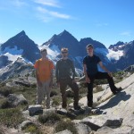
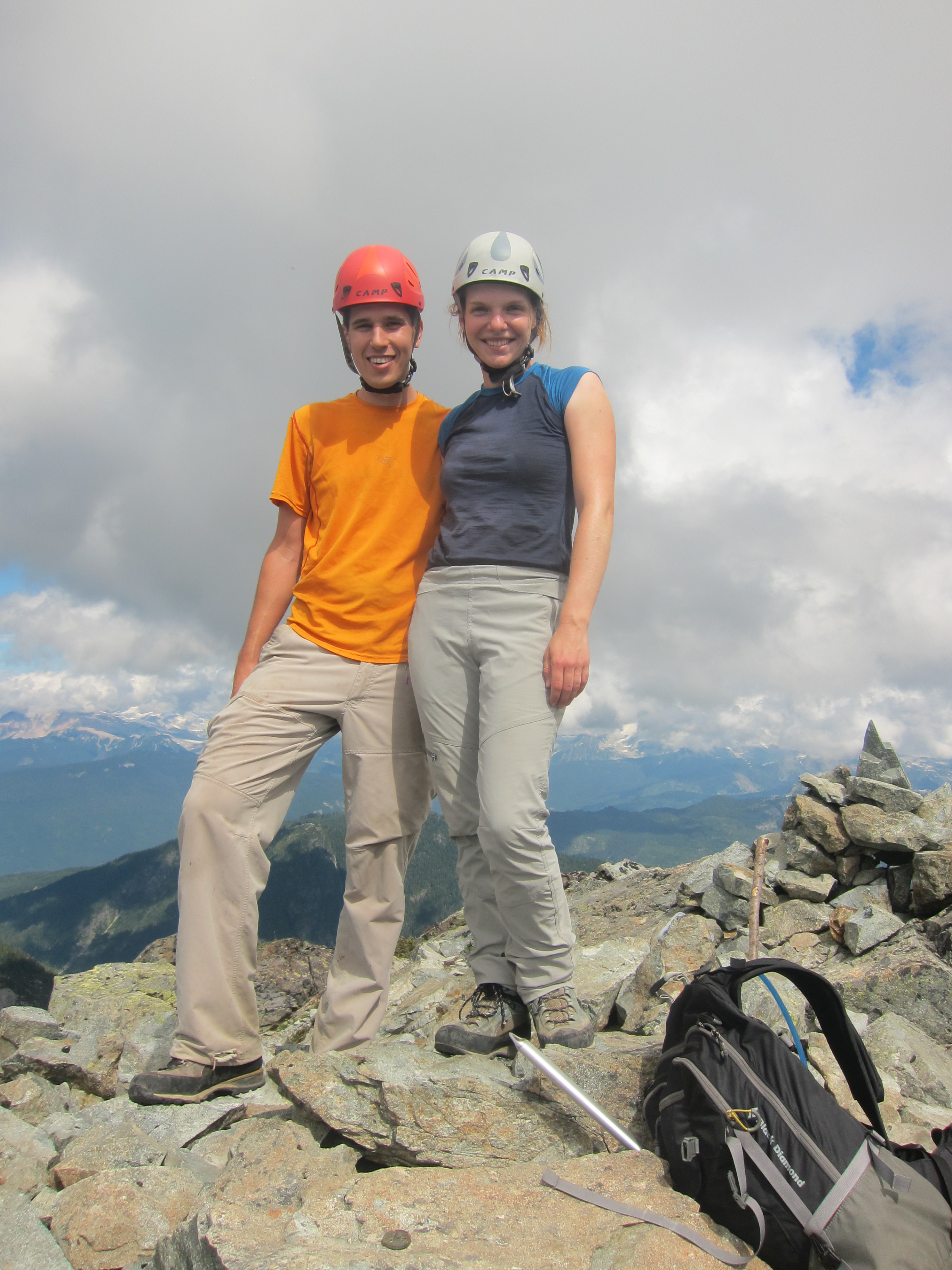
Participants: Brittany Zenger, Ed Zenger, Geoff Zenger, + 4 other BCMC members

Difficulty: 3

Report: Just over three years since my previous trip to Mt. Chief Pascall, I joined Brittany on a BCMC trip that she organized to make a ski ascent and descent of the peak.  We’ve had a bad snow year so far, but the trip was scheduled for a month later in the season than my previous trip and so I was optimistic that there’d be enough snow to avoid any alder bashing and have a decent run down the mountain.  Luckily, someone removed the alder on the lower logging road in the past few years, but as it turned out, there was no good run down to be had.

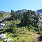
We met up at 8:15 in Pemberton at the Mt. Currie Coffee Company and headed up to the weather station pull out on the Duffey Lake road and set out from the cars at around 9:30am.  So far, so good.  There wasn’t much snow in the trees and the initial creek crossing was a little interesting, but we made it up to the logging road on the opposite side of the valley without too much drama.  From here we followed the logging road to the east to the far edge of the clearcut and made our way up through the trees on the far side of it as there wasn’t quite enough snow to make it up through the clearcut itself.  The going was slow due to the lack of snow, but we made steady progress up to the ridge.  Unlike last time, we stuck a bit too far to the right of the route indicated on Baldwin’s map, but luckily it worked out in the end.  There is a bit of exposure higher up if you stick too far right and it’s definitely easier to stick to the mellow terrain to the left (i.e. if you hit some cliff bands, you should traverse left, not right), but it turns out that either way works.

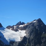
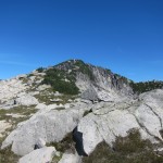
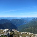
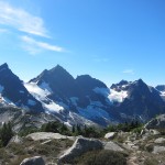
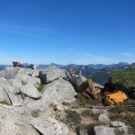
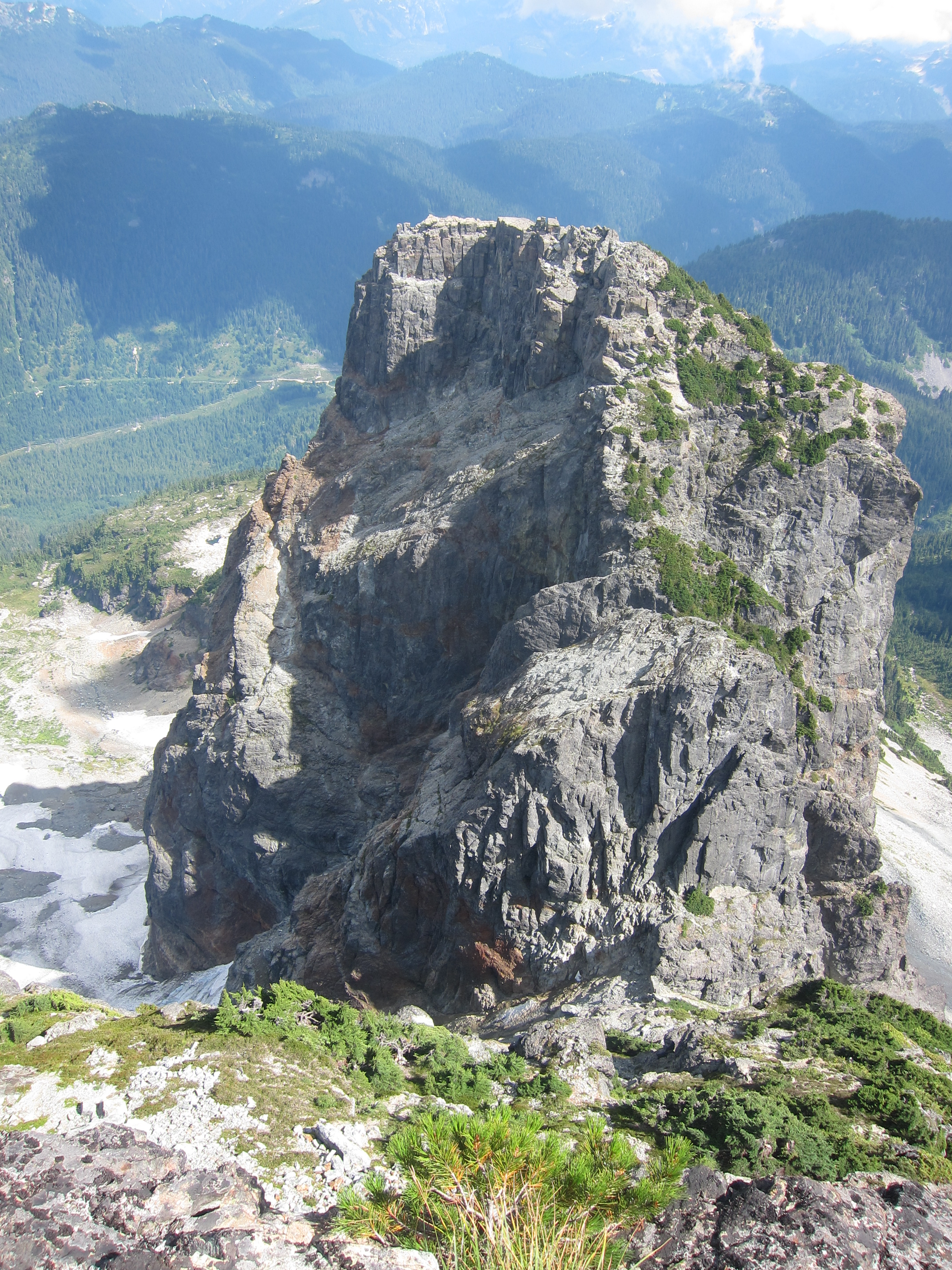
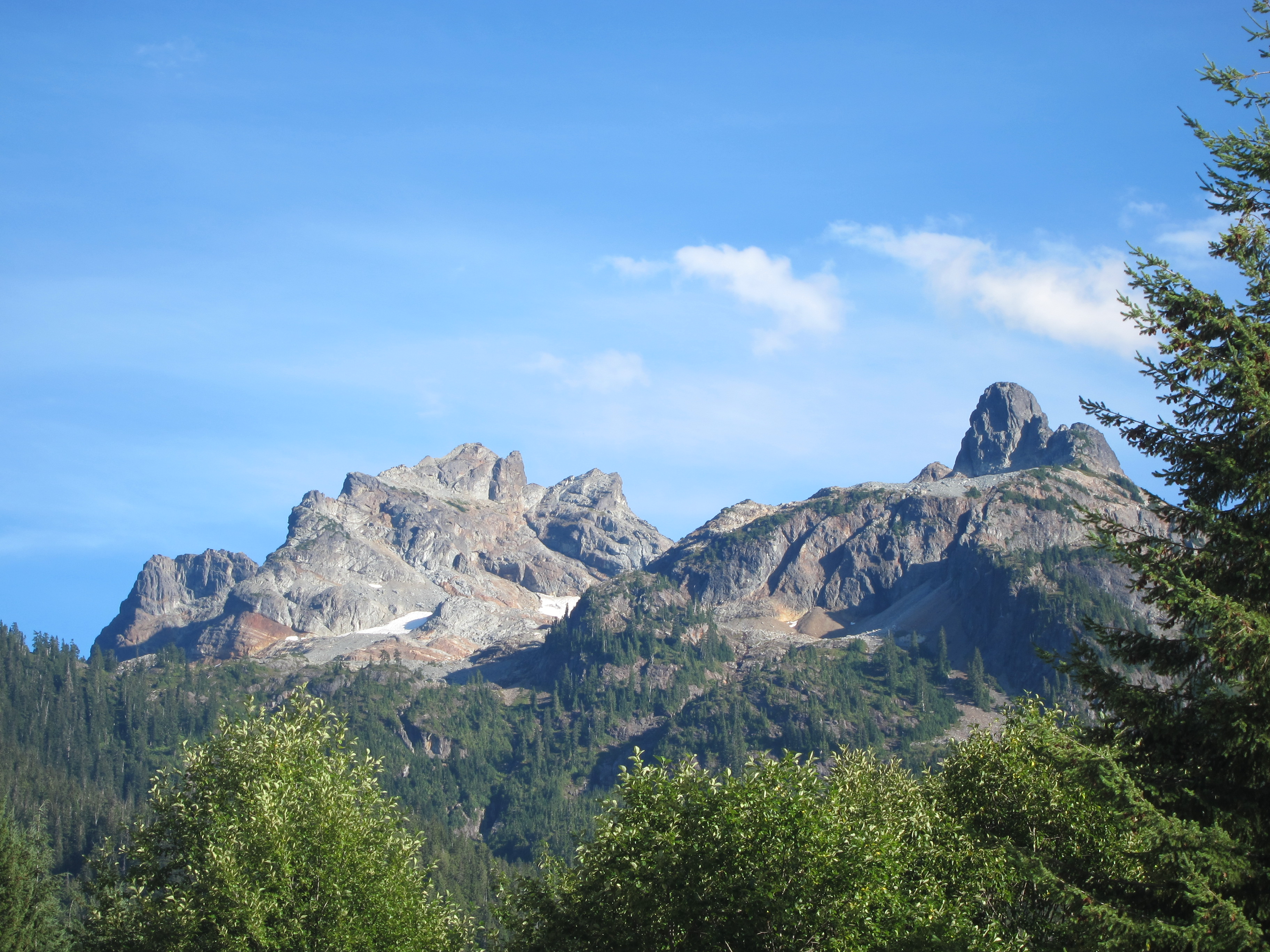
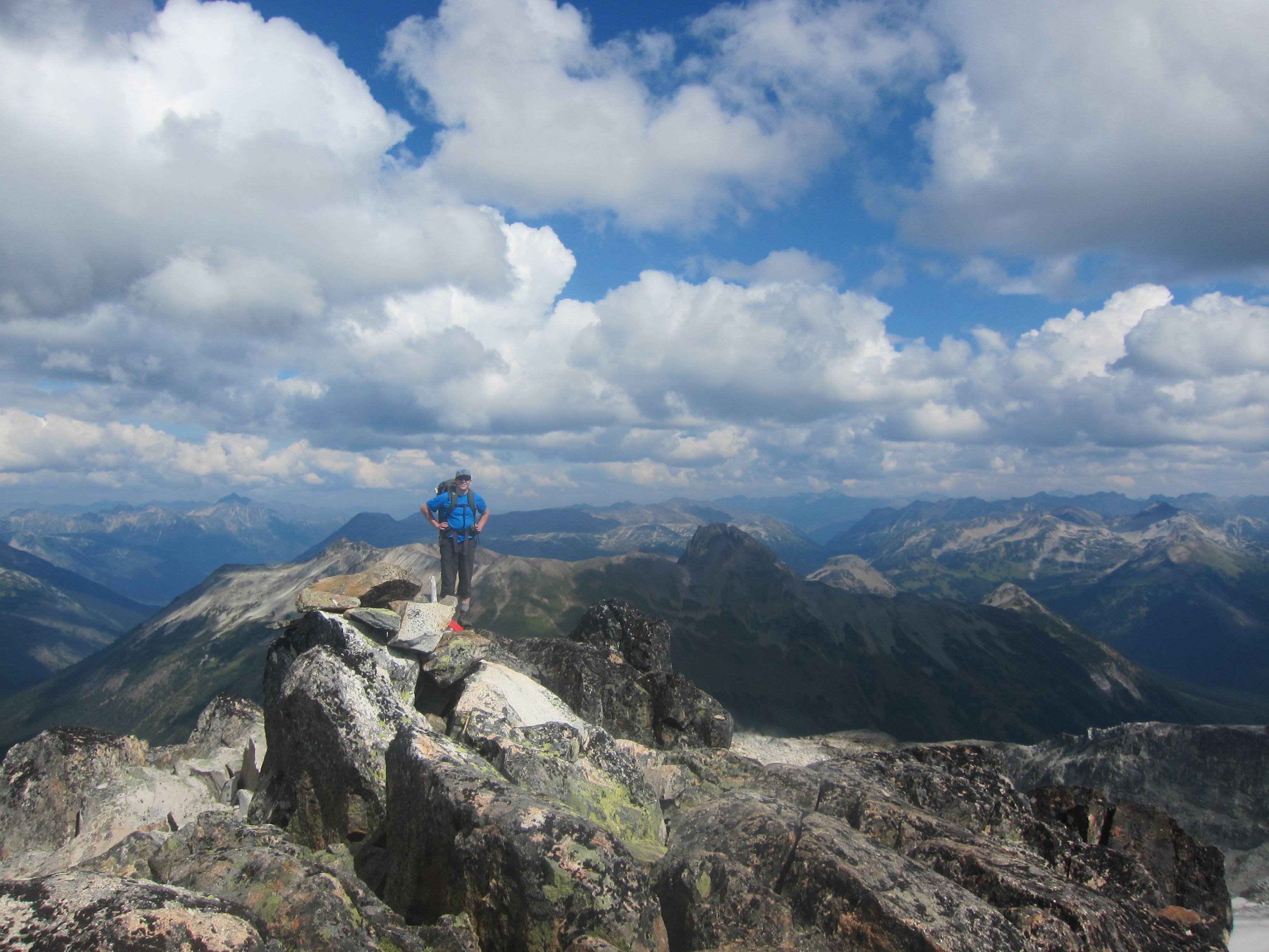
Higher up the skinning became decent, and at the top of the run labelled “Equinox” on Baldwin’s map we left our skis behind and booted up to the summit.  We were on the summit some time between 2 and 2:15, which means that the ascent took about 45 minutes longer than on my previous trip to the peak, but conditions were much more challenging this time around.  The views to the north were great but unfortunately the view to the summit of Joffre was clouded in.    Interestingly, this was the same day that 3 deaths occurred in the central couloir Joffre (partly visible from the summit of Chief Pascall) but in the winter silence nothing seemed amiss.

Now… the descent.  The last time I skiied Chief Pascall the descent took approximately 2 hours (perhaps a bit less) and would’ve been much shorter than that except for a group member going off route at one point and everyone having to wait for him to reascend to the correct path.  This time was another story.  The snow was wet heavy cement in places, and icy with fluff underneath in others.  The common element between both conditions was the simple lack of snow all around.  Given the lack of snow on the ascent route we chose to descend via “Equinox” in the hopes that it would save us from some nasty conditions in the trees lower down.  It didn’t.  It probably wouldn’t have been better on the ascent route but the descent down to the logging road was literally the worst skiing I’ve had in my life.  Hard to turn, obstacles everywhere, and impossible to ski in places due to lack of snow, it took us well past dark to make it down to the road, and we didn’t make it to the cars until about 7:20.  The descent took us just shy of 5 hours and we were all exhausted!  Anyways, thank you to everyone for the trip, I’m glad to have been in the area again and for the great company, but I really hope that ski conditions improve soon so that other trips this year actually have some quality skiing, unlike this one.

Continue ReadingMt. Chief Pascall 2015

Turtlehead Mountain

Date: Oct 21, 2014

Participants: Geoff Zenger, Peter Woodsworth

Difficulty: 1/2 (if on route), 2/3 (route taken)

Report: This report contains the story of the first BCMC expedition to Turtlehead Mountain, Nevada.  After a few training days climbing routes in Red Rocks such as Cat in the Hat (all the way to the top of Mescalito), Geronimo, and Physical Graffiti, Peter and I left the rest of our party down in the valley and ventured forth on an unguided, unassisted, siege-style expedition to conquer Turtlehead Mountain.  No fixed ropes were used.

The morning of the ascent, we had an anti-alpine start, and weren’t at the the Sandstone Quarry parking lot until around 10 o’clock when the solar effect on conditions was already considerable, but as experienced mountaineers we elected to make the ascent regardless.  The route wound its way upwards through cliff bands and desert creek washes, and soon we found our way in the large valley/gully leading up to a col just west of the summit.  Unfortunately, due to congestion on the route due to the hordes travelling downhill, our party became separated and although Peter continued upwards to the col via the standard class 1/2 route, I was sucked offroute into a steep gully, which ascended to the ridgeline above the col.  In places the may have approached class 3.

Just past noon we found ourselves on the summit by ourselves where we celebrated with Gatorade, wraps, and a family sized bag of Sun Chips.  Gazing back down the route to the valley and Sin City below we reminisced on our accomplishment and an hour or so later began our way back down.  An epic was avoided (unlike our tale from 3 days earlier) and we were back in camp with only a few hours of daylight to spare.  The rest of our crew had made it up Birdland today, which I must admit looks fairly impressive from below, but it has nothing on the altitude gained on our expedition to Turtlehead Mountain.

Continue ReadingTurtlehead Mountain

Warner to Tyaughton Lake Bike Ride

Date: Sept 15, 2014

Participants: Max Bitel, Rob Janousek, Jennica Rawstron, Brittany Zenger, Geoff Zenger

Difficulty: Blue

Report: I’ve been wanting to do a Chilcotins bike trip ever since Max, Dan, and a few other friends did their first Chilcotins bike trip back in 2011 and I couldn’t join due to work commitments and since then due to health it simply hadn’t been an option.  I had the realization in early September that if it didn’t happen soon, another year would pass without a Chilcotins trip and decided to do what I could to take a day off work and get a one day float plane drop organized.  Circumstances came together, the trip happened and it was as good as imagined!

We had a relaxing Sunday in town, and in the afternoon went over to meet up with Rob and Jennica to pile into his Delica and make our way up the Hurley River FSR to Gold Bridge and from there up to Tyaughton Lake, where we camped at the forestry recreation site just south of Tyax Lodge.  We got in well after dark and didn’t have much time to do anything other than set up our tents and get to sleep because the next morning we had to get up at 6am to prepare for our float plane drop into Warner Lake.

We had booked an 8am flight with Tyax and everything went as planned.  Our pilot, Pierre, was friendly and although he spent a lot of effort making us understand that if wind conditions weren’t just right we’d have to be dropped off at Spruce Lake instead of Warner Lake, the flight went without a hitch and by a quarter to 9 we were by ourselves in the middle of nowhere, with more than 50km of single track between us and our vehicles!  What a feeling!

Other than the minor issue of Jennica’s front brake not really working, the morning went without a hitch.  The weather was absolutely perfect.  Clear, warm, but not hot and not humid.  We took lots of breaks to take in the views and take photos as we made our way past Trigger Lake and Hummingbird Lake, to the old horse camp, and from there up the long hill towards Potato Patch and Spruce Lake.  We reached an open knoll a bit before Potato Patch at 1:30 where we ate lunch, and from there it was only another 30 minutes or so to the far end of Spruce Lake where we swam and soaked in the sun.

We didn’t leave Spruce Lake until about 3:30, and this wouldn’t have been a problem except that Brittany had a really bad crash down on the Gun Creek trail due to clipping a root sticking out into the trail.  I thought she broke her tailbone (or back) as she had trouble standing or moving her back (and couldn’t ride) for 45 minutes after the crash, but eventually the pain subsided with the help of Tylenol and Vitamin I, and we were able to make it out.  After the crash, the going was very slow, but we reached the final bridge (you don’t actually cross it) a bit before 7pm, and from there it’s easy double track to the logging road, and then it’s easy road all the way out to the road heading up to Tyaughton Lake.  Rob and Max rode ahead to grab their vehicles, and we met them on the main Tyaughton road at about 8 o’clock, just as darkness fell.  The drive back home was long and slow, but nonetheless I showed up to work on time the next day.

Despite the scare of Brittany’s crash it was a really great day.  The trails are in great shape, the company was great, the weather was great, and the length was just right to fit into a late summer day!  Thanks everybody!

Continue ReadingWarner to Tyaughton Lake Bike Ride

Conway Peak

Date: Sept 13, 2014

Participants: Jean-Michel, Julie, Geoff Zenger

Difficulty: 2

Report: Originally intended as an overnight BCMC trip to Stoyoma Mountain and Mount Hewitt Bostock in the northern Coquihalla region, a change of plans and need to be back in Vancouver on Sunday meant that the trip had to be shortened to a day trip.  Opting against driving all the way through Merritt for a day trip, we changed our minds in Chilliwack and headed up Conway Peak, the southernmost peak in the Cheam range.

The road up to Jones Lake and then to the trailhead is in decent shape right now, but definitely requires a 4×4 HC vehicle.  We arrived at the trailhead at around 10 and started our way up the trail at about a quarter past, making our way up the switchbacks on an old road.  The road here is quite overgrown in places, but easy to follow, although we missed the 4th switchback and instead of making the turn right before a creek crossing, we hopped across the creek and continued about 15 minutes right to the end of some even older spur, wasting a good half hour of our time.

Once back across the creek where the switchback should’ve been it was easy to see where the right way to go was, and a few minutes later we entered the old growth forest to follow the old Lucky Four Trail up to Mile High Camp.  This trail is in great condition and is very pleasant.  Just before 1 o’clock we found ourselves getting hungry and decided to stop at the next knoll, and were happy to find that it was indeed the famed mile high camp!  It’d be a great spot to camp with fantastic views all around, although I personally wouldn’t really want to lug an overnight pack all the way up there…

We left the camp at 1:35, and from here the route up Conway is really nice over open heather and rock slopes, and it was easy and fun to make it up to the summit, which we reached at 2:20, 45 minutes after leaving the camp.  Total ascent time, 4 hours, including 35 minutes at mile high camp and 30 minutes on the wrong road.

We had lucked out and had amazing fall weather on the summit, warm, sunny, and clear.  We dozed off for a while, took group shots, gazed at the huge north faces of Foley and Welch, and identified peaks south of the border for nearly an hour before starting back down.

The descent was quick and uneventful and took under 2.5 hours to complete.  Total round trip time was around 7.5 hours.  In all, Conway Peak greatly exceeded my expectations and is a really nice hiking peak that doesn’t see the popularity it deserves.  Great views, nice trail (minus the bottom bit), close to Vancouver.  Recommended!

Continue ReadingConway Peak

Spring / Summer Reading

I feel like I’ve read more than this in the past few months, including a couple works of fiction, but I can’t remember what they were.  Anyways, here’s my reading list (insofar as I can remember) in the last few months:

Enemies, by Tim Weiner: After reading Weiner’s excellent “Legacy of Ashes” (a history of the CIA) some time ago, I recently picked up his history of the FBI.  While not quite as engaging as his history of the CIA, this is still a must read.  Most people probably have no idea how much the FBI operated outside of the law, and arguably as a criminal enterprise for much of its history in the 20th century.  If you think you should always trust the government, then you need to read something like this and see how far a government agency can go, even to the point of it holding more power than a country’s elected officials.

Faraday, Maxwell, and the Electromagnetic Field, by Nancy Forbes and Basil Mahon:  This is a fairly short biography of both Michael Faraday and James Clerk Maxwell, the two most influential men in the development of the theory of the electromagnetic field.  It was pretty good, entertaining enough.  Definitely not a must read, but there was enough in there to keep me interested.

John Clarke, by Lisa Baile: John Clarke was an amazing British Columbian, both through his exploration of the province and his advocacy of its natural wonders and First Nations.  Although he died over a decade ago, it was only recently that a biography was written for him.  I never knew John personally, although I know many people who knew him well.  Similarly, I know Lisa only as a fellow member of the BC Mountaineering Club, and reading the book its clear that this is her first book and that she’s not a professional writer, she does a very good job of portraying all sides of John and demonstrating his deep humanity.  Nonetheless, it is a fascinating read, interspersed with anecdotes from John’s friends as well as his journals.

How Jesus Became God, by Bart Ehrman:  Ehrman has made a dent in popular culture in the past decade or so due to his books on biblical apocrypha, textual evolution, and his stature as both a premier biblical scholar (I’ve read a couple of his textbooks) and an atheist.  “How Jesus Became God” is definitely not a mainstream popular book like some of his older works, but it is accessible enough for the interested layman, and looks at the question of when exactly did Jesus’ followers come to believe that he was divine?  Interestingly enough, it doesn’t seem to have been during Jesus’ lifetime, nor does it appear to have been immediately after his death.  This is a remarkable question that few people have probably asked in the last two millennia.  Nonetheless, it’s worth asking, and the answers are more nuanced than you might expect.

Stress Test, by Timothy F. Geithner:  I really liked this book.  I’d already read quite a few books on the financial crisis prior to reading this one a couple months ago (such as the excellent “Too Big To Fail”, but I hadn’t read any of the books by one of the principal actors.   As Geithner himself repeats many times in this book, he was not a banker by trade, nor had he ever worked on Wall Street, yet he ended up as the Chair of the New York Federal Reserve and then served as the Treasury Secretary during Obama’s first term, and consequently was right in the middle of the efforts to resolve the crisis and its aftermath.  The book is made vastly more interesting and entertaining by Geithner’s clear perspective of himself as an outsider, a non politician (for example, he gets all his news by watching Jon Stewart’s “Daily Report”)

No Place To Hide: Edward Snowden, the NSA, and the U.S. Surveillance State, by Glenn Greenwald:  Greenwald was the first reporter to report on the contents of the documents Snowden leaked from the NSA, and this short little book is his recollection of the events leading up to the disclosure as well as as summary the most important programs gleaned from the leaks.  If you’ve been following the NSA disclosures closely as reported by the Guardian or Bruce Schneier, you probably won’t learn much about the programs from this book, but for someone wanting a quick summary or just wanting to hear firsthand about how the reporting started, this is a good enough read.

Capital in the Twenty-First Century, by Thomas Piketty: A month or so ago someone expressed their supreme surprise that despite how much I normally read, I still hadn’t read Piketty.  Well, guess what?  I did it.  There’s been so much buzz about this book that I don’t need to say much about it.  All I’ll say is that the first third and the last third are really interesting, and could be considered a must-read.  The middle third is very dense with charts and numbers, and while important from a documentary standpoint, is less interesting to someone brave enough to trust his interpolations without seeing all the underlying data.  Regardless, his key message about the natural rise of inequality as the rate of return on capital is greater than the rate of economic growth (so more and more accumulates to the wealthy) is something that everyone should hear about and ponder.


Continue ReadingSpring / Summer Reading

Sky Pilot Mountain

Date: Aug 27, 2014

Participants: Brittany Zenger, Geoff Zenger, Edzis, Anders

Difficulty: 4 (short 4th section, lots of 3rd)

Report: I’ll keep this short because the route is so popular and so well documented.  Brittany and I saw that the forecast for the long weekend was wet, and we made the decision to take the Wednesday off to get in one last day of nice weather for this August.  We took the new gondola up a bit past 9, and hiked up the newly cleared and well marked “Sky Pilot Valley Trail” and followed it up to the West Ridge route up Sky Pilot.

Just as we reached the Stadium glacier we ran into Edzis and Anders, two nice Latvians living currently in Vancouver and who had seen nice photos from Sky Pilot online.  They didn’t know the exact route, and after a brief chat we loaned them some poles and grouped up with them for the ascent.  As relatively inexperienced scramblers the pink slab was a bit too difficult for them (from base to rap rings above it is 17m), but luckily I had brought a short rope and with the rap rings at the top of the pitch (also there are two rings in the final ascent gully) I was able to give them a quick belay to get down the most challenging parts.  Experienced scramblers will be able to downclimb these sections, but I’d bring a rope if you’re going with anyone less experienced.

Total ascent time was just over 3.5 hours.  One hour 15 to the end of the Sky Pilot valley trail, another hour and a bit to the Stadium glacier.  From the bottom of the pink slab to the summit was about 45 minutes.  The descent was only slightly shorter due to the aforementioned belays that I gave on the two steep parts.  In all, it was a beautiful day, and the rock is just perfect for scrambling on.  Highly recommended even with its popularity!


Continue ReadingSky Pilot Mountain

Opal Lake Scrambles

Date: Aug 23/24, 2014

Participants: David Carne, Michelle Lappan, Brittany Zenger, Geoff Zenger

Difficulty: 3

Report: Opal Lake has long had my attention as a weekend destination due to the fact that the peaks on either side of it are both listed as 3 star scrambles in Matt Gunn’s guide.  With only a few weeks left in summer proper, we decided to have a go at it.  Setting out at a relaxed pace from the Whistler cabin Saturday morning, we had a breakfast at Mt. Currie coffee in Pemberton and headed up the Hurley and over Railroad Pass to the Hope Creek FSR.  The road is in great shape until about 11.2 km, where we had to park due to severe deactivation.  No worries, even if we had gone through the first big ditch, there are many more and we were glad to have parked where we did.  Regardless, the end of the road is only about a 50 minute walk from this point.

Immediately after starting up the road we encountered what we very obviously grizzly prints.  Huge!  We’d see many more prints over the weekend but luckily, no bear.  The road went by quick, and we were pleased to find a flagged footbed through the forest at the end of the road all the way to the crossing of the creek coming down from Tenquille Glacier.  The creek crossing was easy at mid day (more on this later), and although we couldn’t find any path on the other side of the creek, the going was easy through fairly mature forest and a bit of bush, and we quickly wound up at Opal Lake.  Total time from end of road: 90 minutes.  The lake was much nicer than I expected!  This was probably because I had read a trip report that called it a “scum pond” (it’s not), but also because it’s situated in a beautiful alpine pass.  At first we were worried about water, but it turns out that about 50m east of the lake there’s a great little stream with clean running water.  Once at the pass, we set up our tents and prepared to set off for Chipmunk Mountain.

We followed Gunn’s suggested route up the “steep heather” to a gentle plateau leading to Chipmunk, and indeed the heather slope is really steep.  That said, as we found on the descent, all other slopes are steep too and it probably is the best route.  We moved steadily at a moderate pace and in seemingly no time made it up to the summit of Chipmunk.  There was some fun scrambling found near the summit that we elected to take to avoid the loose rock in the gully bottom, but either way the summit is easy to attain.  The ascent took only 1.5 hours from camp, and after a nice break on the summit to eat a snack and gaze over at the Tenquille area to the south, Locomotive & Sampson areas to the west, and Beaujolais and Sockeye Horn (known as Mystery Peak in Gunn’s book) to the east, we made our way back down to camp to enjoy a good meal before darkness fell.

It clouded over in the evening and according to David it rained overnight, but luckily by the time we arose in the morning, the skies were beginning to clear and after a slow morning at camp, we headed up the North Ridge of Tenquille Mountain.  At this time of year, the talus field below the ridge is really loose and not fun to ascend, but once on the ridge proper, the route is really, really nice.  Although at times it looks like the route is going to get really hard, Gunn’s description is easy to follow and all difficulties are easily avoided.  We were a bit slower ascending Tenquille than Chipmunk, but it still took only a little over 2 hours from the lake to make the summit.  Once on top, we had a bit of disagreement over whether to continue on to Goat Mountain or not, but with a bit of arm twisting, David was convinced to join me, and the two of us headed for a quick jaunt to Goat while Brittany and Michelle lounged about and waited in the warm sun on the summit of Tenquille.

Although it looks tricky from the summit of Tenquille, it turned out to be easy to make it over to Goat Mountain, essentially just sticking to the good rock at the left hand side of the obvious cliff bands (and just right of the main gully heading up the face).  Near the top there’s a bit of fun scrambling on good rock, and 50 minutes after leaving the top of Tenquille we stood on the summit of Goat and filled out the summit register (apparently Goat is the only mountain in the region with a register).  From the summit of Goat there are great views of Tenquille Lake itself (not visible from the top of Tenquille Mountain), but we didn’t want to keep our better halves waiting long, and after only a few minutes on top made our way back to Tenquille Mountain.  Although it occasionally threatened to rain at times during the day, it never did and most of the time we had good weather.

The descent back to camp was quick, and after a brief stop over to pack up, we departed camp just past 4pm.  The creek crossing was quite a bit more exciting on the way back due to the increased water flow after the overnight rain and it being later in the day, but we managed to find a reasonable crossing point not far upstream from where we had crossed the previous day.  From there on it was straightforward through the forest and down the road, and we reached the jeep at 6 o’clock sharp.  In all, it was another great weekend.  Thanks to everyone for the great trip, and hopefully there are still a few good weekends left this year!

Continue ReadingOpal Lake Scrambles

Watersprite Peaks

Date: July 27-28

Participants: Dave Scanlon, Brittany Zenger, Geoff Zenger

Difficulty: 2-5

*** NOTE: This report describes work on the original Watersprite trail, which no longer exists.   Please consult other sources for a description of the current trail and access to the Watersprite area ***

Report: Brittany and I had gone in to Watersprite Lake with Dave and a couple others two winters ago just as a day trip to check out the skiing opportunities in the area, but until now we hadn’t ever been in the area in summer.  The BCMC (BC Mountaineering Club) has a tenure to build a hut at Watersprite Lake, and last week we were given the chance to head in there again with Dave to do a bit of improvement to the trail that he’s been building and to try and summit a few of the peaks surrounding the lake and see how we liked the area.

We met up at St. David’s at about 9 o’clock Sunday morning, just before the church crowd arrived, and piled into Dave’s 4×4 to make our way up towards the trailhead to get to the lake.  We drove up towards Squamish, turned  past the Apron parking lot onto Mamquam FSR, turned left onto the Skookum creek system just past the 13km mark and ascended the road up to the old upper staging area for the recently completed Skookum creek run-of-river IPP where we parked the car and set out up the road just before 10:30 (image removed at request from SAR).  Most of the drive in is 2wd accessible, but the last few km are a bit steep and loose.  The first 3.5km or so into Watersprite is on an old logging road, and after our snipping efforts last weekend is reasonably clear of alder and bush.  It took us about an hour and a half to reach the flagged turn off from the road to drop down into the meadows below where Dave has cleared and flagged a trail that can be followed up to the lake.  En route to the lake we helped fix up the trail, did a bit more snipping, and eventually arrived at the camping area / proposed hut location at the outflow of Watersprite Lake shortly before 3pm, for a total time to walk in of about 4.5 hours.

At the lake we set up camp and had a snack, but as the day was still young at around 4:30 I decided to head out on my own to ascend Dreadnought Peak, just to the NE of the lake.  I made my way around the south side of the lake to head up east to the col between Dreadnought and Watersprite Tower.  From here, Dave said he’d heard there was a class 3 route up to the summit of Dreadnought, but despite trying a few approaches to get onto the ridge I was unable to find one that looked like it’d go at anything less than a stiff class 4, and eventually found myself heading up the large obvious rock gully that heads up towards the west ridge of Dreadnought a couple hundred metres west of the col.  The gully was pretty unpleasant, but except for its exit, wasn’t particularly hard or steep.  On the way down I found that the steep exit can be avoided through the bushes on the left (west) of the gully.  Above the gully, pleasant easy scrambling led me to the summit of Dreadnought which I reached at 6pm.  There are three summits of Dreadnought, all perhaps 50 feet apart and all apparently within about 1 foot of elevation.  After gazing at the great view of Mamquam, Garibaldi, Sky Pilot, Tantalus, and the lesser known peaks to the east I descended back to camp for dinner and relaxation.

The following morning we headed up to attempt Watersprite Tower, Dave’s main objective for the trip.  I had brought along a 30m rope and a small set of nuts and cams, but from the sub-summit of the tower we found that our rope wasn’t long enough to rappel into the notch!  Furthermore, the climbing on the far side looked pretty difficult… After much hemming and hawing we eventually decided to give up on finding a way down into the notch and instead decided to traverse the ridge along the south side of the lake around over the high summit south of the lake and over towards Martin Peak.  Watersprite Tower would have to wait for a later attempt.  As an aside, there is a crazy balanced pillar on the sub-summit of Watersprite that couldn’t be moved into place by heavy machinery if you wanted to!

The ridge around the south of the lake is a very fun scramble.  Always interesting, and never too difficult, with a few short 3rd class sections.  The only tricky routefinding was the descent from the high point on the ridge (Peak 1877) to the col between it and the intervening bump between it and Martin Peak.  There was a cliff that we possibly could have rappelled, but we found instead that it was better to drop down heather slopes to the south, into the bowl below, and reascend to the col via heather and talus slopes.  From this point we had the option of continuing to Martin Peak, but as this col is the normal descent route from Martin Peak and we were already getting tired we decided to skip the final summit on the ridge and just descend down easy snow slopes back to Watersprite Lake.  We made it back to camp at about 2pm, so our total round trip time for the loop was about 6.5 hours.

Once back in camp we slowly packed up, and departed camp close to 3 o’clock to make our way back down to the car.  It would take us between 3.5 and 4 hours back to the car (so, so, so much easier in winter), and the final road seemed to go on forever, but we eventually made it and concluded another highly successful and fun trip.  The hiking around the lake isn’t super easy, but with some flagging it would be accessible to most experienced hikers and it is a very beautiful area.  Personally I wish the approach was an hour or two shorter, but apparently most people want a hut that’s a bit farther from the cars… apparently I dislike long approaches more than most, and 4-4.5 hours isn’t that excessive in the summer (it took us only around 3 hours in winter on skis).   Finally, many thanks to Dave for building a trail into the lake and showing us the way in.

Continue ReadingWatersprite Peaks

Tenquille Lake Area

Date: Aug 1-2, 2014

Participants: Fatemeh Riahi, Ali Kamali, Devin Erickson, Brittany Zenger, Geoff Zenger

Difficulty: 2

Report: Brittany has been asking to go into Tenquille Lake and do a few of the nearby hikes / scrambles for a few years now, but until last week the time and opportunity had never arisen.  Luckily, we’ve spent the last couple weeks on vacation, and what better way to spend the last couple days of it than taking some friends out for their first ever backpacking experience at a beautiful lake and with a perfect weather forecast.

We met up at Mt. Currie coffee Friday morning at 9 o’clock, and drove off towards Birken where we took the Tenquille-Birkenhead FSR to access the area from the east.  Most of the road is in very good shape (probably want a 4×4 all the way from where you leave the Pemberton Portage road), although the last 5km or so has been deactivated and requires a high clearance 4×4.  We departed from the trailhead at about a quarter to 11, and arrived at the cabin at the west end of the lake almost exactly two hours later.  Luckily we were the first to arrive at the lake for the long weekend and had our choice of camping location.  We set up camp perhaps 200 feet from the cabin in a large open area, and sat down in the cabin to enjoy a good lunch.  The lake itself is beautiful and the view to the west is dominated by Sun God (which we ascended a few years ago, it’s easy from this angle to see how the peak got its name).

On our way we were passed by a large party of 18 mountain bikers, all on 2015 Giant Reign’s (disclaimer: I own a 2014 Giant Reign).  Apparently the group was press junket of sorts, a mix of bike company employees and journalists flown in to review the new bikes in a beautiful environment.  They had been dropped off at the head of Barbour’s valley and were making their way by Tenquille Lake in order to descend the trail down to the Pemberton Valley.  It’d be a wonderful place to bike, although I couldn’t help but notice that it would be better to bike there later in the season when it was a bit drier… some of the muddier areas near the lake looked like a war zone after all the bikes had pass through.

After a hearty lunch and setting up camp, we headed up to Copper Mound.  We misread the directions in Gunn’s book and thought that there would be a trail heading up to Fossil Pass from Tenquille Pass, but after hiking up to Tenquille Pass and descending a fair ways down the other side, we realized that that was not the case, and made our way up the open slopes to Fossil Pass and from there up the easy scree and talus fields to the summit of Copper Mound.  The views from the summit were excellent!  There were a couple of paragliders flying overhead, the Pemberton Valley long below on one side, and views of Goat, Tenquille, the Sampson area, Currie, Ipsoot, Rhododendron, and the peaks at the northern end of the Pemberton Icefield.  While the rest of our party wanted to lounge about on top, I wanted to bag another peak, and set off for a quick ascent of Mt. McLeod.  I moved quick and made it summit to summit in 45 minutes, took a few quick pictures, and scurried back to Fossil Pass where I arrived just a few minutes before everyone else.  From here it was an easy descent back down to the lake where we hung out and had a great dinner.  Devin tried out the plastic kayak under the cabin while dinner was being cooked, and while it made for great photos, the kayak turned out to have holes in its bottom and he ended up unexpectedly wet and joined us back in the cabin much sooner than we expected.

On the Saturday we had a slow morning eating breakfast, packing up our tents, and talking to some of the people who had arrived in the area the previous evening.  We set off with all our gear again at about a quarter to 11, and dropped all of our bags except for two small day bags just past the turn off to Barbour’s valley.  The trail up into the valley is in great shape, and following Gunn’s directions we made our way up Mt. Barbour.  The route is mostly hiking, but has a 5-10 minute section of moderate scrambling just below the summit that added to the fun and epicness of the ascent.  Just like Copper Mound, the views from the top were great, but the summit has a much more aesthetic atmosphere than Copper Mound, and there was unanimous agreement that it was our favourite peak of the trip.  We left the summit at about 2:45 and headed down to our bags and from their to the Jeep, arriving at the Jeep just past 6:30.

Two full days of hiking, but everyone survived and at least claimed to have fun 🙂  We were even down early enough to enjoy a dinner at the Wood in Pemberton before saying goodbye and bringing our vacation to an end.  Tenquille Lake exceeded my expectations with regards to beauty and ease of access and I can see why it’s so popular these days.  The only downside of the area was the massive number of biting horseflies.  I can’t wait to get back up there and ascent the peaks on the north side of the lake!  Thanks to all for the great trip!


Continue ReadingTenquille Lake Area

Lone Mountain

Date: June 7, 2014

Participants: Sergii Bogomolov, Geoff Zenger

Difficulty: 2/3 (Short sections of moderate scrambling)

Report: Hiking the Lightning Lakes trail in Manning Park out to Thunder Lake has been on my list for some time, but Manning Park always seemed like a long ways to go for just a lake hike… Luckily, a couple years ago I noticed a peak called “Lone Mountain” in Beckey’s guidebook to the north Cascades, and I decided that any trek I did out to Thunder Lake should include an ascent of Lone Mountain, located on the SW side of the lake.  I posted a trip a while ago on the BCMC schedule and had some interest from a few people, but by the date of the trip, everyone had bailed except for Sergii, and on a nice Saturday morning we met up near my place in New West and drove out to Manning Park.  In the end I’m glad that there were only a couple of us and not a larger group because the trip would prove significantly more strenuous than expected.

We started out from the Spruce Bay parking area around 9:45am, and moved quickly along the lakes trail, reaching Strike Lake camp at about 11 o’clock.  After a quick snack break we continued on towards Thunder Lake.  There was some snow on the trail in sections here, but the going was quick and we reached the end of the official trail at Thunder Lake a bit past 11:30.  We followed a little used path around the northern side of the lake up towards some waterfalls coming down from Snow Camp Mountain above the outflow of the lake.  From here we bushwhacked down the little creek to the outflow from Thunder Lake where we were happy to find a thick logjam in the river that was easily crossed, and on the other side at a quarter to 1 we stopped for a full lunch break.

There is a large talus field perhaps 100m along the lake shore from the outflow of Thunder Lake that we wanted to take up towards the ridge, and so we trekked diagonally upwards through the bush to hit it.  The dirt slopes and bush are ridiculously steep on this section, but we found our way to the talus slope and followed it upwards until it became a steep and exhausting scree gully.  The heat and scree made ascent slow, and we eventually bailed out of the scree gully to the right (north), which in retrospect was a great decision because it brought us back to a firm, open talus field that led up to the ridge.  From the topo map and Google Earth I had expected the ridge to be an easy walk, but it proved to be an alternating sequence of bushy thrashing and steep dirt, with a couple short scrambling moves thrown in.  Luckily there isn’t any serious exposure, and we eventually made our way up to where we hit snow, perhaps 100m below the summit.  The snow line was surprisingly high, but I guess it’s a big cooking bowl around Thunder Lake that traps heat.

We reached the summit of Lone Mountain around 2:45, and sat down for a long break.  The view of Hozomeen from the top is amazing.  There is probably no better vantage point possible of the group and all three peaks are visible.  There are also good views over to the Skyline trail that crosses from Lightning Lake to the Skagit River, but otherwise the summit is quite unremarkable as it is lower than almost everything else in the area.  Tired and out of water, we departed the summit a bit before 3:30 to thrash back down to the lake.

We were back down at the lake at about 4:50, and after a quick break, decided to bushwhack horizontally along the lake edge to take the lower trail along Thunder Lake back to the main trail.  Big mistake!  It took us 40+ minutes to thrash through the thick alder and other foliage.  We really should’ve just followed the creekbed back up to the upper trail.  Nonetheless, we persevered and made our way back to the main trail, where we eventually found a good creek that we could refill our water from, and made the long trudge back to the car, which we finally reached at 8:20.  10.5 hours round trip!

In the end, am I glad I went to Lone Mountain?  Yes, I am.  But I am definitely never going back there again.  After doing the trip it’s clear why it’s rarely done… it’s a long ways with a lot of bush, scree, and sheer exertion to reach a very minor summit.  Regardless, it was a great trip and I have to thank Sergii for his great companionship on this mountain trek!

Continue ReadingLone Mountain