Silverdaisy Mountain (2015)

Date: April 26, 2015

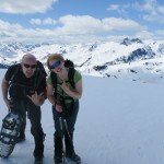
Participants: Brittany Zenger, Geoff Zenger

Difficulty: 1

Report: Silverdaisy attempt #2!  We tried skiing Silverdaisy just after new years a few years ago but it had snowed heavily in the few days before our trip and we ran out of time after slogging up the old mining/logging road from Cayuse Flats.  This time we’d be much more successful ascending from the other side

We arrived at the Sumallo Grove parking lot at about 9am and 10 minutes later were on our way.  We were a bit worried about recent snowfall and whether the trail through the forest would be followable, but it turns out that the trail is well defined (generally on an old double-track path) and well marked and we had no problems following it even once we encountered deep snow at about 1400m.  The trail is a starting to get quick a bit of deadfall on it, especially lower down so if anyone wants to organize a trail clearing day this fall and is wondering where to go, keep the Silverdaisy trail in mind.

Leaving the car at 9:10, it was a bit under 20 minutes to the Silverdaisy trail turnoff.  The trail switchbacks steeply up the side of the mountain before easing off slightly as it heads into the long valley splitting Silverdaisy and Hatchethead.  It wasn’t long after entering the valley that we first encountered snow, at first a little and soon a lot.  There were a few places we had to look around to find the flagging early on, but the trail quickly reaches an old road, at which point it’s obvious where to go to ascent to the col between Silverdaisy and Claimstake mountain.  About 200m below the col the snow became extremely mushy and we put on snowshoes to ease the ascent.  Looking over at Claimstake/Hatchethead on the ascent, it looks like in the winter there could be some really nice ski lines available.

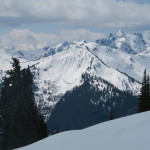
Total time to the col: 4 hours.  From the col it’s an easy broad ridge ascent through sub-alpine terrain to the summit and we had a great day for it.  Light overcast, cool, completely clear views.  Ascending the ridge took nearly exactly an hour, and at about a quarter past 2 we were on the summit, gazing at the views of Hozameen, Silvertip, Frosty, Brice and Outram.  Brice in particular looked like it’d have some fantastic winter ice lines on it for the hardcore crowd.

We didn’t linger long on the summit because the wind picked up, and headed off down the snow.  Descending the snow was no problem at all and very fast.  The trail out was a real slog once the snow ended, but easy enough, and we made it back to the parking lot right at 6 o’clock, for a total round trip time of just a bit under 9 hours.  I probably wouldn’t spend a summer day on this hike when there are more exciting ones to do, but for an early season ascent, this was a great trip!

P.S. I found out that on the same day we did Silverdaisy, another party took the same trail up but cut off of it to do a traverse of Hatchethead and Claimstake mountains, descending to the Silverdaisy-Claimstake col, and then back down to the cars… an idea for next year?


Continue ReadingSilverdaisy Mountain (2015)

Metal Dome

Date: May 2, 2015

Participants: Devin Erickson, Brittany Zenger, Geoff Zenger

Difficulty: 1/2

Report: Metal Dome is a popular mountain so I don’t need to say too much.  We started out from the cars at around 9:30, parking right next to the snowmobile cabin up Brandywine FSR.  Hit snow about 5 minutes up the snowmobile access cut from there, and proceeded easily on snow to the summit.  Amazing views, great day.  Total round trip at a very relaxed pace with lots of time on the summit of only about 5 hours.  Great trip for beginners!

Continue ReadingMetal Dome

Needles Traverse (N to S)

Date: May 9, 2015

Participants: Ed Zenger, Geoff Zenger

Difficulty: 3 (some scrambling, steep bush)

Report: For a few years now I’ve had the idea that I want to knock off all of the north shore peaks listed in Fairley’s guidebook, and one of the closest set of peaks to Vancouver that I hadn’t previously ascended were the Needles, the 3 summits on Lynn ridge lying between Lynn peak and Coliseum mountain.  The needles are visible from much of the lower mainland, and don’t look like much, but a traverse of the Needles and Lynn ridge makes for a full day adventure, only minutes from the city.

Note: If you’re wanting to just go and bag the highest Needle (the middle), by FAR the most efficient route would be to bike up the Seymour river and take the Hydraulic Creek trail up to the South Needle and then scramble over to the Middle Needle (many people will want a rope to descend the South to the Middle needle col) and then reverse the route after bagging the summit.  We didn’t do this because a traverse just sounds more exciting!

We set out from the regular Lynn Headwaters park trailhead at 8:30 towards Norvan falls, which was the usual trudge taking a bit under an hour and a half, and from there went up the Coliseum trail.  I’ve only gone up Coliseum from the other side before so it was interesting to see that the Norvan side isn’t really that much less steep for the first bit, although it does fairly quickly (after about 30 minutes) level off as it starts traversing into the broad bowl between Coliseum and the Needles.

At approximately 800m (or perhaps just below), just under an hour after starting up from Norvan falls, the trail enters the bottom a large open slope, just to the north of the North Needle, with a steep narrow gully visible in the top right corner of the bowl above.  The ridge from the north needle to where the ridge hits the Coliseum trail is reportedly simply awful, and so rather than do the full ridge, we bushwhacked up this bowl towards the gully on the upper right (generally able to stay on boulders but some bush), and approximately 100m to the left of the upper right gully found an easy dirt slope that led up to the ridge.  On this slope we hit our first flagging tape of the day.

Note: If you’re doing the traverse in the other direction, at the first minor col north of the north needle, look for occasional flagging tape heading down to your left towards the Norvan trail.  It is probably hard to follow as it’s a little spaced, but this is your best option to get off the ridge.

The ridge up to the north needle was bushy, but otherwise no problem, and we were quickly on top, approximately 4 hours from starting at the car.  The views were great and we had a quick bite to eat before descending the ridge and going up the middle needle.  There’s a small amount of bushy, minor exposed scrambling heading up to the middle needle, but nothing bad, and on top we had our main lunch for the day.  Right on the flat summits of these two needles was the only snow of the day, just a few inches of mush.

Descending the middle needle you lose a lot of elevation into the steep col between it and the south needle, and here you encounter the only real difficulty of the day, a choice between some extremely steep bush on the right or a short (10m) 3rd class slab that was wet.  Going up was no problem, but I would imagine that many people would want a hand line or rappel to get down if doing the traverse the other way.

From the south needle onwards there’s a well defined trail, presumably to the popularity of the Hydraulic Creek trail build approximately 10 years ago.  We, however, did not take that trail as our car was down at the Lynn Headwaters parking lot, and continued past the Hydraulic Creek trail junction along the ridge.  This part of the ridge is full of ups and downs and is boring, boring, boring until the Lynn peak viewpoint, after which it is all downhill on a tedious old rocky skid track.

I wouldn’t do the traverse again unless someone built a proper trail due to the bushiness in places, but it was a very full day with lots of adventure and aside from the last couple hours of the trip was actually a lot of fun.  Total time required: 9.5 hours, total distance just under 19.6km, and total elevation gain slightly over 1900m!

Last word: Should I do the traverse N -> S or S -> N?  I would highly recommend doing the traverse N -> S instead of the other way around because from below it’s easy to see how to shortcut onto the ridge at the right place (so fewer route finding difficulties), the 2 scrambling steps are done going up instead of descending them, and because the toughest parts of the day are done early on when you’re fresh instead of at the end of the day.

GPS Track: Link to KMZ

Needles route

Continue ReadingNeedles Traverse (N to S)