Other Scrambles to do in 2024

A few years back I wrote a post ranking the 103 Hikes and Gunn’s scrambles, and promised to write up a ranking of some of the other scrambles in Southwest BC that aren’t in those books. 3 years later, I finally get around to writing that post. The criteria for this list are that I’ve done the trip since 2010, aren’t in the scrambles guidebook, require some off trail travel or scrambling, don’t require any use of ropes for ascent or descent by a typical scrambler (i.e. no trips like Blanshard Needle where most people will want a rope for climbing and descending at least one pitch), and I have to have liked the trip enough to recommend that you go there!

So, without further ado…

  1. Mt. Lindeman (Moderate)
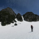
    Lindeman is one of my favourite moderate scrambles in BC as it has a bit of everything. A walk down a deactivated logging road, steep hiking through trees, wandering through meadows and scrub near treeline, a. gully ascent, some snow travel, and some straightforward scrambling near top, with amazing views all around, with Mt. Rexford on one side, Macdonald to the north, and the huge drop down to Chilliwack Lake on the east.

  2. Coquihalla Mountain (Easy)
    Illal Meadows is one of my favourite camping destinations, and is a great way to turn an ascent of Coquihalla mountain into a relaxed weekend adventure.   While you’re there though, it takes only a couple hours from the meadows to swing around the east side of Coquihalla towards the south and then up to the aesthetic summit. It’s also possible to ascend as a difficult scramble from the col just to the northeast of the summit.
    • Side Trip: Jim Kelly Peak (Moderate)
      Right above Illal meadows is Jim Kelly peak, which takes only ~30 minutes to ascend from the base. Might as well do it while you’re in the area for a fun extra little jaunt! Illal Mountain and Spider Peak are also possible to ascend from the meadows but have little to offer for the scrambler other than a minor sense of completeness.
  3. Mountain Lake Peaks
    For how close the mountain lake area is to Vancouver, it’s amazing how little love it gets. The obvious reason is the gate blocking the road right at highway 99, but even in the years before the gate was installed, I think I only once ever encountered another person in the area while up there. The BCMC has a key, so put a trip on their schedule and get yourself up there! The Wind Lake trail gets you up to Mountain Lake in only a couple hours from the end of the road and is usually in a reasonable state of repair, though I’ve done trimming with hand shears the last couple times I was up there. There are lots of peaks in the area, and it is the standard approach to Ledge Mountain (I’ve never made it up, always hit bad weather on attempts) and Ledgeling, as well as a route to Sky Pilot, but two mountains stand out as excellent scrambling in the area.
    • Mt. Sheer (Difficult)
      The obvious horn right above Mountain Lake. Head direct up the SW ridge from Mountain Lake, for a really fun exposed class 3 on great rock. It looks harder than it is. Just below the summit there’s a short class 4 step without much exposure. On the way down, it’s possible to avoid downclimbing the lower half of the SW ridge by descending the obvious heather gully and connecting to the ridge at its base.
    • Ben Lomond (Moderate)
      A very fun adventurous moderate scramble, especially as a Fall trip when days are short.  Leave the Wind Lake trail shortly before reaching the lake to go up over Ben More, down the obvious slopes towards Ben Lomond, up a short tricky dirty step to connect to the main talus slopes below Ben Lomond and then work your way up to the west ridge following the most obvious line. On the way back, it’s possible to descend to the pond below Ben Lomond and Red Mountain and then up and through the col between Ben More and Ben Lui to reach Wind Lake and start down the trail back to your car.
  4. Watersprite Area Peaks
    Back in 2013, Brittany & I helped Dave Scanlon construct the first proper trail and bridges into the Watersprite area, and it’s amazing how popular the area has become the years since my dad (Ed) & his gang of BCMC’ers built their hut. From a base at the lake, there are two trips to recommend to the coastal scrambler.
    • Watersprite / Gibson / Martin Traverse (Moderate)
      While Watersprite Tower itself is low 5th with high exposure, it’s possible to scramble up the gully immediately south of the tower onto the ridge that connects Watersprite to Gibson and Martin peaks. From the ridge just shy of Watersprite Tower, it’s possible to traverse over Gibson and all the way over to Martin for a great day of mostly easy scrambling with a few moderate steps. Highly recommended!
    • Dreadnought Peak (Moderate)
      The second scramble of note in the area is Dreadnought Peak. It’s possible to ascend the ridge from the Dreadnought / Watersprite col directly (difficult in places), or to head up the obvious gully just to the west of the col, which other than being loose and a bit unpleasant for the last few minutes near the top isn’t particularly difficult. The summit has a really neat near vertical groove in it to the north that is used occasionally as an alpine ice route just outside Squamish!
  5. Linus Mountain (Moderate)
    Statimcets is the “Downton Creek” peak in the old Scrambles book, and as the book says, there are many other great scrambles in the area. The one worth calling out as particularly nice is Linus peak, which can be done as a moderate scramble with occasional mild exposure on the ridge. Ascend from the meadows to the col between Linus and Schroeder peak (i.e. col to the S of Linus), and follow the ridge up to the summit, never beyond moderate difficulty though with some mild exposure in places. It’s possible to return the way you came or to continue on to Statimcets for a longer day. The upper meadows in Downton creek are without a doubt among my favourite camping destination in SW BC.

  6. Seed Peak & Mt. Gillespie (Easy / Moderate)
    Difficult to access for many years, the road leading up to Seed Peak was rebuilt in 2019/2020 for logging and is now in great condition. When I went in in early June 2020, the old trail was overgrown and in disrepair, and we did some work to replace flagging and do some trimming. A few months later there was a clear footbed once again and a proper trail, just showing how important it is to keep foot traffic going to these amazing areas. Seed Peak is really just a beautiful hike into the alpine, but Mt. Gillespie can also be added on for a longer day by descending to the lake and working your way onto Mt. Gillespie’s northwest ridge.

  7. Crown Mountain via Crater Slabs (Difficult, Exposure)
    One of my favourite local scrambles in the fall when the days are short.   The recommended circuit is to head up the Hanes Valley trail, branch off to the right just before the trail starts ascending to Crown pass and instead head up into the canyon draining the slabs below Crown Mountain. The canyon has a few interesting class 3 steps, and at the end of the canyon there’s a short class 4 step to get onto the main couloir slabs. From this point, there is fun moderate scrambling all the way up to intersecting the trail just below the summit. Be careful to frequently look up and choose the route as going a few metres left or right can make a big difference in terms of difficulty. Once you’ve reached the summit, follow the standard trail back to Grouse mountain and skyride down to save your knees! It is possible to traverse to the right and leave the main couloir and head straight to the summit, but this increases the difficulty a fair bit and I wouldn’t recommend doing so.

    The one big problem with this route is the high objective hazard from other hikers above who can rock knocks down, so going midweek is strongly recommended.

  8. Conway Peak (Easy)
    The southernmost peak in the Cheam group. It’s essentially just a pleasant hike with a bit of routefinding needed once reaching the alpine, but very worth it for the views of the backside of Foley, Welch, as well as the peaks across the border to the south.

  9. Needles Traverse (North Shore) (Moderate)
    More interesting trips still covered in snow? Why not ascend some of the north shore’s lower summits! Hike the Norvan falls trail, and head up the Coliseum trail from the falls. Once you reach the first open area, you can ascend direct up a talus field onto the ridge to the north of the North Needle, and from here all three needles can be traversed easily, with just a few moderate scrambling steps. From the south needle there’s a well established trail that can be followed back to Lynn peak and down to where you started, or alternatively it’s possible to turn off and head down the Hydraulic creek trail to the Lower Seymour conservation reserve.

  10. Sigurd Peak (Easy)
    Off the same trail as leads to Ossa is the Sigurd Peak trail. In a sense it’s great bang for your buck. Park and go up! It’s over 1800m elevation gain from where you leave your car to the summit, but the trail is in great shape, as are the views. Just think of it as doing two grouse grinds, with a better view.

  11. Mt. Bishop, Deacon, and Presbetyr (Easy / Moderate)
    A fantastic bike & hike right near town, but with… elevation! Bike up to the Seymour dam, find the start of the Vicar Lakes trail, and start going up. And up. And up. Really, there’s a lot of up. This is probably the steepest trail near Vancouver, with plenty of roots, and ropes. Above Vicar lakes follow the marked route up to treeline and then cross the talus field to the south to find the easiest way up Mt. Bishop.

    Deacon (Jarrett) & Presbetyr peaks can be added on to make for a three-fer day while you’re up there. In the Spring, ice-axe and comfort on somewhat exposed snow to 45 degrees is necessary to descend to the slopes below Deacon from the Bishop trail, making it into an easy mountaineering expedition, but I’ve been told this is an easy heather / talus slope to descend once the snow melts.

  12. Snass Mountain (Moderate)
    A popular route in Manning Park is the so-called “Punch Bowl” loop, ascending the Whatcom trail past the flowering meadows of the Punch Bowl, and returning via the Dewdney trail. This loop is a worthwhile hike on its own, either as a day trip or an overnighter, but as a scrambler, you’ll want more. In order to get more, ascend the west ridge of Snass from

  13. Bendor Range Peaks (Moderate)
    The Bendor Range is occasionally easy to access, depending on the current quality of the Truax Creek FSR. When it’s in good shape, it can be used to access a large number of peaks, of which I’ve only done a couple. There is great camping to be found near the small cluster of lakes just below 2000m a few km to the south east of the end of Truax Creek FSR, and from a camp here, it’s possible to climb Williams Peak (moderate), Mt. Bobb (easy), and Bendor Mountain (difficult, I didn’t attempt due to rain). On the other side of the valley other members of the camp I was involved in also climbed Truax and Fergusson, but I can’t vouch for them. That said, there are two easy day trips possible from these lakes, both involving full days of cross country alpine & sub-alpine travel.
    • Williams Peak (Bendor Range)
      Begin by heading north from the small lakes camp and ascending the peak labelled “Rush” on bivouac. From here I descended to the east to bypass “Wilmot” peak, ascending to the grey rock to reach the south ridge of Williams and beating by ~1 hour my companions who traversed over Wilmot. The south ridge of Williams is an interesting easy/moderate scramble that goes through a really neat corridor section just before the summit.
    • Mt. Bobb
      From the small lakes camp, ascend snow or rocks to the col south of the lakes and make your way from lake to lake as you traverse cross-country towards Mt. Bobb. Mt. Bobb itself is a straightforward ascent over easy talus and heather, not much of a scramble but a full day XC adventure!
  14. Mt. Seymour via Scrambling routes (Moderate / Difficult)
    If route quality is judged by how often I do it, this would clearly be #1. Where else can you find an almost infinite variety of scrambling lines within an hour of your car than on Mt. Seymour? There are so many lines possible up pump peak, and all sorts of interesting lines possible on the 3rd peak as well if you head to the right (east) of the main trail.
    • Side Trip: Runner Peak (Moderate)
      Have a bit too much energy but already reached the final peak of Mt. Seymour? Descend the Elsay Peak trail from between the second and third peaks of Seymour and from the low point, turn off the trail and head up the boulder gully to the north of Mt. Seymour. From the top of this gully, a quick moderate scramble up Runner Peak makes for an extra bit of fun on your day before your hustle back to your more relaxed companions.

  15. Deeks Peak (Easy)
    For the final peak on this list, we have the least loved(?) peak on the east side of Howe Sound. My preferred route is the so called “bypass trail” that leaves the Deeks Lake trail early on, goes straight up the west ridge of Deeks (please bring shears! badly in need of a trim!), and then to traverse over the top and from the summit to follow the flagged route down towards the Deeks / Windsor col, down to Deeks Lake, and then all the way back to the car. I suppose people avoid this because the trail needs love, and there’s > 1500m elevation gain without much break, but with a bit more traffic this could once again be a local favourite.
Continue ReadingOther Scrambles to do in 2024

Deeks Peak (2017)

Date: July 8, 2017

Participants: Brittany Zenger, Geoff Zenger

Difficulty: 2

Report: Brittany, Eira, and I arrived home a day earlier than expected from Hornby Island, and with great looking weather coming the following day, we decided to have a go at Deeks peak.  I had a failed attempt of Deeks on skis back in December and I was eager for the opportunity to deal with unfinished business.

Much like last year when heading to Mt. Hanover, we drove up the Deeks road for ~3.2km to just before the final steep rise on the road and parked here so as to not destroy the XTerra on the final stretch of road.  The road seemed to be in even worse shape than last year and it’s getting to the point where I might just give in and park by the highway the next time I head up towards Deeks Lake.

We left the car at 8:25 and started our march up towards Deeks.  About half an hour up the Deeks lake trail there is a marker on a tree pointing towards the “Bypass trail”, and this is the route we chose for our ascent.  The “bypass trail” (aka “Deeks direct”, aka “Deeks W Ridge direct”) is the most direct trail up to the summit of Deeks but is in need of some love and care.  There are a few places on the trail where we were left hunting around wondering where the next ribbon was, but for the most part it is obvious enough to follow.  The only point with real confusion was where the trail popped out onto a boulder field and it wasn’t obvious that the trail continued to directly up and to the right without ever crossing the boulders.  That said, with a bit of work, I could see this trail becoming very popular as it really is a fantastic route.

As the trail nears treeline it became increasingly steep, overgrown and buggy, but by noon we were clear from the trees, and although we lost the trail markers we headed up straight for the summit without any difficulties, and were on top by 12:45.  The air was clear and the views were great, so we stopped for a lunch and to ponder our way down, eventually deciding to descend towards the Deeks-Windsor col to find the regular trail down to Deeks Lake.

We started our descent at 1:30 and quickly discovered that the route down the east side of Deeks (towards the Deeks-Windsor) col is steep, not travelled very often, and hard to follow with occasional snow patches obscuring the footbed.  Nonetheless, we managed to follow the route all the way to the final bump above the col, where we lost it.  Unfortunately we turned off the ridge too early and instead of going up and over the final minor bump we turned to our right and worked our way down a very steep, unpleasant, and precarious bushy slope until we found the flagging from the proper trail from Deeks joining us from the left.  From here it was just a couple minutes walk to meet the main trail heading up to Windsor.  Unlike the Deeks trail, this trail was in fine condition and we were able to make our way down to Deeks Lake, where we arrived at 3:45 and stopped for our final snack of the day.

From Deeks Lake it was the familiar old slog down to the car, which we reached at 5:15 for a total round trip time of just under 9 hours.  As it stands now, I wouldn’t recommend Deeks over the other peaks in the area like Brunswick or Harvey, but with a bit of work on the bypass trail, Deeks could once again be a north shore classic.


Continue ReadingDeeks Peak (2017)

Capilano Mountain

Date: July 1, 2016

Participants: Steve White, Geoff Zenger

Difficulty: 2 (hands needed for a few short steps, easy snow)

Report: A promising forecast for Canada Day led me to post a trip on the BCMC schedule and look for some company to join me on an excursion up Capilano Mountain.  I lucked out and Steve volunteered to join me, but we both ran out of luck when the forecast turned out to be dead wrong and we spent most of the day in the rain and fog.

The gate at the bottom of Phyllis Creek road is permanently locked, and so we parked in the pullout right below the gate at the edge of Furry Creek golf course, and by 8:10 we had our bikes good to go and started up towards Capilano Mountain.  The road was easier than I remembered driving years ago, and we only had to push the bikes up two short hills en route to the turnoff to Downing Creek road, which would take us to the Beth Lake trailhead.  Route notes: on Phyllis Creek road, take a right at the first fork and always follow the most well used path up to the turnoff, which is just before the 4km marker, not just past as Matt Gunn’s guidebook indicates.

About 100m after turning on to Downing Creek road, we crossed Phyllis Creek, and the road began to deteriorate as the alder encroached on the path.  A few hundred metres later we started to encounter lots of small windfall, and about 500m from the turnoff we gave up on the bikes and left them in a ditch.  This proved to be wise as the road became increasingly overgrown from this point and bikes wouldn’t have helped at on all the descent beyond this point.  As a result, we had to travel the remaining 2.5km to the old Beth Lake trailhead on foot.

The first 0.5-1km of the trail up to Beth Lake is badly overgrown with a variety of bushes, including devils club and plenty of blueberries.  Making matters worse, the skies had opened and by the time we reached the older growth above we were thoroughly soaked.  We persevered nonetheless.  At this time the trail is easy enough to follow, although it won’t be too many years until the trail becomes a challenge to hike unless someone heads up and clears the trail up to the old growth.

We reached Beth Lake at around 11:00, and as we stopped for a quick snack and drink, the clouds descended and we had our first experience with the fog that would engulf us until we reached our bikes again later in the day.  From the lake, the trail is a bit of a mess for the first 10 minutes as it traverses onto the ridge to the west of the lake, but soon improves and until we reached snow at around 1300m it was in good shape.

Above treeline the route is fairly well marked with cairns and we had little difficulty following it until near the col west of the summit (south of Gordon lake), but as the fog became even more dense, we had to check a GPS route a couple times to determine the right way to proceed.  The summit block itself was quite easy to ascend, mostly on snow except for a steep step near the summit where we moved onto the rocks and heather to the side of the gully.  We reached the summit at about 1:50 and were treated to glorious views of fog and more fog.

In the fog we started down the summit in the wrong direction, but noticed our mistake quickly and found our tracks in the snow to follow back down.  The descent down to the bikes was aided greatly by the snow and we were back down at the lake in what seemed like no time.  From the lake down to the bikes was an annoying combination of bush and logging road walking, but once we reached the bikes, all was better.  There are few experiences in life I enjoy better than coasting down a logging road on a bike at the end of a long hike, revelling in the thought that some poor souls have had to suffer the long logging road descent on foot.  The bike descent was fast and fun, and soon enough we were back at our vehicle, just in time to witness the skies begin to clear.

Thank you very much Steve for joining me on this adventure.  There were no views, and the conditions weren’t great, but at least Capilano mountain has been bagged at last.

Total ascent time: 5 hours, 40 minutes.  Total descent time: approx. 3 hours.


Continue ReadingCapilano Mountain

Mt. Hanover

Date: May 14, 2016

Participants: Radmila Bridges, Geoff Zenger

Difficulty: 3 (snow to 40 degrees, some scrambling moves)

Report: Another month, another chance for an adventure.  With a baby at home I have to be more selective than I used to when it comes to getting out these days, and it gives me incentive to pick destinations closer to Vancouver to minimize travel time.  There aren’t many significant peaks near Vancouver that I haven’t climbed, but one notable exception was Mt. Hanover and so I posted a last minute trip on the BCMC schedule to try and find a couple people to head up Hanover with me.

Saturday morning we drove up to the Porteau Rd turnoff on Hwy 99 and seeing that the gate was open to the upper Deeks Creek trailhead, we drove up.  The road is in pretty bad condition in a few places with quite large loose rocks and deep grooves, but the Jeep survived the ascent and we quickly shaved off 3km of boring logging road hiking from the day.  I don’t know how much longer the road is going to be in driveable condition with a regular 4wd that has not been jacked up, but for now it goes.  We parked at the so called “upper parking area” at about 7:50, and shortly after 8, walked up the road another few hundred metres to the “upper upper parking area”, where the trail begins.  In theory someone could drive up these final few hundred metres, but I was not willing to risk in my jeep.

The trail to Deeks lake is in excellent condition, with only a couple minor pieces of deadfall to contend with and we reached the lake at 9:20am and stopped for our first break.  Deeks lake is larger than I thought it was, and there are a couple nice camping spots by the lake.  Nonetheless, we didn’t wait there long and soon turned right, crossed the logjam at the exit to the lake, and continued on the Howe Sound Crest trail around the lake and worked our way through pleasant terrain up towards Hanover Lake.  The creek was running high at the place where the trail crosses to the east side of the creek, but luckily there was a large nearby snow bridge that we used to cross.  At Hanover lake the trail gave way to snow, and above the lake we missed the place where the trail crosses back to the right side of the creek, but it was no problem because at the exit of Brunswick lake there was another logjam that was easily crossed, and just past 11am we were at the Brunswick Lake emergency shelter, where we stopped for our second break of the day.

From the emergency shelter, we followed the HSCT markers towards Hat pass until the terrain became open and there was an obvious location to contour to the left onto a bench and start heading towards Mt. Hanover.  Below Mt. Hanover the snow was mushy and slowed our progress, but we steadily ascending up until the notorious two gullies on the south / south east side of Hanover came into view, and we found ourselves below them at around 12:30.  In summer conditions the left gully is reportedly much easier than the right gully due to some difficult scrambling moves required to get around two chockstones in the right gully.  However, in mid May conditions, the left gully was an alternating mix of rock and snow patches with a few difficult looking gaps in the snow, whereas the right gully appeared to be snow filled completely and so we took out our ice axes and started up the right gully.

Not far up the right gully we encountered a significant moat in the snow at the first chockstone, a few metres deep, but not terribly wide, and we were able to bypass it on the right via a few easy scrambling moves on the rock.  Above this it was steady step kicking all the way up to the summit (soft enough to not need our crampons), which we reached just past 1:30.  The gully varies in steepness, but about 2/3 of the way up has a sustained section of 40 degree snow that, while not hard, was somewhat stressful due to the big hole 3/4 of the way down the gully that loomed below us.  It eases off a bit below the summit, and the gully tops out on the literally a few metres from the true summit.  We spent a few minutes taking photos on the summit, and the crossed back over the top of the gully to a nearby subsummit that was snow free and were we could sit on the rocks, eat lunch, and enjoy the views all around.  Total ascent time: 5.5 hours.

The descent down the summit gully was slow as we had to face inwards and carefully follow our steps the whole way down.  At the gap / chockstone, I misplaced one of my poles on the rock and it slipped down into the hole.  Luckily, it landed on a snow lip and I was able to get myself into a position where I was able to fish it out with my ice axe.  That left the chockstone hole unsatisfied and demanding sacrifice, and as Radmila crossed from the rock back onto the snow, she dropped one of her poles into the hole, where unlike my pole it did not land on a ledge and is now waiting to be found by another adventurer.

By 3:15 we were back on the easy snow below the summit block and put away our ice axes.  From here, we motored down nonstop, and reached the car at about 10 to 6, for a total descent time of about 3.5-3.75 hours.  Car to car time was a bit shy of 10 hours.  In all, it was a great early season trip.  I probably could’ve chosen a shorter/easier trip for my first real hiking/scrambling trip of the year, but given my lack of free time it was great to get out and knock off one of the remaining local mountains from my hit list.  Mt. Hanover is quite out of the way, and so I wouldn’t recommend tackling it until someone has already knocked off the more popular local trips (Brunswick, Harvey, Lions, etc), but it is nonetheless a worthwhile outing.  Many thanks to Radmila for accompanying me and providing great company for the day.

Continue ReadingMt. Hanover

Needles Traverse (N to S)

Date: May 9, 2015

Participants: Ed Zenger, Geoff Zenger

Difficulty: 3 (some scrambling, steep bush)

Report: For a few years now I’ve had the idea that I want to knock off all of the north shore peaks listed in Fairley’s guidebook, and one of the closest set of peaks to Vancouver that I hadn’t previously ascended were the Needles, the 3 summits on Lynn ridge lying between Lynn peak and Coliseum mountain.  The needles are visible from much of the lower mainland, and don’t look like much, but a traverse of the Needles and Lynn ridge makes for a full day adventure, only minutes from the city.

Note: If you’re wanting to just go and bag the highest Needle (the middle), by FAR the most efficient route would be to bike up the Seymour river and take the Hydraulic Creek trail up to the South Needle and then scramble over to the Middle Needle (many people will want a rope to descend the South to the Middle needle col) and then reverse the route after bagging the summit.  We didn’t do this because a traverse just sounds more exciting!

We set out from the regular Lynn Headwaters park trailhead at 8:30 towards Norvan falls, which was the usual trudge taking a bit under an hour and a half, and from there went up the Coliseum trail.  I’ve only gone up Coliseum from the other side before so it was interesting to see that the Norvan side isn’t really that much less steep for the first bit, although it does fairly quickly (after about 30 minutes) level off as it starts traversing into the broad bowl between Coliseum and the Needles.

At approximately 800m (or perhaps just below), just under an hour after starting up from Norvan falls, the trail enters the bottom a large open slope, just to the north of the North Needle, with a steep narrow gully visible in the top right corner of the bowl above.  The ridge from the north needle to where the ridge hits the Coliseum trail is reportedly simply awful, and so rather than do the full ridge, we bushwhacked up this bowl towards the gully on the upper right (generally able to stay on boulders but some bush), and approximately 100m to the left of the upper right gully found an easy dirt slope that led up to the ridge.  On this slope we hit our first flagging tape of the day.

Note: If you’re doing the traverse in the other direction, at the first minor col north of the north needle, look for occasional flagging tape heading down to your left towards the Norvan trail.  It is probably hard to follow as it’s a little spaced, but this is your best option to get off the ridge.

The ridge up to the north needle was bushy, but otherwise no problem, and we were quickly on top, approximately 4 hours from starting at the car.  The views were great and we had a quick bite to eat before descending the ridge and going up the middle needle.  There’s a small amount of bushy, minor exposed scrambling heading up to the middle needle, but nothing bad, and on top we had our main lunch for the day.  Right on the flat summits of these two needles was the only snow of the day, just a few inches of mush.

Descending the middle needle you lose a lot of elevation into the steep col between it and the south needle, and here you encounter the only real difficulty of the day, a choice between some extremely steep bush on the right or a short (10m) 3rd class slab that was wet.  Going up was no problem, but I would imagine that many people would want a hand line or rappel to get down if doing the traverse the other way.

From the south needle onwards there’s a well defined trail, presumably to the popularity of the Hydraulic Creek trail build approximately 10 years ago.  We, however, did not take that trail as our car was down at the Lynn Headwaters parking lot, and continued past the Hydraulic Creek trail junction along the ridge.  This part of the ridge is full of ups and downs and is boring, boring, boring until the Lynn peak viewpoint, after which it is all downhill on a tedious old rocky skid track.

I wouldn’t do the traverse again unless someone built a proper trail due to the bushiness in places, but it was a very full day with lots of adventure and aside from the last couple hours of the trip was actually a lot of fun.  Total time required: 9.5 hours, total distance just under 19.6km, and total elevation gain slightly over 1900m!

Last word: Should I do the traverse N -> S or S -> N?  I would highly recommend doing the traverse N -> S instead of the other way around because from below it’s easy to see how to shortcut onto the ridge at the right place (so fewer route finding difficulties), the 2 scrambling steps are done going up instead of descending them, and because the toughest parts of the day are done early on when you’re fresh instead of at the end of the day.

GPS Track: Link to KMZ

Needles route

Continue ReadingNeedles Traverse (N to S)

Mt. Elsay & Runner Peak

Trip Date: October 6, 2012

Participants: Alice Hwang, Leif, Dave Percival, Chloe Tergiman, Lida Vavrova, Bob Woodhouse, Geoff Zenger

Difficulty: 2 (Elsay), 3 (Runner Peak)

Report: Time and time again I’ve gone to the top of Mt. Seymour and gazed over at Mt. Elsay, and at long last, I got around to putting a trip to Mt. Elsay on the BCMC schedule.  We met in the Seymour parking lot just before 8:30 with the objective of reaching Mt. Elsay via the trail that descends to the west from the col between the second and third peaks of Seymour.  Despite being early October, the sun was already shining bright and the air quite warm by this time in the morning.

We made excellent time up the Mt. Seymour trail, taking a small detour to scramble directly up the face to Pump Peak, and reached the col between the second and third peaks of Seymour just before 10 o’clock.  From here, a flagged route descends to the west and contours around the third peak of Seymour, eventually descending to a basin below Runner peak, and from there rising once again towards Mt. Elsay (albeit with plenty of up and down).  The trail is generally in great shape, although in a few places it’s easy to accidentally wander off the route on old game paths, as a few of us did on a couple occasions.  I had initially thought that it would take us a good 4 hours to reach Mt. Elsay, but we were on the summit at 11:45, just three and a quarter hours from when we started.  With the clear autumn air, the views from the summit were fantastic.  Peaks as far away as Shuksan, Cheam, Slesse, Sky Pilot, Mamquam, and Robie Reid were all clear in the distance, and of course all of the north shore mountains were visible too much closer by.

We departed the summit around 12:30 and were back in the basin below Runner Peak a bit before 1:30.  Although not an official objective of the trip, with the day so young, most of us decided to make a detour and climb Runner Peak as well (two party members headed straight back to the cars in order to be back in town by mid-afternoon).

Some wishful thinking and questionable routefinding decisions led us to try to short-cut the need to climb to the Seymour-Runner col before ascending Runner Peak, and we began by climbing a steep bushy gully, only to find that it petered out near the top.  Everyone except Bob decided to descend back down to the rocks and snow below, and to head up to the standard route via the Seymour-Runner col.  Bob, however, decided to forge his own traverse route around Runner Peak on a series of vegetated ledges, apparently also with a fair bit of 4th/low-5th climbing needed to move between them.

Someone has flagged the route up Runner Peak from the Seymour-Runner col, and is it easy to follow.  There is a short 3rd class section about half way up from the col, with little exposure.  It was a little awkward to descend, but is unlikely to daunt anybody willing to make the trek all the way over there from Seymour.  Above the 3rd class section there are only another few minutes of scrambling / hiking needed to reach the summit.  We summited Runner at 2:30, and once again sat down to enjoy the magnificent views (and also confuse the group of people on top of Seymour, who it seemed couldn’t figure out how we had gotten over to Runner Peak).

We left the summit of Runner Peak at about 3 o’clock, and made our way down to the low basin below the peak to regain the Mt. Elsay trail.  The hardest part of the day was making it back up from here to the Mt. Seymour trail.  The trail is steep, and we had already been hiking a long time.  Nonetheless, everyone made it up with their spirits still intact, and once on the Mt. Seymour trail it was quick going down to the cars, which we reached just before 5:30.  In the end, my B2 trip turned into a C3, but it was a great trip nonetheless.  We had perfect conditions, interesting objectives, and a great group of people.

Continue ReadingMt. Elsay & Runner Peak

Mt. Fromme

Trip Date: Feb 12, 2012

Participants: Ed Zenger, Geoff Zenger

Difficulty: 2

Report: With Britt’s recent back injury, and a rather rotten forecast, I wasn’t going to be heading out of town this weekend, and so the question became one of finding a reasonable trip to go on without driving far, that I had never done before, and that wouldn’t require good weather.  In the end, I managed to convince my dad to head for a quick jaunt up Mt. Fromme from Prospect Road.  We set out in a slight drizzle, ascended up the mountain biking trails to the Peer Jynt trail, and then up Bill’s Trail to the summit.  Remarkably, despite it being early February, our snowshoes stayed on our backs and we made the full ascent and descent without needing to put them on.  We didn’t encounter any snow until around 775m, and the snow wasn’t continuous in the trees until around 850m!

It was snowing slightly at the summit despite the temperature hovering above 0, and at the summit we had no views whatsoever.  From the perspective of wanting an interesting destination or wanting great views, Fromme isn’t a great place to go, but it is somewhere slightly off the beaten track despite its closeness to the city, and at this time of year, there are no crowds whatsoever.  Total return trip was around 4 hours 15 minutes.

Verdict: 1/3.  Go there once, or if you just want some exercise on a rainy day, but there are better options nearby.

Continue ReadingMt. Fromme

Crater Slabs (October 2011)

Trip Date: October 15, 2011

Participants: Saravie Brewer, Max Bitel, Brittany Zenger, Geoff Zenger

Difficulty: 4

To find a more detailed trip report, please see my report of the route from the previous year.

For the second year in a row, early October brought a string of fair weather days, and Max suggested that we repeat our trip from the previous October to Crown Mountain via the Crater Slabs route, and this time bring Brittany and Saravie along with us for a taste of more serious scrambling.  We met up at about a 6:45 at the base of Grouse, where we left a vehicle and shuttled over to the entrance of Lynn Headwaters Regional Park, where we parked just outside the gate (as the gate is closed from 7pm-8am at this time of year) and were hiking up the road at about a quarter to 8.  The previous year we started our trip by hiking directly up to Dam Mountain from the base of the skyride and dropping down from Crown pass to Hanes Valley, but the direct route into Hanes Valley from Lynn proved to be much more efficient, and I recommend doing the trip as a loop for anyone who’s able to organize a vehicle shuttle.

We quickly made our way up Lynn Valley, and then Hanes Valley, and stopped for lunch high on the talus field before the gully that starts the route proper.  In order to give a lengthy headstart to another pair that we encountered wanting to do the same route and minimize the risk of being hit by rocks kicked down by them, we took our time and enjoyed the sunny autumn air, and began our way up the gully shortly after noon.  The route was dry, and once again we were able to provide plenty of entertainment to the crowds up on the summit of Crown gazing down upon us as we made our way up the slabs.  Near the top of the slabs, I made my way off to the left hand side of the main couloir with Brittany and Saravie (the easiest way out), while Max headed out on to the slabs directly below the summit and once the rest of us had established ourselves on the summit block, he made his way straight up to us.  He reports that the upper section of the slabs just below the summit venture into low-5th territory and that anyone who found the lower slabs challenging should exit straight up the couloir as the rest of us did.

Full of adrenaline from the climb up the slabs, Brittany was strangely hesitant to climb the summit block, but in the end we all got our photos of a beautiful fall afternoon and relaxed to enjoy some home made banana bread (far superior to Clif bars, I must say).  We left the summit at around 4:15, and made our way back to the Grouse mountain chalet, arriving after dark, only to buy our downloading tickets and to find that the red skyride was undergoing maintenance and that we’d have to line up for the blue skyride.  Had we known how long the line would be, we would have hiked down the BCMC trail in the dark.  However, as we already had our tickets, we settled down in the cafeteria to eat dinner and wait… and ended up waiting nearly 3 hours, finally arriving back at the base of grouse around 11pm.  Despite this delay though, the day could not be damaged, and an exhilarating and fun day was had by all of us.

Verdict: 3/3

Continue ReadingCrater Slabs (October 2011)

Harvey-Brunswick Crossover

Trip Date: October 8, 2011

Participants: Marion Carpent, Natasha Suvorova, George Malburg, Brittany Zenger, Ed Zenger, Geoffrey Zenger

Difficulty: 2.  Steep bush descending down the north east ridge of Harvey.

Elevation Gain: ~1800m

Report: After this year’s short hiking season in August and September, early October brought cool and grey weather, but the forecast for this Saturday was for clear skies until early in the afternoon.   I had previously climbed Brunswick the previous fall with Jeff Ross and James Clarke, and had previously ascended Harvey in winter via its North Face Ramp, but had never previously ascended Harvey in summer conditions, and so a trip to climb both Mt. Harvey and Mt. Brunswick in a day was hastily arranged.  We chose to climb Harvey first and Brunswick second for two reasons: first, we weren’t sure how difficult the Harvey NE ridge would be and wanted to encounter it early in the day, and second, the trail down from Brunswick is more pleasant than the hike down from Harvey.

We met at the Lions Bay trailhead at around 8:15, and set off on the trail a bit past 8:30 under cloudy skies.  Although Brittany wasn’t feel great, the trip up the Harvey trail to Harvey’s SW ridge was fairly quick and uneventful, and we reached the ridge just as the skies were clearing up just past 10:30, and stopped for a snack and to enjoy the sunny heat.  The SW ridge is a straightforward hike with a few short sections of class 2 scrambling, although I was surprised to find that the ridge was substantially more complex than was apparent when we descended it the previous winter.  We summitted Harvey at about 11:45, had a short break, and set out to find the route down the NE ridge into Magnesia Meadows.

In winter conditions, the NE ridge was much steeper than we had expected, with a few sections of 60 degree snow and ice to be negotiated, and it was interesting to descend the same ridge in summer (although damp) conditions.  The trail was fairly rough but easy to follow, and without any serious difficulties.  I wouldn’t recommend that anybody downclimb the NE ridge without having any prior experience downclimbing steep roots and short rock steps using vegetable belays as there are a few sections with exposure, but most coastal hikers/scramblers would be comfortable downclimbing the route.  As with all routes, it would probably be somewhat easier to climb than to downclimb.

We quickly made it down to the base of Harvey’s NE ridge, hit the Howe Sound Crest Trail soon thereafter, and stopped at the Magnesia Meadows emergency shelter for a proper lunch break.  After a lengthy break, we followed the HSCT over to its junction with the Brunswick trail, reaching the intersection at about 2:15.  From here it was just the regular route to the summit of Brunswick, which we reached at about 10 to 3.  By this point, the weather forecasted had moved in, and with the fog and cold wind, it felt like we were getting our first tastes of the upcoming winter.  Nobody wanted to stop for too long, and we soon made our way back down to Lion’s bay.  I reached the base with Brittany at around 4:40 (some jogging involved), and the last of us was down at the cars by 5:30.  In all, an excellent autumn workout for all with lots of varied terrain and eminently suitable for days with questionable forecasts.

Verdict: 3/3.  An excellent late season hike/scramble.  You will find me repeating this route in many autumn’s to come.

Continue ReadingHarvey-Brunswick Crossover

Mt. Seymour

Trip Date: Dec. 4, 2011

Participants: James Clarke, Stetson (James’ dog), Geoff Zenger

Difficulty: 2 (usually)

Report: By the morning of James’ early season BCMC trip to Mt. Seymour, we were down to just James, his dog Stetson, and myself.  Leaving the Mt. Seymour parking lot at 8am on a sunny Sunday, we were able to quickly ascend to the regular winter trail to the 2nd peak of Seymour before the snowshoeing crowds hit the mountain.  From the second peak we could see that there was a lot of exposed rock on the 3rd peak and that it wouldn’t be possible to ski all the way up, and so we ditched our skis in some bushes on the 2nd peak and began the traverse over to the 3rd peak.  Unfortunately for us, I had neglected to bring an ice axe and the traverse over to the col between the 2nd and 3rd peaks was covered with a thin layer of ice that, given that this was my 5th or 6th trip to Mt. Seymour in 2011, rendered the traverse too sketchy to be bothered with.

We reascended the second peak and ate our lunch as the first of the snowshoeing hordes caught up to us.  A brisk wind picked up, and we headed back down the trail, skiing down the southwest face of pump peak, and due to the presence of a dog, had to ski the trail down from Brockton Point.  Stetson at one point got distracted by the adoring crowds and disappeared for a good 10 minutes, but was eventually found mooching food from a group of friendly admirers.  Just below Brockton Point, Stetson was nearly fined by the park rangers for being off leash (a technicality, truly, as he was attached to a leash… just no human holding on to the other end), but managed to charm his way out of a ticket.  We reached the parking lot around 1 o’clock, by which point the trail was populated by the steady stream of hikers normally reserved for the grouse grind.

In the end, it was a failed attempt on Seymour, but we had fantastic weather, good views, and was a good trip for a day when I had to be back in town by early afternoon to visit with some visiting family.

Continue ReadingMt. Seymour