Silverdaisy Mountain (2015)

Date: April 26, 2015

Participants: Brittany Zenger, Geoff Zenger

Difficulty: 1

Report: Silverdaisy attempt #2!  We tried skiing Silverdaisy just after new years a few years ago but it had snowed heavily in the few days before our trip and we ran out of time after slogging up the old mining/logging road from Cayuse Flats.  This time we’d be much more successful ascending from the other side

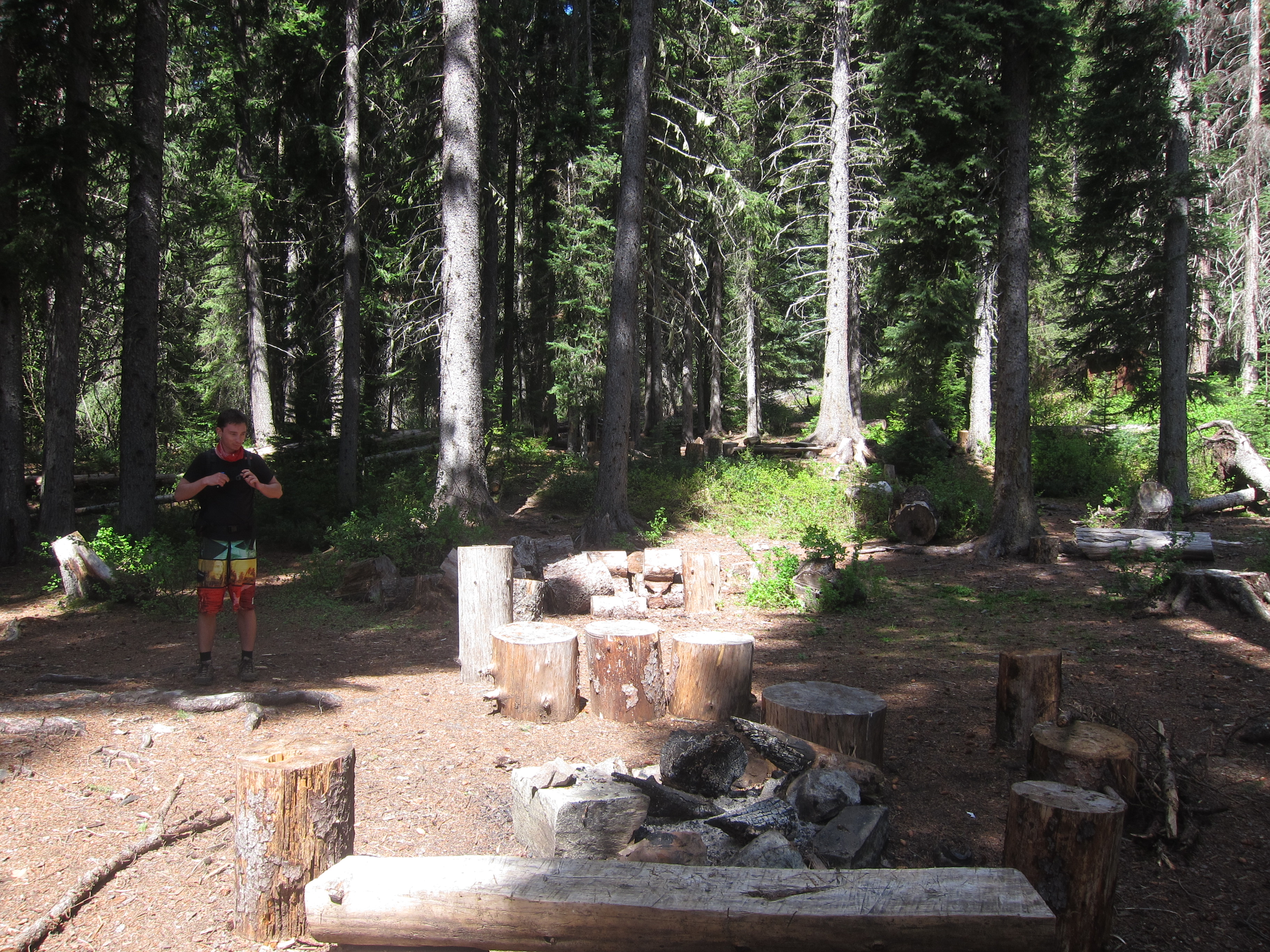
We arrived at the Sumallo Grove parking lot at about 9am and 10 minutes later were on our way.  We were a bit worried about recent snowfall and whether the trail through the forest would be followable, but it turns out that the trail is well defined (generally on an old double-track path) and well marked and we had no problems following it even once we encountered deep snow at about 1400m.  The trail is a starting to get quick a bit of deadfall on it, especially lower down so if anyone wants to organize a trail clearing day this fall and is wondering where to go, keep the Silverdaisy trail in mind.

Leaving the car at 9:10, it was a bit under 20 minutes to the Silverdaisy trail turnoff.  The trail switchbacks steeply up the side of the mountain before easing off slightly as it heads into the long valley splitting Silverdaisy and Hatchethead.  It wasn’t long after entering the valley that we first encountered snow, at first a little and soon a lot.  There were a few places we had to look around to find the flagging early on, but the trail quickly reaches an old road, at which point it’s obvious where to go to ascent to the col between Silverdaisy and Claimstake mountain.  About 200m below the col the snow became extremely mushy and we put on snowshoes to ease the ascent.  Looking over at Claimstake/Hatchethead on the ascent, it looks like in the winter there could be some really nice ski lines available.

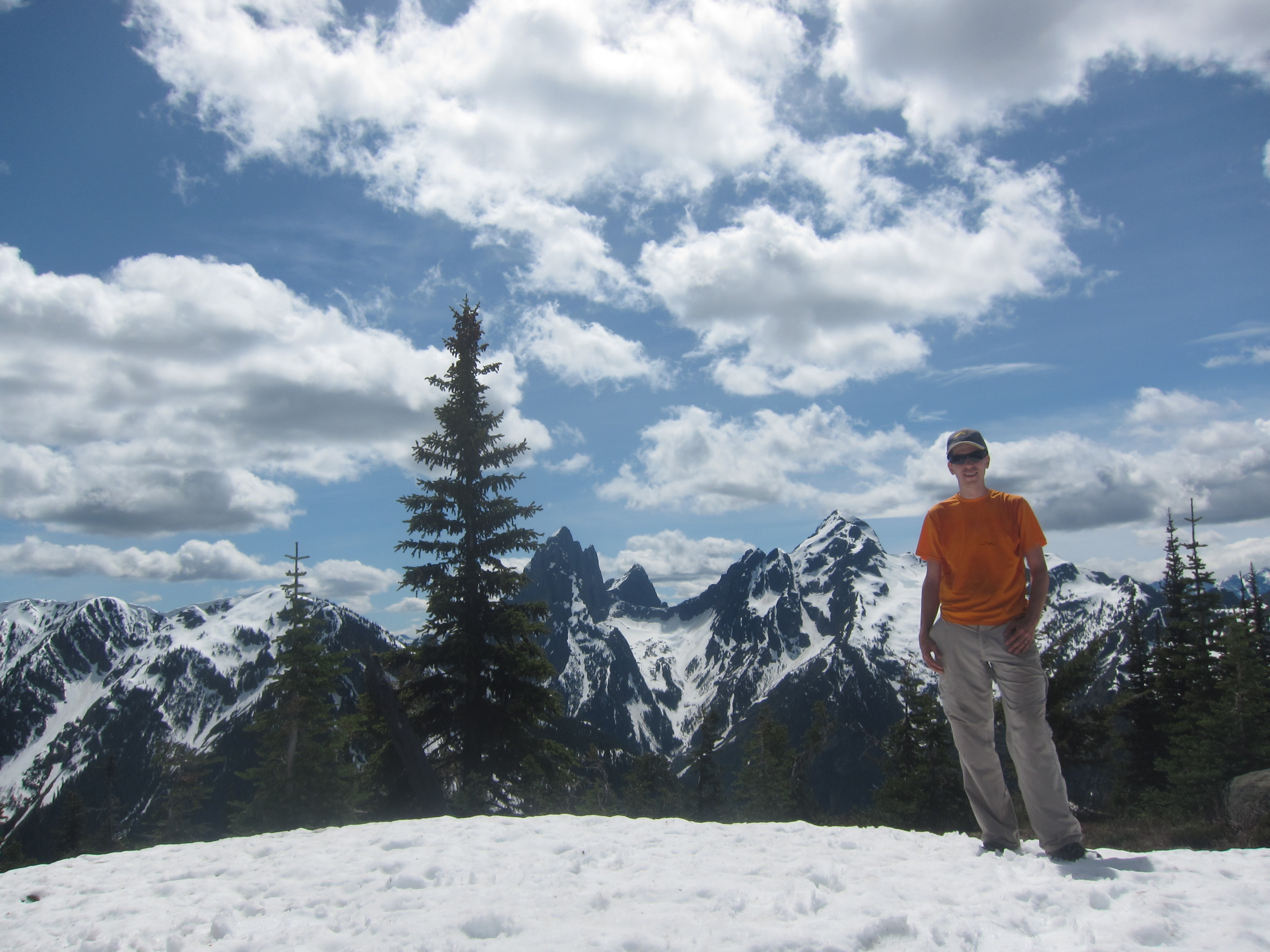
Total time to the col: 4 hours.  From the col it’s an easy broad ridge ascent through sub-alpine terrain to the summit and we had a great day for it.  Light overcast, cool, completely clear views.  Ascending the ridge took nearly exactly an hour, and at about a quarter past 2 we were on the summit, gazing at the views of Hozameen, Silvertip, Frosty, Brice and Outram.  Brice in particular looked like it’d have some fantastic winter ice lines on it for the hardcore crowd.

We didn’t linger long on the summit because the wind picked up, and headed off down the snow.  Descending the snow was no problem at all and very fast.  The trail out was a real slog once the snow ended, but easy enough, and we made it back to the parking lot right at 6 o’clock, for a total round trip time of just a bit under 9 hours.  I probably wouldn’t spend a summer day on this hike when there are more exciting ones to do, but for an early season ascent, this was a great trip!

P.S. I found out that on the same day we did Silverdaisy, another party took the same trail up but cut off of it to do a traverse of Hatchethead and Claimstake mountains, descending to the Silverdaisy-Claimstake col, and then back down to the cars… an idea for next year?


Continue ReadingSilverdaisy Mountain (2015)

Lone Mountain

Date: June 7, 2014

Participants: Sergii Bogomolov, Geoff Zenger

Difficulty: 2/3 (Short sections of moderate scrambling)

Report: Hiking the Lightning Lakes trail in Manning Park out to Thunder Lake has been on my list for some time, but Manning Park always seemed like a long ways to go for just a lake hike… Luckily, a couple years ago I noticed a peak called “Lone Mountain” in Beckey’s guidebook to the north Cascades, and I decided that any trek I did out to Thunder Lake should include an ascent of Lone Mountain, located on the SW side of the lake.  I posted a trip a while ago on the BCMC schedule and had some interest from a few people, but by the date of the trip, everyone had bailed except for Sergii, and on a nice Saturday morning we met up near my place in New West and drove out to Manning Park.  In the end I’m glad that there were only a couple of us and not a larger group because the trip would prove significantly more strenuous than expected.

We started out from the Spruce Bay parking area around 9:45am, and moved quickly along the lakes trail, reaching Strike Lake camp at about 11 o’clock.  After a quick snack break we continued on towards Thunder Lake.  There was some snow on the trail in sections here, but the going was quick and we reached the end of the official trail at Thunder Lake a bit past 11:30.  We followed a little used path around the northern side of the lake up towards some waterfalls coming down from Snow Camp Mountain above the outflow of the lake.  From here we bushwhacked down the little creek to the outflow from Thunder Lake where we were happy to find a thick logjam in the river that was easily crossed, and on the other side at a quarter to 1 we stopped for a full lunch break.

There is a large talus field perhaps 100m along the lake shore from the outflow of Thunder Lake that we wanted to take up towards the ridge, and so we trekked diagonally upwards through the bush to hit it.  The dirt slopes and bush are ridiculously steep on this section, but we found our way to the talus slope and followed it upwards until it became a steep and exhausting scree gully.  The heat and scree made ascent slow, and we eventually bailed out of the scree gully to the right (north), which in retrospect was a great decision because it brought us back to a firm, open talus field that led up to the ridge.  From the topo map and Google Earth I had expected the ridge to be an easy walk, but it proved to be an alternating sequence of bushy thrashing and steep dirt, with a couple short scrambling moves thrown in.  Luckily there isn’t any serious exposure, and we eventually made our way up to where we hit snow, perhaps 100m below the summit.  The snow line was surprisingly high, but I guess it’s a big cooking bowl around Thunder Lake that traps heat.

We reached the summit of Lone Mountain around 2:45, and sat down for a long break.  The view of Hozomeen from the top is amazing.  There is probably no better vantage point possible of the group and all three peaks are visible.  There are also good views over to the Skyline trail that crosses from Lightning Lake to the Skagit River, but otherwise the summit is quite unremarkable as it is lower than almost everything else in the area.  Tired and out of water, we departed the summit a bit before 3:30 to thrash back down to the lake.

We were back down at the lake at about 4:50, and after a quick break, decided to bushwhack horizontally along the lake edge to take the lower trail along Thunder Lake back to the main trail.  Big mistake!  It took us 40+ minutes to thrash through the thick alder and other foliage.  We really should’ve just followed the creekbed back up to the upper trail.  Nonetheless, we persevered and made our way back to the main trail, where we eventually found a good creek that we could refill our water from, and made the long trudge back to the car, which we finally reached at 8:20.  10.5 hours round trip!

In the end, am I glad I went to Lone Mountain?  Yes, I am.  But I am definitely never going back there again.  After doing the trip it’s clear why it’s rarely done… it’s a long ways with a lot of bush, scree, and sheer exertion to reach a very minor summit.  Regardless, it was a great trip and I have to thank Sergii for his great companionship on this mountain trek!

Continue ReadingLone Mountain

Mt. Outram

Date: May 24, 2014

Participants: Brittany Zenger (organizer), Paul Ng, Doug Bull, Maria Poechaker, John Blair, Britt van Rooij, Gusta van Zwieten, Rob Janousek, Geoff Zenger

Difficulty: 2 (trail and snow-walking, very long)

Report: After our unsuccessful attempt on Mt. Outram in early May a couple years ago, Brittany had unfinished business with the mountain, and posted a trip on the BCMC schedule to make another attempt.  The forecast for the day was only so-so but 9 of us were undaunted and made our way out to the western edge of Manning Park to march up towards the summit.

We started out on the trail at around 9:40am, and I was pleasantly surprised to find that someone has done substantial work on the trail in the past couple years.  The trail is in good shape and was easy to follow until we hit snow, just before the crossing of 17-mile creek (perhaps 150 metres higher than where we hit snow two years ago).  There are still a few good snow bridges over the creek, and so we had no difficulty getting over despite the rushing torrent below.  We crossed the creek right at noon, and once across the creek, we lost the markers, but as the trail just switchbacks up the ridge, we chose to ascend straight up, and popped out into the open (snow-covered) meadows just metres from where the trail does so.  We stopped here for a lunch break as the 4 hour mark of our trip ticked by, and then proceeded up the snow covered ridge to the main summit.  Generally the snow quality was good for foot travel, but in places was simply terrible, and the party members who had lugged snowshoes up were glad to have done so.  Even from the meadows it’s a surprisingly long ways up the ridge, but we finally made it to the summit a bit before 3:30, for a total ascent time of about 5:45.  Success!

Unfortunately, the views from the summit were very limited due to cloud and occasional fog, and so we couldn’t see much of anything, but we were all happy nonetheless to have made it all the way up (more than 1800m elevation gain!) and after a quick break started the long trek down.  The snow quality was even worse on the way down, and in people were postholing all over the place until we descended far enough to reach firmer snow.  This wouldn’t have been too much of a problem except that it resulted in a couple tweaked knees, which would lead to the rest of the descent being much slower than anticipated.  Lower down there were great glissading opportunities until we picked up the trail again just a bit above 17-mile creek, and from there it was a long slow journey down the trail as knees were nursed and the long grind of the day took its toll.  The last of us made it back to the parking lot a bit before 8:30pm, and we packed up as quick as we could to go enjoy some food and drink in Hope.

Thank you everyone for coming out!  It was a great trip, both long and rewarding with great company.  Thank you to Brittany for organizing!


Continue ReadingMt. Outram

Silverdaisy Attempt

Trip Date: January 7, 2012

Participants: Brittany Zenger, Ed Zenger, Geoff Zenger

Difficulty: 2

Report: Seeking a reasonable destination for a day with a poor weather forecast and with high avalanche danger in the alpine, we settled on a trip to Silverdaisy Mountain, via the Cayuse FSR.  Setting out from the car at around 9:30, our first observation was that the snow level was extremely low, even for Manning Park, with only around 40cm of snow on the ground at the parking pull out.  There was a small amount of fresh snow on the ground in that area, and the going was quick for the first few km up the road, but the amount of fresh snow increased steadily as we ascended, and by the time we reached the old mine location, amounted to around 8-10 inches.  Yet at the same time, there wasn’t enough snow in the trees to ascend the ridge above the mine as Baldwin recommends, and had no option but to follow the roads towards the Silverdaisy-Claimstake col.

Needless to say, with nearly a foot of powder, breaking trail was extremely tiring and very slow, and although the road system was easy enough to follow, reaching the col requires over 10km of skiing on the road.  We reached a cluster of plywood shelters (for tree planters, I presume) approximately 150m distant (and 30 feet vertical) from the col around 2:30, which was our turnaround time.  Skiing back down the road was fun with all of the fresh powder, and took only 1 hour.  Interestingly, on the way down we noticed from tracks that a marten had walked down our skin track for several km.  In the future, I’d recommend that people only do this trip if either there is enough snow in the trees to skin directly up to the ridge from the old mine site, or if the snow is well settled so that the road up to the Silverdaisy-Claimstake col can be ascended quickly.

Continue ReadingSilverdaisy Attempt