Capilano Mountain

Date: July 1, 2016

Participants: Steve White, Geoff Zenger

Difficulty: 2 (hands needed for a few short steps, easy snow)

Report: A promising forecast for Canada Day led me to post a trip on the BCMC schedule and look for some company to join me on an excursion up Capilano Mountain.  I lucked out and Steve volunteered to join me, but we both ran out of luck when the forecast turned out to be dead wrong and we spent most of the day in the rain and fog.

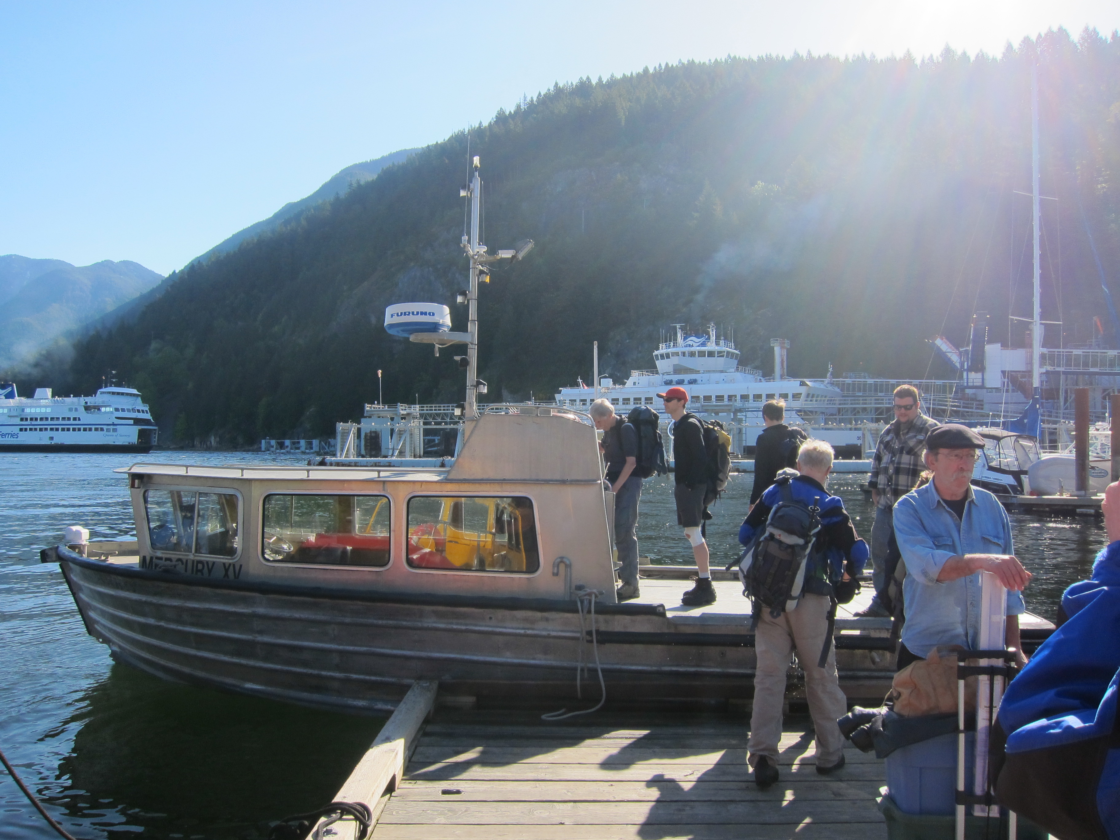
The gate at the bottom of Phyllis Creek road is permanently locked, and so we parked in the pullout right below the gate at the edge of Furry Creek golf course, and by 8:10 we had our bikes good to go and started up towards Capilano Mountain.  The road was easier than I remembered driving years ago, and we only had to push the bikes up two short hills en route to the turnoff to Downing Creek road, which would take us to the Beth Lake trailhead.  Route notes: on Phyllis Creek road, take a right at the first fork and always follow the most well used path up to the turnoff, which is just before the 4km marker, not just past as Matt Gunn’s guidebook indicates.

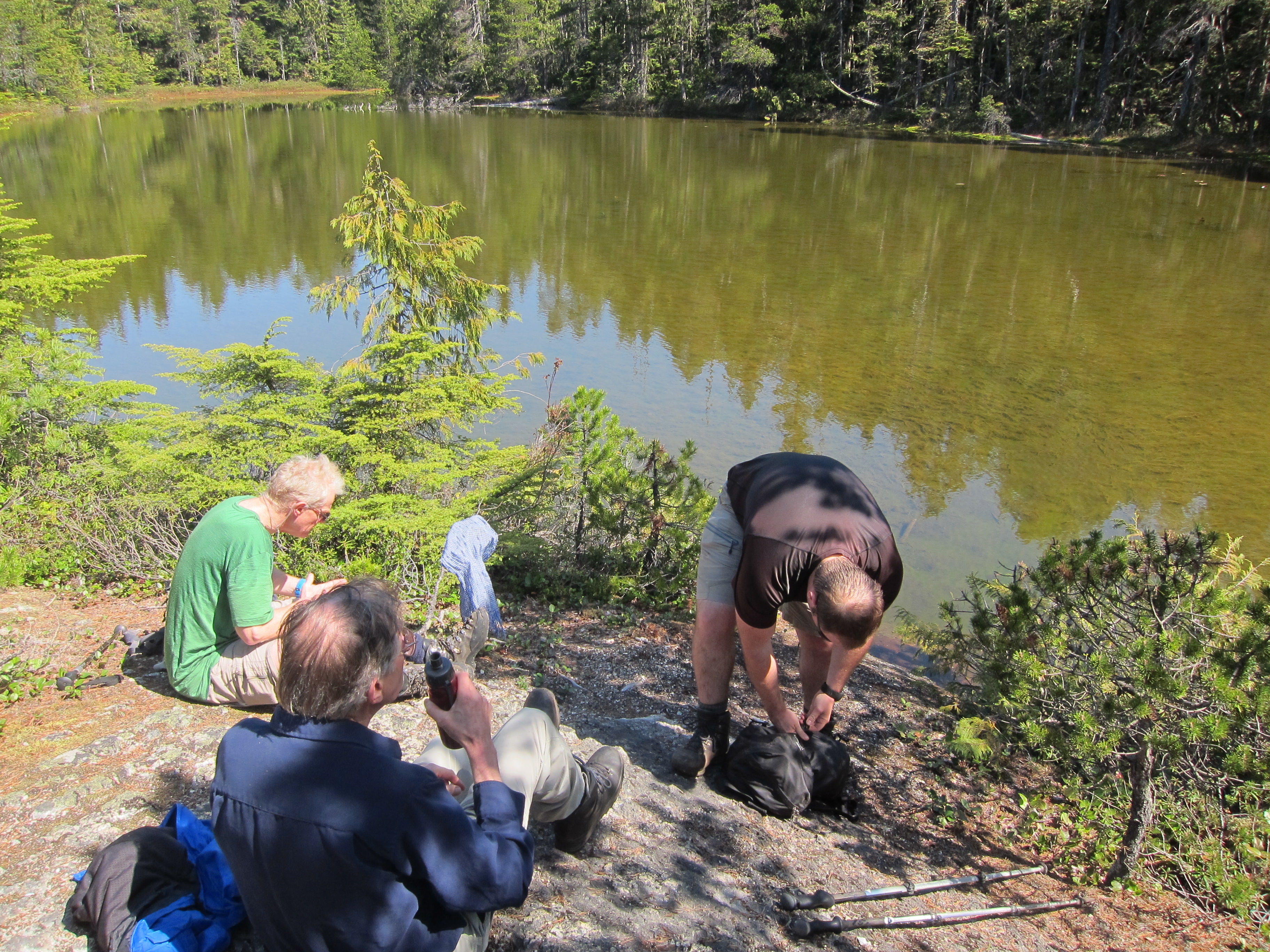
About 100m after turning on to Downing Creek road, we crossed Phyllis Creek, and the road began to deteriorate as the alder encroached on the path.  A few hundred metres later we started to encounter lots of small windfall, and about 500m from the turnoff we gave up on the bikes and left them in a ditch.  This proved to be wise as the road became increasingly overgrown from this point and bikes wouldn’t have helped at on all the descent beyond this point.  As a result, we had to travel the remaining 2.5km to the old Beth Lake trailhead on foot.

The first 0.5-1km of the trail up to Beth Lake is badly overgrown with a variety of bushes, including devils club and plenty of blueberries.  Making matters worse, the skies had opened and by the time we reached the older growth above we were thoroughly soaked.  We persevered nonetheless.  At this time the trail is easy enough to follow, although it won’t be too many years until the trail becomes a challenge to hike unless someone heads up and clears the trail up to the old growth.

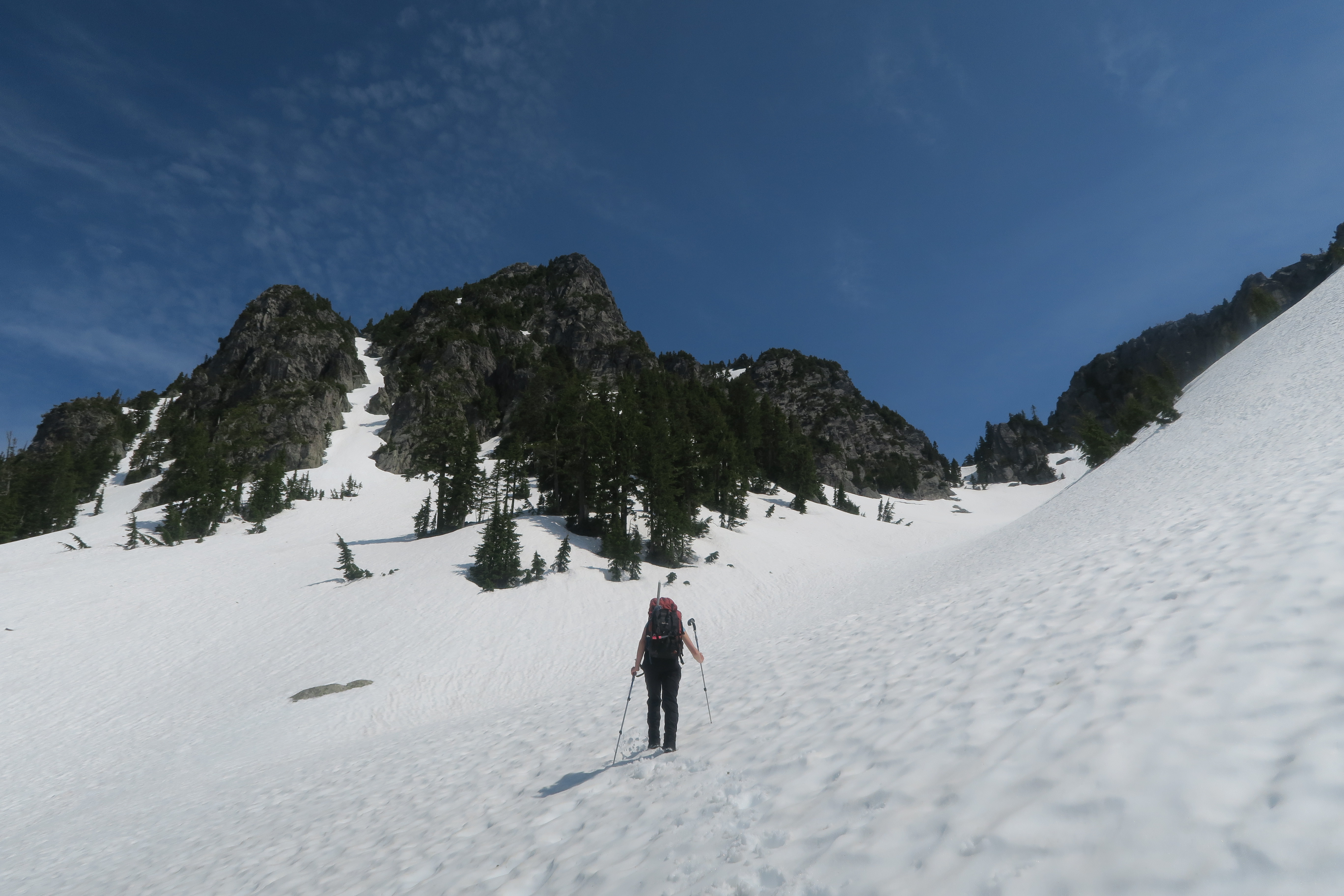
We reached Beth Lake at around 11:00, and as we stopped for a quick snack and drink, the clouds descended and we had our first experience with the fog that would engulf us until we reached our bikes again later in the day.  From the lake, the trail is a bit of a mess for the first 10 minutes as it traverses onto the ridge to the west of the lake, but soon improves and until we reached snow at around 1300m it was in good shape.

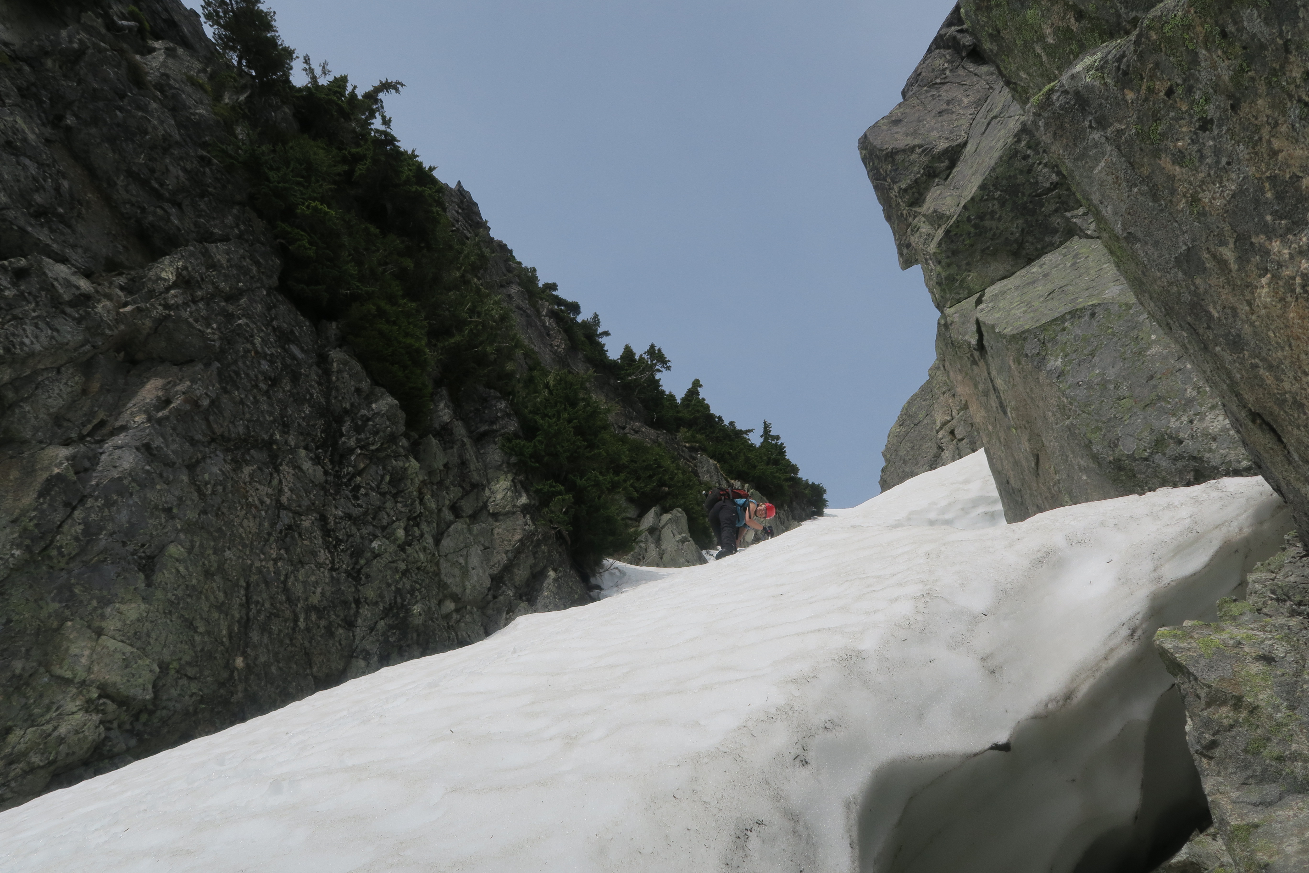
Above treeline the route is fairly well marked with cairns and we had little difficulty following it until near the col west of the summit (south of Gordon lake), but as the fog became even more dense, we had to check a GPS route a couple times to determine the right way to proceed.  The summit block itself was quite easy to ascend, mostly on snow except for a steep step near the summit where we moved onto the rocks and heather to the side of the gully.  We reached the summit at about 1:50 and were treated to glorious views of fog and more fog.

In the fog we started down the summit in the wrong direction, but noticed our mistake quickly and found our tracks in the snow to follow back down.  The descent down to the bikes was aided greatly by the snow and we were back down at the lake in what seemed like no time.  From the lake down to the bikes was an annoying combination of bush and logging road walking, but once we reached the bikes, all was better.  There are few experiences in life I enjoy better than coasting down a logging road on a bike at the end of a long hike, revelling in the thought that some poor souls have had to suffer the long logging road descent on foot.  The bike descent was fast and fun, and soon enough we were back at our vehicle, just in time to witness the skies begin to clear.

Thank you very much Steve for joining me on this adventure.  There were no views, and the conditions weren’t great, but at least Capilano mountain has been bagged at last.

Total ascent time: 5 hours, 40 minutes.  Total descent time: approx. 3 hours.


Continue ReadingCapilano Mountain

Mt. Hanover

Date: May 14, 2016

Participants: Radmila Bridges, Geoff Zenger

Difficulty: 3 (snow to 40 degrees, some scrambling moves)

Report: Another month, another chance for an adventure.  With a baby at home I have to be more selective than I used to when it comes to getting out these days, and it gives me incentive to pick destinations closer to Vancouver to minimize travel time.  There aren’t many significant peaks near Vancouver that I haven’t climbed, but one notable exception was Mt. Hanover and so I posted a last minute trip on the BCMC schedule to try and find a couple people to head up Hanover with me.

Saturday morning we drove up to the Porteau Rd turnoff on Hwy 99 and seeing that the gate was open to the upper Deeks Creek trailhead, we drove up.  The road is in pretty bad condition in a few places with quite large loose rocks and deep grooves, but the Jeep survived the ascent and we quickly shaved off 3km of boring logging road hiking from the day.  I don’t know how much longer the road is going to be in driveable condition with a regular 4wd that has not been jacked up, but for now it goes.  We parked at the so called “upper parking area” at about 7:50, and shortly after 8, walked up the road another few hundred metres to the “upper upper parking area”, where the trail begins.  In theory someone could drive up these final few hundred metres, but I was not willing to risk in my jeep.

The trail to Deeks lake is in excellent condition, with only a couple minor pieces of deadfall to contend with and we reached the lake at 9:20am and stopped for our first break.  Deeks lake is larger than I thought it was, and there are a couple nice camping spots by the lake.  Nonetheless, we didn’t wait there long and soon turned right, crossed the logjam at the exit to the lake, and continued on the Howe Sound Crest trail around the lake and worked our way through pleasant terrain up towards Hanover Lake.  The creek was running high at the place where the trail crosses to the east side of the creek, but luckily there was a large nearby snow bridge that we used to cross.  At Hanover lake the trail gave way to snow, and above the lake we missed the place where the trail crosses back to the right side of the creek, but it was no problem because at the exit of Brunswick lake there was another logjam that was easily crossed, and just past 11am we were at the Brunswick Lake emergency shelter, where we stopped for our second break of the day.

From the emergency shelter, we followed the HSCT markers towards Hat pass until the terrain became open and there was an obvious location to contour to the left onto a bench and start heading towards Mt. Hanover.  Below Mt. Hanover the snow was mushy and slowed our progress, but we steadily ascending up until the notorious two gullies on the south / south east side of Hanover came into view, and we found ourselves below them at around 12:30.  In summer conditions the left gully is reportedly much easier than the right gully due to some difficult scrambling moves required to get around two chockstones in the right gully.  However, in mid May conditions, the left gully was an alternating mix of rock and snow patches with a few difficult looking gaps in the snow, whereas the right gully appeared to be snow filled completely and so we took out our ice axes and started up the right gully.

Not far up the right gully we encountered a significant moat in the snow at the first chockstone, a few metres deep, but not terribly wide, and we were able to bypass it on the right via a few easy scrambling moves on the rock.  Above this it was steady step kicking all the way up to the summit (soft enough to not need our crampons), which we reached just past 1:30.  The gully varies in steepness, but about 2/3 of the way up has a sustained section of 40 degree snow that, while not hard, was somewhat stressful due to the big hole 3/4 of the way down the gully that loomed below us.  It eases off a bit below the summit, and the gully tops out on the literally a few metres from the true summit.  We spent a few minutes taking photos on the summit, and the crossed back over the top of the gully to a nearby subsummit that was snow free and were we could sit on the rocks, eat lunch, and enjoy the views all around.  Total ascent time: 5.5 hours.

The descent down the summit gully was slow as we had to face inwards and carefully follow our steps the whole way down.  At the gap / chockstone, I misplaced one of my poles on the rock and it slipped down into the hole.  Luckily, it landed on a snow lip and I was able to get myself into a position where I was able to fish it out with my ice axe.  That left the chockstone hole unsatisfied and demanding sacrifice, and as Radmila crossed from the rock back onto the snow, she dropped one of her poles into the hole, where unlike my pole it did not land on a ledge and is now waiting to be found by another adventurer.

By 3:15 we were back on the easy snow below the summit block and put away our ice axes.  From here, we motored down nonstop, and reached the car at about 10 to 6, for a total descent time of about 3.5-3.75 hours.  Car to car time was a bit shy of 10 hours.  In all, it was a great early season trip.  I probably could’ve chosen a shorter/easier trip for my first real hiking/scrambling trip of the year, but given my lack of free time it was great to get out and knock off one of the remaining local mountains from my hit list.  Mt. Hanover is quite out of the way, and so I wouldn’t recommend tackling it until someone has already knocked off the more popular local trips (Brunswick, Harvey, Lions, etc), but it is nonetheless a worthwhile outing.  Many thanks to Radmila for accompanying me and providing great company for the day.

Continue ReadingMt. Hanover

Mt. Artaban & Burt’s Bluff

Trip Date: Nov 11, 2013

Participants: Geoff Zenger, Brittany Zenger, Ed Zenger + a BCMC party of another 12 people

Difficulty: 1

Report: A few weeks ago I chose to roll the dice on Vancouver’s November weather and put a trip on the BCMC schedule a traverse hike up and over Mt. Artaban on Gambier Island.  At an elevation of only 615m and requiring a water taxi to get to, Mt. Artaban isn’t the kind of place I’d be likely to head on a summer weekend, but it seemed like it could be a great place to head for an off-season hike.  I was right 🙂

We departed Sunset Marina just after 9am on Rembrance Day, and by 9:30 were standing on the Halkett Bay dock.  This wasn’t where we expected to be dropped off (it turned out that we actually thought we were going to Halkett Bay Marine Provincial Park, not just Halkett Bay), but after a few wrong turns and with the friendly assistance of a woman working at Camp Fircom, we found the trail heading towards Mt. Artaban and headed up.  The trail up Mt. Artaban is well marked and in good condition, never too steep and generally very pleasant.  Despite having 15 people in the party we didn’t have any trouble getting up, and were all on the summit by 11:15 enjoying the great views of the peaks above Lions Bay while enduring the blustery summit winds.

Although we had originally thought of spending a long time on the summit, the wind was too much for us and at a quarter to noon we decided to descend towards Brigade Bay to the north of Mt. Artaban.  This trail isn’t in as good shape as the trail up from Halkett Bay, but it is still easy to follow and in an hour we found ourselves back down at the water.

At this point it was only nearing 1 o’clock and we still had 3 hours to make our way over to Camp Artaban where we were scheduled to be picked up at 4pm, and so the group consensus was to try and also hike up the trail to Burt’s Bluff.  On the Gambier Island trail map the Burt’s Bluff trail looks like it’s about 250m long with 100m elevation gain and marked with green markers.  In reality, the green markers are only green on the backside and have been sun-bleached to blue/teal on the front and the trail ascends over a couple kilometres to about 450m.  That said, the view from the top is great and if you’re doing this trip I highly recommend heading up there as well.  We reached the top just before 2:30 and after a very quick break turned around to make our way down and to Camp Artaban.

Down on the main trail connecting Brigade Bay to Camp Artaban, we headed towards Camp Artaban and despite some confusion over where exactly Camp Artaban was that could have easily been avoided by looking at Google Earth before the trip, we eventually found our way to the dock at the camp with a comfortable 10 minutes to spare before our scheduled departure time from the island.  In all, a great day and a great off-season trip.  Thank you to everyone who came along!

Disclaimer: Leading Peak on Anvil Island remains my favourite Howe Sound Island hike by a significant margin.

Continue ReadingMt. Artaban & Burt’s Bluff

Leading Peak (Anvil Island)

Trip Date: May 12, 2012

Participants: Geoff Zenger + a party of 12 BCMC members and guests

Difficulty: 2

Report: For years I’ve been looking out the window on the drive to and from Squamish and gazing at the peak on Anvil Island.  This spring I decided to do something about it, contacted the bible camp on Anvil Island to find a good weekend to land on their property, chartered a water taxi, and posted a trip on the BCMC schedule.  In the end, 12 people signed up for the trip.

To save on parking costs in Horseshoe Bay, we met at St. David’s at 8am, dropped off most of our vehicles, and quickly made our way down to Horseshoe Bay where we caught a chartered water taxi operated by Mercury Launch.  Without any hassle we loaded onto the water taxi and promptly set off for Anvil Island at 9am, arriving there at 9:30.  The water taxi has quite a racket going, with a minimum fee, but no discount per person, and at $25/person each way, they reaped $650 from us for 2 hours of work. At least it’s still cheaper than buying our own boat… Once at the bible camp, we had little difficulty finding the caretaker to pay the $25 fee to use their dock and drop off our signed waivers to cross their property, and set out on the trail proper around 9:45.

The trail up to Leading peak is generally in very good condition, is well marked, and the terrain varied.  On the way up we stopped at the “white spot” (some sort of navigational aid?) viewpoint to take photos and then again at a little lake for lunch. There are a couple short scrambling steps near the summit, but without any exposure, and these were quickly navigated. Despite our relaxed pace on the ascent, the last of our party reached the summit just past 12:30 (with the first people reaching the summit perhaps 45 minutes earlier).  

Our party spread itself wide on the summit rocks and the heli-pad, and we took our time to lounge about in the hot sun.  The views were excellent, with Garibaldi, Sky Pilot, Ledge, the other Howe Sound islands, and the western-most North Shore mountains all visible.  As we had a hard deadline to return to the camp to catch our return water taxi, we couldn’t sleep all day on the summit however, and started making our way down a bit before 1:30.

The descent was straightforward and uneventful, and everyone made it back to the docks by 3:42, just in time to catch the water taxi, which was scheduled to leave at 3:45.  The weather remained fantastic and most of the party lazed on the back of the water taxi as it carried us back to Horseshoe Bay, enjoying the great views all around.

Climbing Leading peak requires more effort than heading to the summits on Bowen or Gambier Island, but the effort is rewarded with a more interesting trail, a nicer summit, and better views.  I think that all of us would agree that was an excellent destination for a sunny spring day.

Thanks to everyone who signed up and came out. It was an excellent day all around!

Continue ReadingLeading Peak (Anvil Island)