Lone Mountain

Date: June 7, 2014

Participants: Sergii Bogomolov, Geoff Zenger

Difficulty: 2/3 (Short sections of moderate scrambling)

Report: Hiking the Lightning Lakes trail in Manning Park out to Thunder Lake has been on my list for some time, but Manning Park always seemed like a long ways to go for just a lake hike… Luckily, a couple years ago I noticed a peak called “Lone Mountain” in Beckey’s guidebook to the north Cascades, and I decided that any trek I did out to Thunder Lake should include an ascent of Lone Mountain, located on the SW side of the lake.  I posted a trip a while ago on the BCMC schedule and had some interest from a few people, but by the date of the trip, everyone had bailed except for Sergii, and on a nice Saturday morning we met up near my place in New West and drove out to Manning Park.  In the end I’m glad that there were only a couple of us and not a larger group because the trip would prove significantly more strenuous than expected.

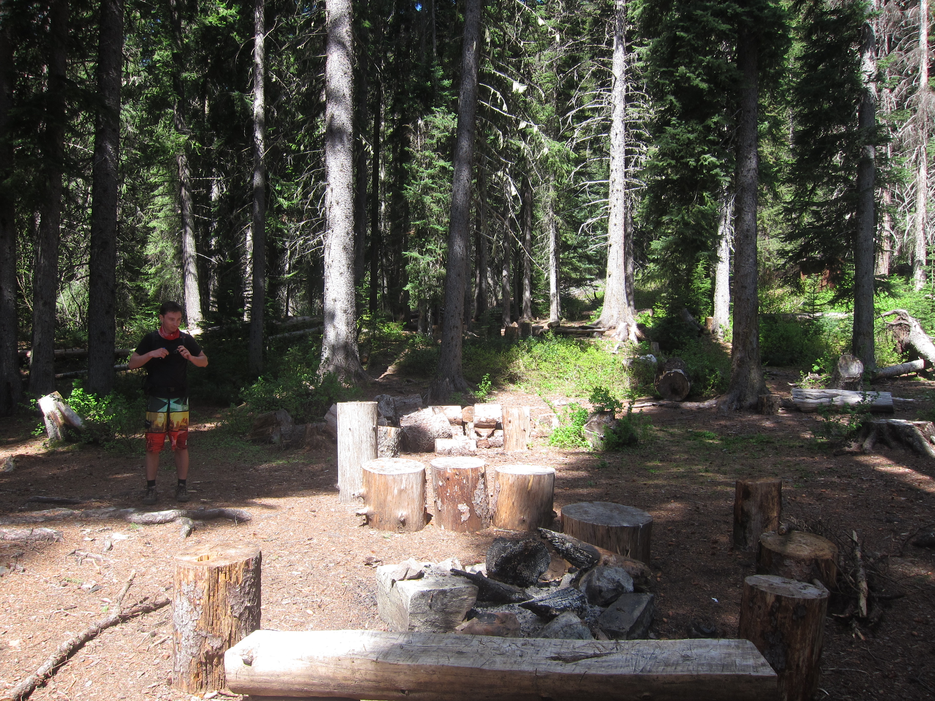
We started out from the Spruce Bay parking area around 9:45am, and moved quickly along the lakes trail, reaching Strike Lake camp at about 11 o’clock.  After a quick snack break we continued on towards Thunder Lake.  There was some snow on the trail in sections here, but the going was quick and we reached the end of the official trail at Thunder Lake a bit past 11:30.  We followed a little used path around the northern side of the lake up towards some waterfalls coming down from Snow Camp Mountain above the outflow of the lake.  From here we bushwhacked down the little creek to the outflow from Thunder Lake where we were happy to find a thick logjam in the river that was easily crossed, and on the other side at a quarter to 1 we stopped for a full lunch break.

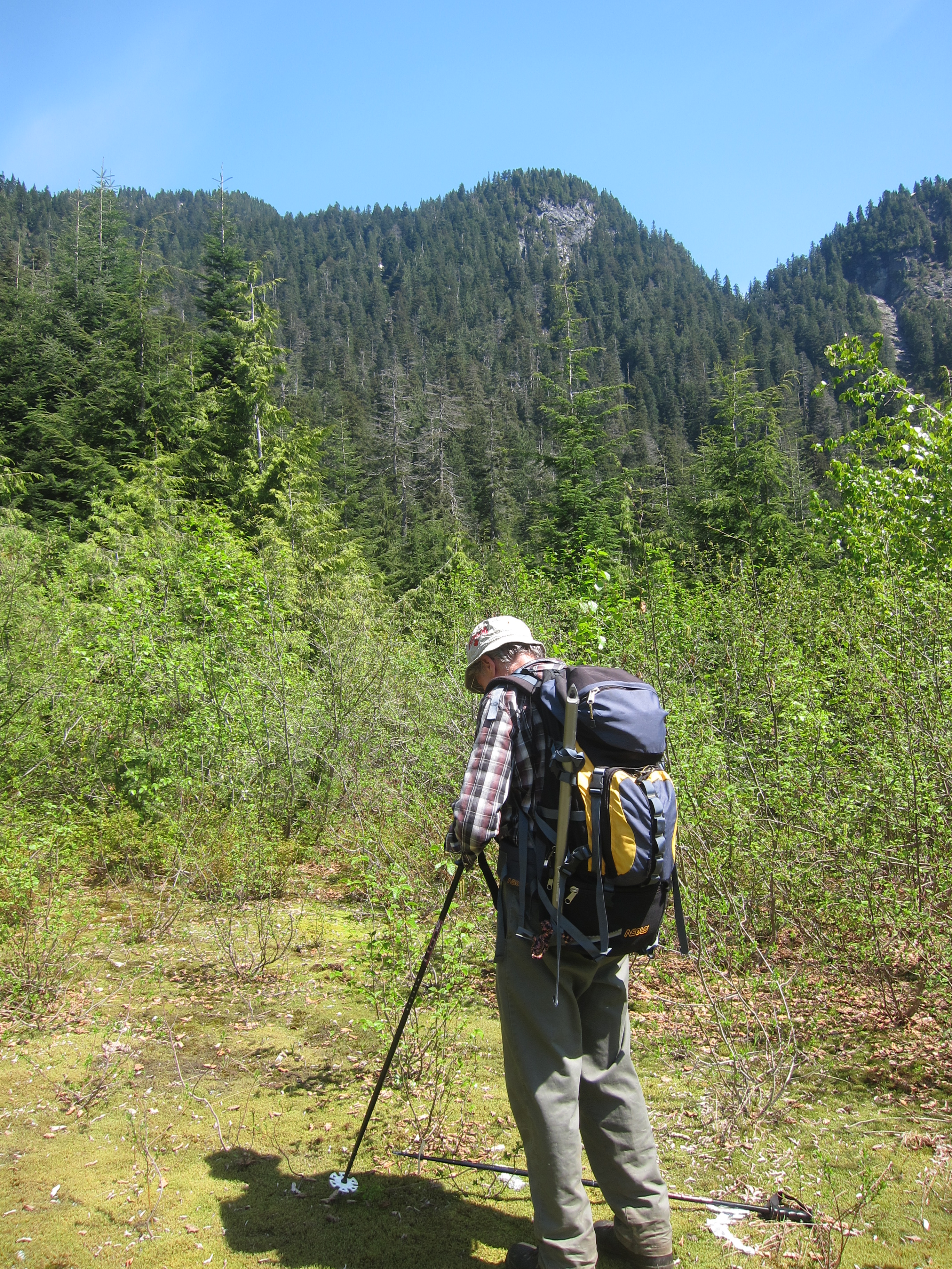
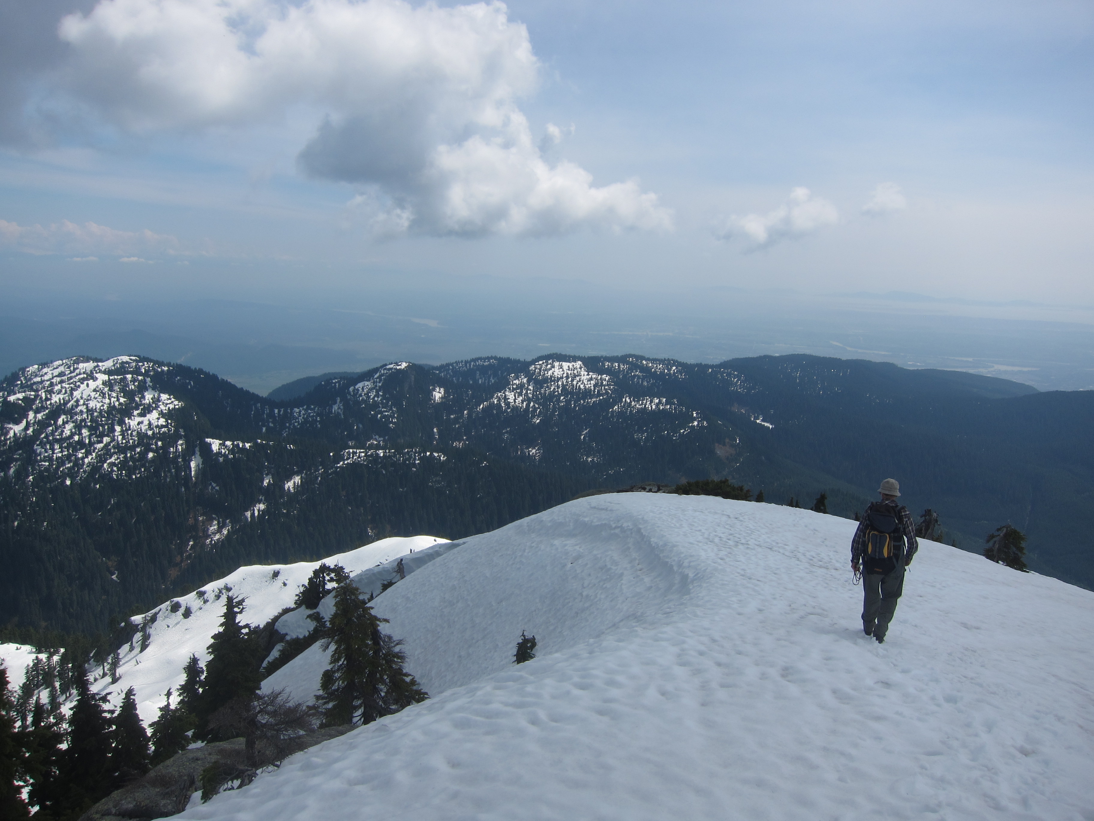
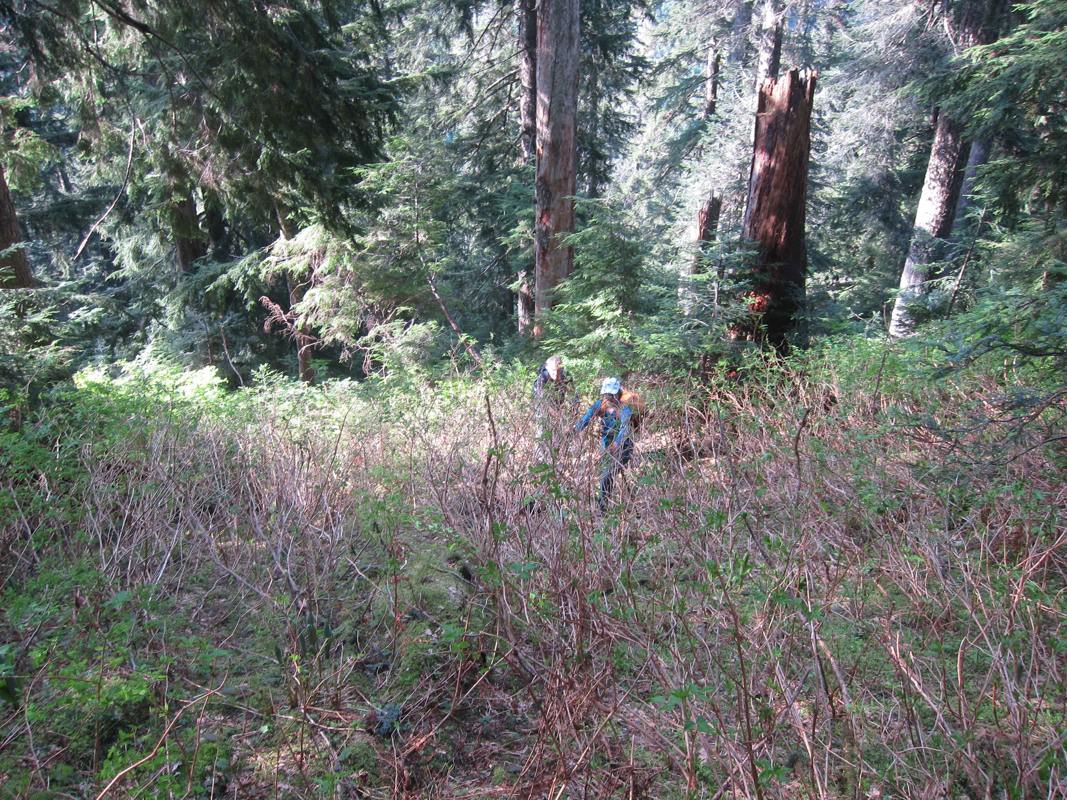
There is a large talus field perhaps 100m along the lake shore from the outflow of Thunder Lake that we wanted to take up towards the ridge, and so we trekked diagonally upwards through the bush to hit it.  The dirt slopes and bush are ridiculously steep on this section, but we found our way to the talus slope and followed it upwards until it became a steep and exhausting scree gully.  The heat and scree made ascent slow, and we eventually bailed out of the scree gully to the right (north), which in retrospect was a great decision because it brought us back to a firm, open talus field that led up to the ridge.  From the topo map and Google Earth I had expected the ridge to be an easy walk, but it proved to be an alternating sequence of bushy thrashing and steep dirt, with a couple short scrambling moves thrown in.  Luckily there isn’t any serious exposure, and we eventually made our way up to where we hit snow, perhaps 100m below the summit.  The snow line was surprisingly high, but I guess it’s a big cooking bowl around Thunder Lake that traps heat.

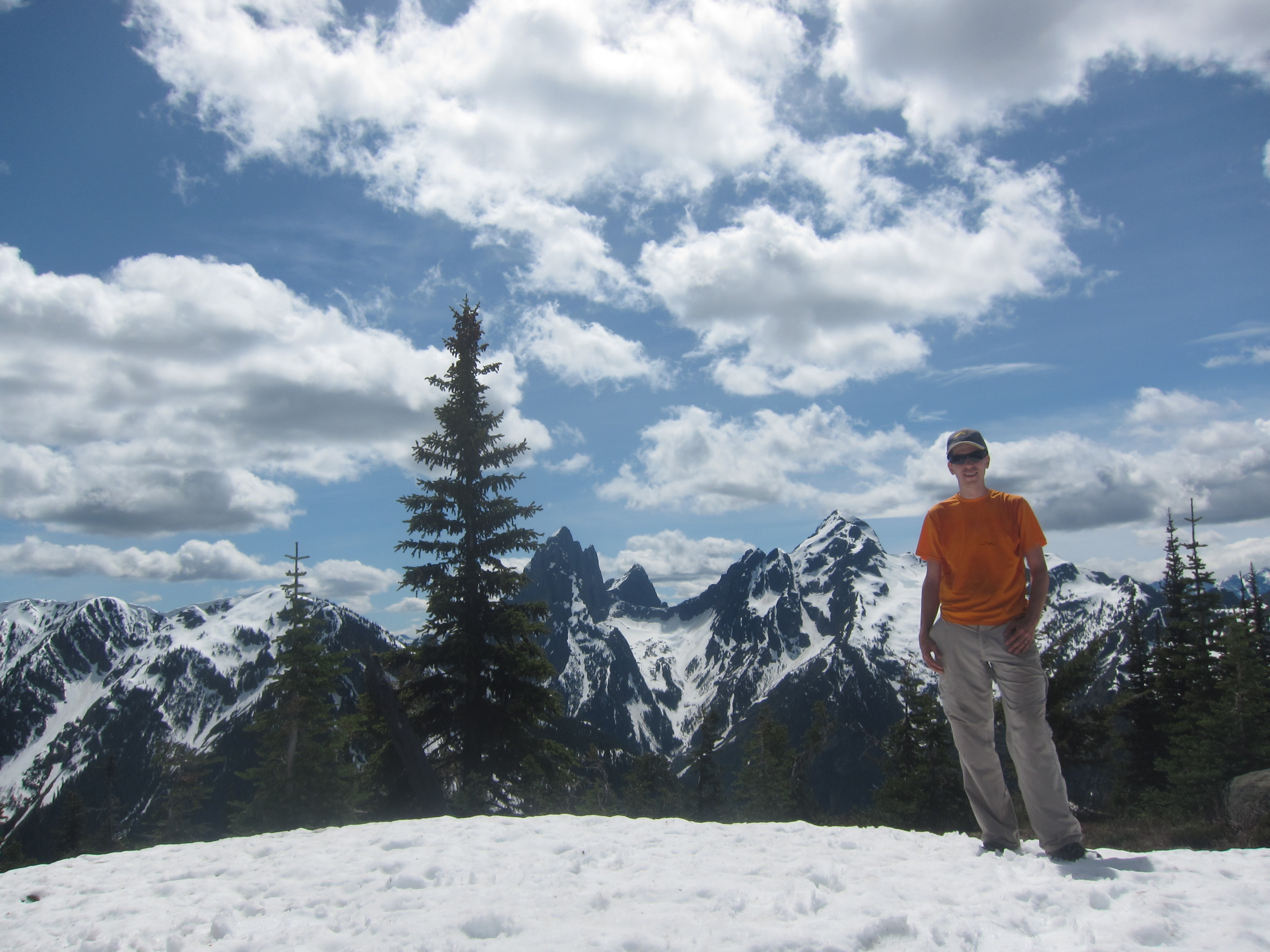
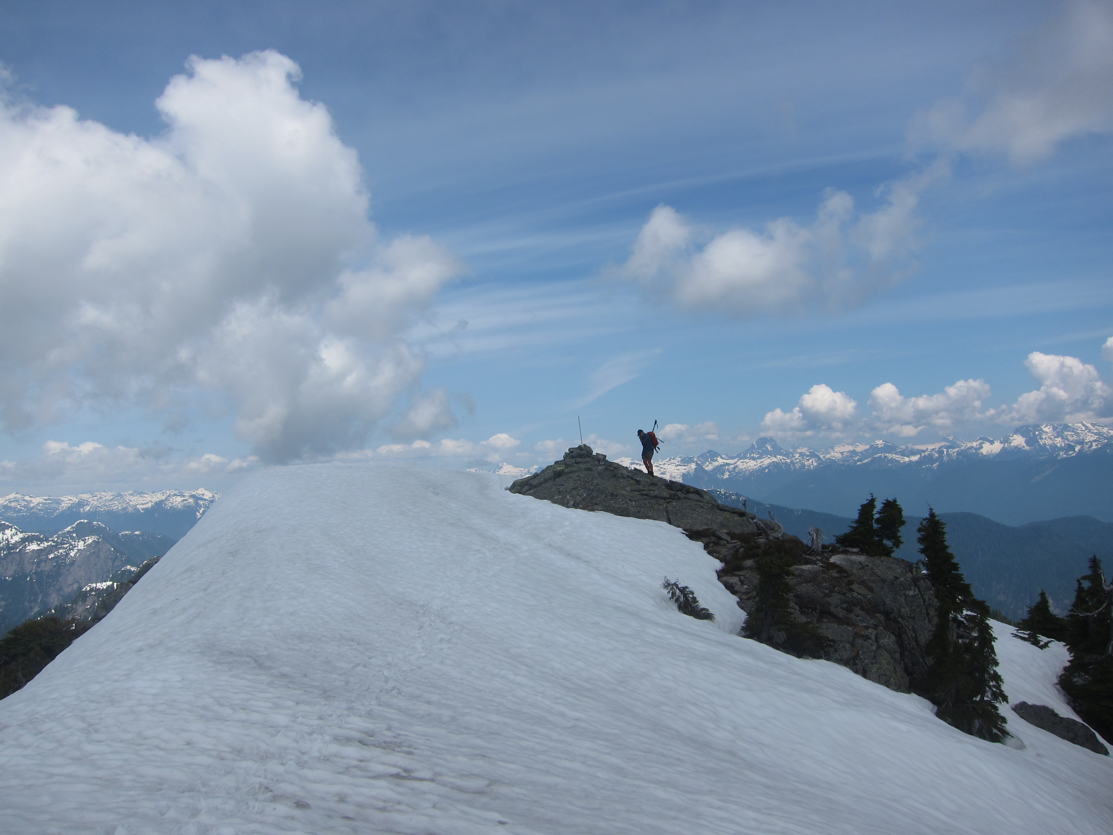
We reached the summit of Lone Mountain around 2:45, and sat down for a long break.  The view of Hozomeen from the top is amazing.  There is probably no better vantage point possible of the group and all three peaks are visible.  There are also good views over to the Skyline trail that crosses from Lightning Lake to the Skagit River, but otherwise the summit is quite unremarkable as it is lower than almost everything else in the area.  Tired and out of water, we departed the summit a bit before 3:30 to thrash back down to the lake.

We were back down at the lake at about 4:50, and after a quick break, decided to bushwhack horizontally along the lake edge to take the lower trail along Thunder Lake back to the main trail.  Big mistake!  It took us 40+ minutes to thrash through the thick alder and other foliage.  We really should’ve just followed the creekbed back up to the upper trail.  Nonetheless, we persevered and made our way back to the main trail, where we eventually found a good creek that we could refill our water from, and made the long trudge back to the car, which we finally reached at 8:20.  10.5 hours round trip!

In the end, am I glad I went to Lone Mountain?  Yes, I am.  But I am definitely never going back there again.  After doing the trip it’s clear why it’s rarely done… it’s a long ways with a lot of bush, scree, and sheer exertion to reach a very minor summit.  Regardless, it was a great trip and I have to thank Sergii for his great companionship on this mountain trek!

Continue ReadingLone Mountain

Coquitlam Mountain

Date: May 30 to June 1, 2014

Participants: Geoff Mumford, Brittany Zenger, Ed Zenger, Geoff Zenger

Difficulty: 2 (with class 5 bush!)

Report: Coquitlam Mountain is a peak that you can see from much of the Lower Mainland, but is seldom climbed.  Why is that?  Could it be that an ascent requires over 2700m elevation gain?  The worst bushwhacking I’ve ever encountered with tricky routefinding?  Has to be timed just right for conditions to be any good?  Or all of the above?

Aware that we’d be in for a long and strenuous trip, but unaware of just how long and difficult the trip would be, we met up late Friday afternoon and started the trudge up Burke Mountain around 5pm.  We had a bit of difficulty finding the right turnoff to take to find the Burke ridge trail and wasted about 15 minutes by turning off too early only to find ourselves at an old abandoned cabin and having to go back to the main road to find the correct trail higher up (see photo below for what the correct trail looks like).  Nonetheless, by a few minutes past 7 we had found the correct trail and headed up towards the ridge.  We first hit snow about 40 minutes from the start of the trail, and although in places the flagging was hard to follow, we persevered and just before 9 o’clock stopped to set up camp on a flat open section of ridge, perhaps 750m short of the summit of Burke.

Saturday morning we woke up a bit past 6, had a slow breakfast, got our acts together, and started moving around 7:20, quickly reaching the summit of Burke.  From Burke summit it was fairly easy to descend a rib and then a gully to its left down to the creek in the basin down to the N/NW, bypassing a number of cliff bands on the way.  We were lucky to hit the creek right where a large log crossed it, and we were soon across and making our way up to the low point in the ridge above (this appears as the col just below 1000m according to the topo map).  Up to here there hadn’t been much bush, and the going fairly easy, but from here we made a routefinding blunder and decided to descend straight through the old clearcut down towards Or Creek.  The top hundred metres or so had some snow and were no problem, but below was the worst bush I’ve encountered.  No joke: the worst.  Devil’s club, devil’s club, other small prickly bushes, and more devil’s club.  It would’ve been much smarter to traverse right until we hit mature forest and to descend through it down to the road below (we would later ascend via this route).  Nonetheless, we eventually made it down to an old logging road at about 11:15, perhaps 100m upstream from where an old bridge used to cross Or Creek, and sat down for lunch.

At this point we realized we were travelling significantly slower than expected, largely due to there being much less snow than expected, and soon got moving.  We quickly transitioned into our water shoes and waded across Or Creek (never more than shin deep, also Geoff M found a log across somewhere downstream to avoid wading), and travelled up the old Or Creek road to its headwaters below Coquitlam Mountain and Widgeon Peak.  By the end of the road, it was clear that there was going to be a lot more devil’s club to go through to reach the mature forest and/or snow on the ridge and Brittany wisely elected to stay put and sleep rather than wade through more bush.  Starting around noon, we headed diagonally upwards to the ridge (it would be better to stay low and traverse horizontally to the mature forest as quickly as possible), up the ridge to the left of the main creek, until it reached a large open basin to the right, and traversed left to avoid a cliff band and continue up the ridge.   It took us well over an hour to ascend the roughly 200m until we finally hit snow.  In a good snow year this would’ve taken perhaps 20 minutes.  Note that at one point someone flagged a good route up the ridge to the alpine, but the flagging has largely disintegrated and is useful only to the extent that when it is occasionally seen it can be used to affirm your routefinding decisions to that point.

From where we hit snow to the summit was quick and straightforward, and we finally reached the summit at 2:20pm.  7 hours from leaving camp.  The views from the summit were much better than I anticipated, as Coquitlam Mountain is actually quite prominent.  There are great views of Judge Howay, Robbie Reid, the Five Fingers area, Golden Ears, and the Lower Mainland!  Unfortunately, we realized we had a long ways back to camp and didn’t wait long on the summit.  Luckily, descending on snow is quick, and we made it back to the end of the Or Creek road by 4pm.  It’s really too bad that there’s no vehicle access up Or Creek because if you could convince someone to let you drive up there, from where the bridge is out to the summit and back would be an excellent 4 to 5 hour long round trip hike if done early season on snow or if someone brushed out a route through the bush.

With our learning in hand from the mistakes made on the approach to the mountain, the return to camp was slow, but slightly less bushy than our trek in the other direction.  We ascended through the trees climber’s left of the clearcut back to the intermediate ridge between Or Creek and Burke Summit, reaching the ridge approximately 60m higher than necessary, but with significantly fewer scratches than we would’ve otherwise incurred.  From here it was a bushy descent down to the basin below Burke, and a long slog back up again.  We finally reached Burke summit again around 8:30 where we ran into some other campers who were surprised to see us appear up the ridge so late in the day, and after a brief chat with them finally made it back to camp at 9.  What a long day!  Between 1700m and 1800m elevation gain (on the day),  a good amount of cross country travel, and by far the worst bush I’ve ever encountered.  I was exhausted and had little appetite so after a bit of soup went straight to sleep.

We rose late Sunday, enjoyed the beautiful sunny morning, and slowly packed up camp to get moving a bit past 9am to descend back down to our car parked near the gun club below.  The descent was easy and uneventful, and to make things a bit quicker rather than trudge down the road we descended down some bike trails like Sandinista and Deliverance to shorten our descent.  We reached the car again right at noon, fully exhausted from a long trek.  It was a good trip, but I’m never doing it again.

Lessons Learned:

  • Go when there’s snow.  With snow cover down to Or Creek (~800m, sheltered), the trip to and from Burke summit would probably be around 3 hours quicker and substantially less painful.  Some people have found ideal conditions in early June in high snow years but this year we were probably 3-4 weeks too late for good travel conditions.
  • When descending from the low point in the ridge in between Burke Summit and Or Creek, head into the mature forest to skiiers right.  Horrible, horrible bush is to be found by descending straight down.
  • If you do happen to hit bush and not snow at the end of Or Creek, stay low and travel to the mature forest to the north as quickly as possible to minimize bush.  The forest nearer the creek is reasonably open in comparison to the surrounding bush.
Continue ReadingCoquitlam Mountain