Tricouni Peak

Trip Date: September 8

Participants: Andrzej Jarzabek, Paul Ng, Arnold Witzig, Will ?, Brittany Zenger, Geoff Zenger

Difficulty: 2/3.  Easy scrambling, some mild exposure on route

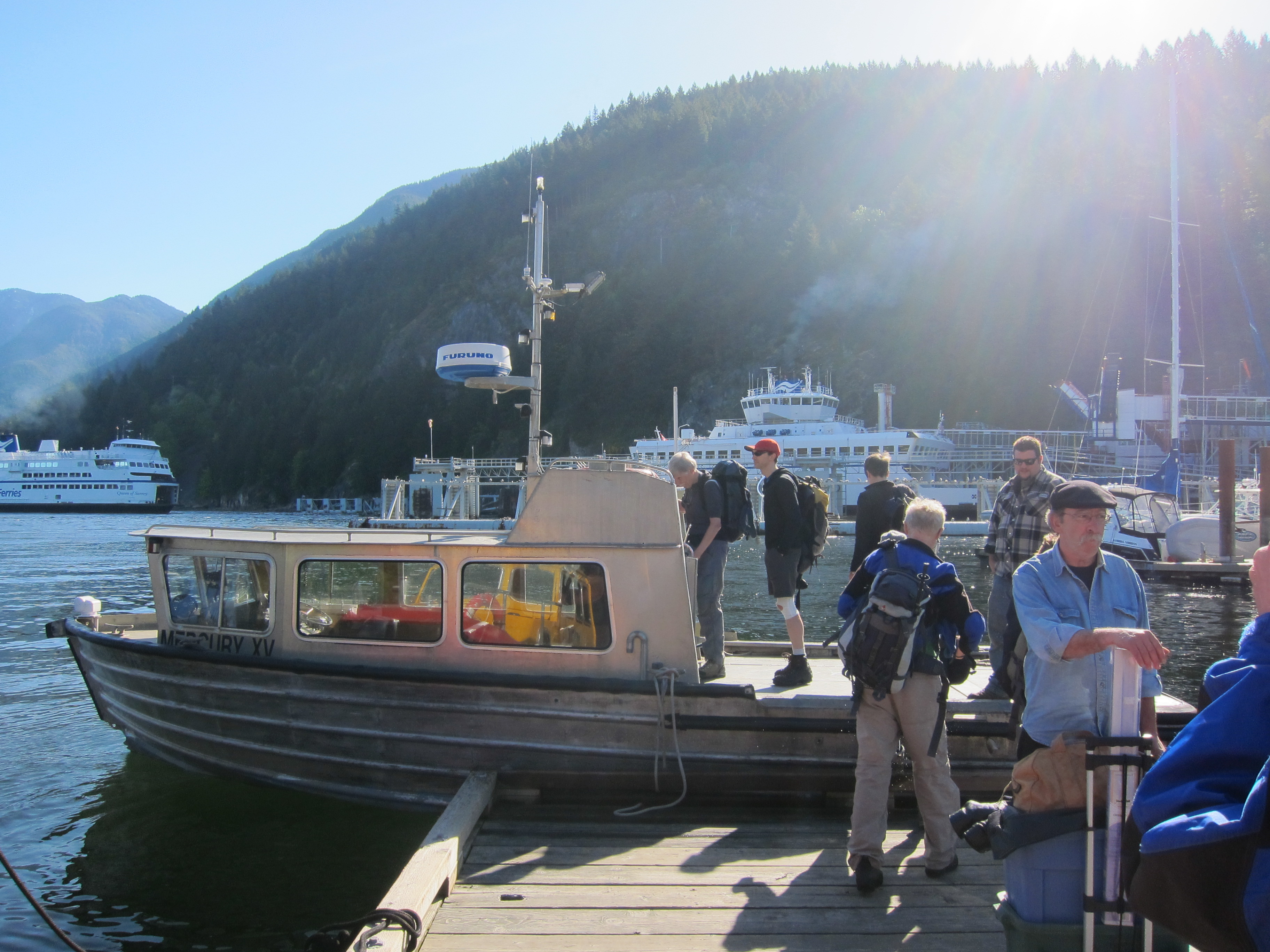
Report: I bought myself a used Jeep Liberty two weeks ago, and now having a 4×4 I decided to change the destination of my trip on the BCMC schedule to Tricouni Peak, which is essentially inaccessible with a 2wd car.  The trip was scheduled for the same day as the Vancouver-Whistler GranFondo bike race, but a bit of investigation revealed that the first road closures would be at 7:15 in Porteau Cove, and so by leaving Vancouver early enough, I determined that we would be able to stay ahead of the road closures and make it up the Squamish Valley to High Falls Creek.

We met at the Chevron station at Boundary & Dominion at 6:15, and quickly head off for Squamish, reaching Squamish at around 7:30, and made our way up the Squamish valley, and then up the High Falls Creek road network.  There is one nasty section of road about 2.5km from the Tricouni Meadows parking area, but after this the road is in fairly good shape until less than 1 km from the landing at the end of the road.  This last section of road is in really rough shape, but we pressed on to the end, and were able to set off on the trail a bit past 9 o’clock.  At this point, the weather was cool and sunny, but it would soon warm up rapidly.

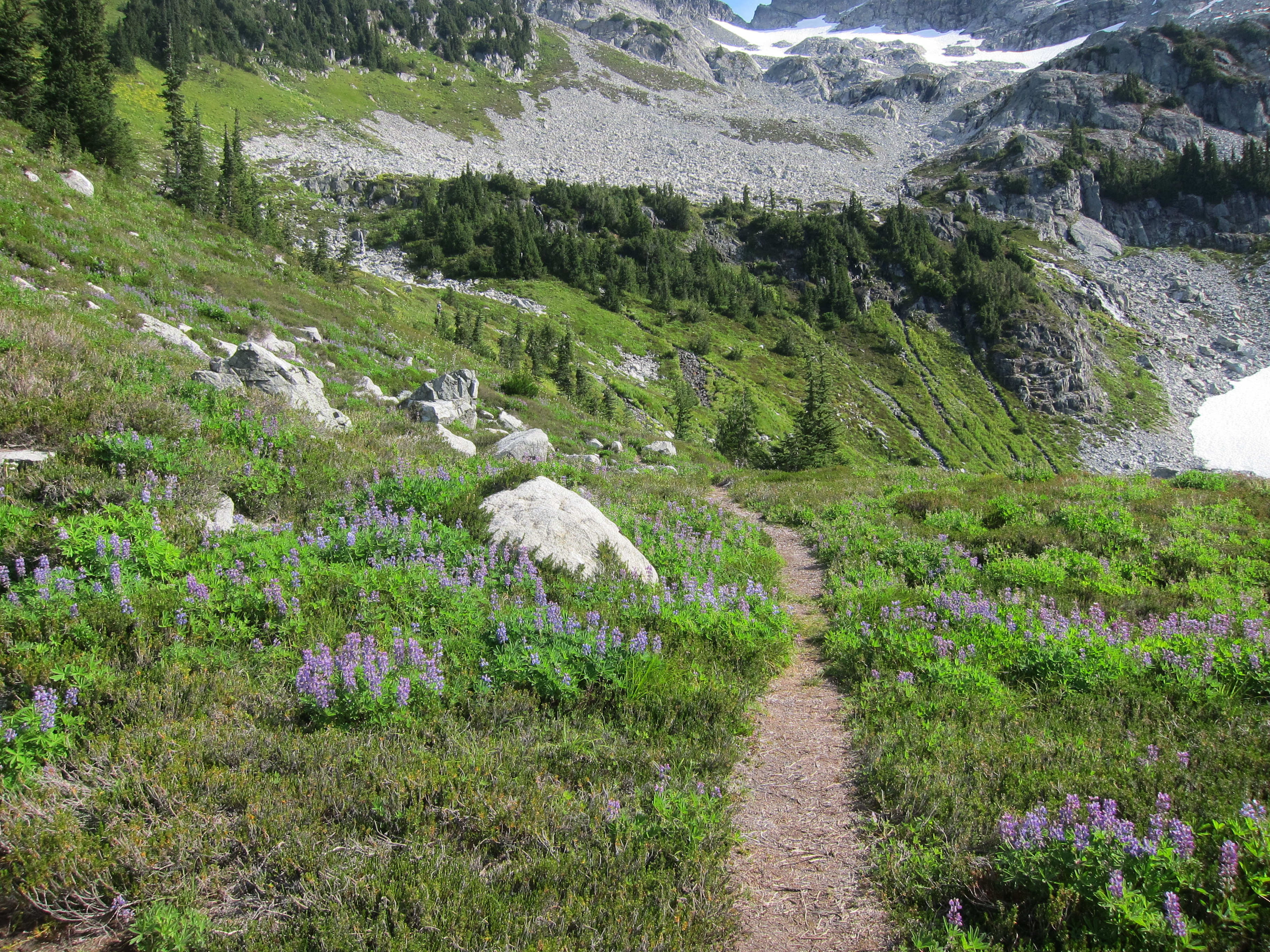
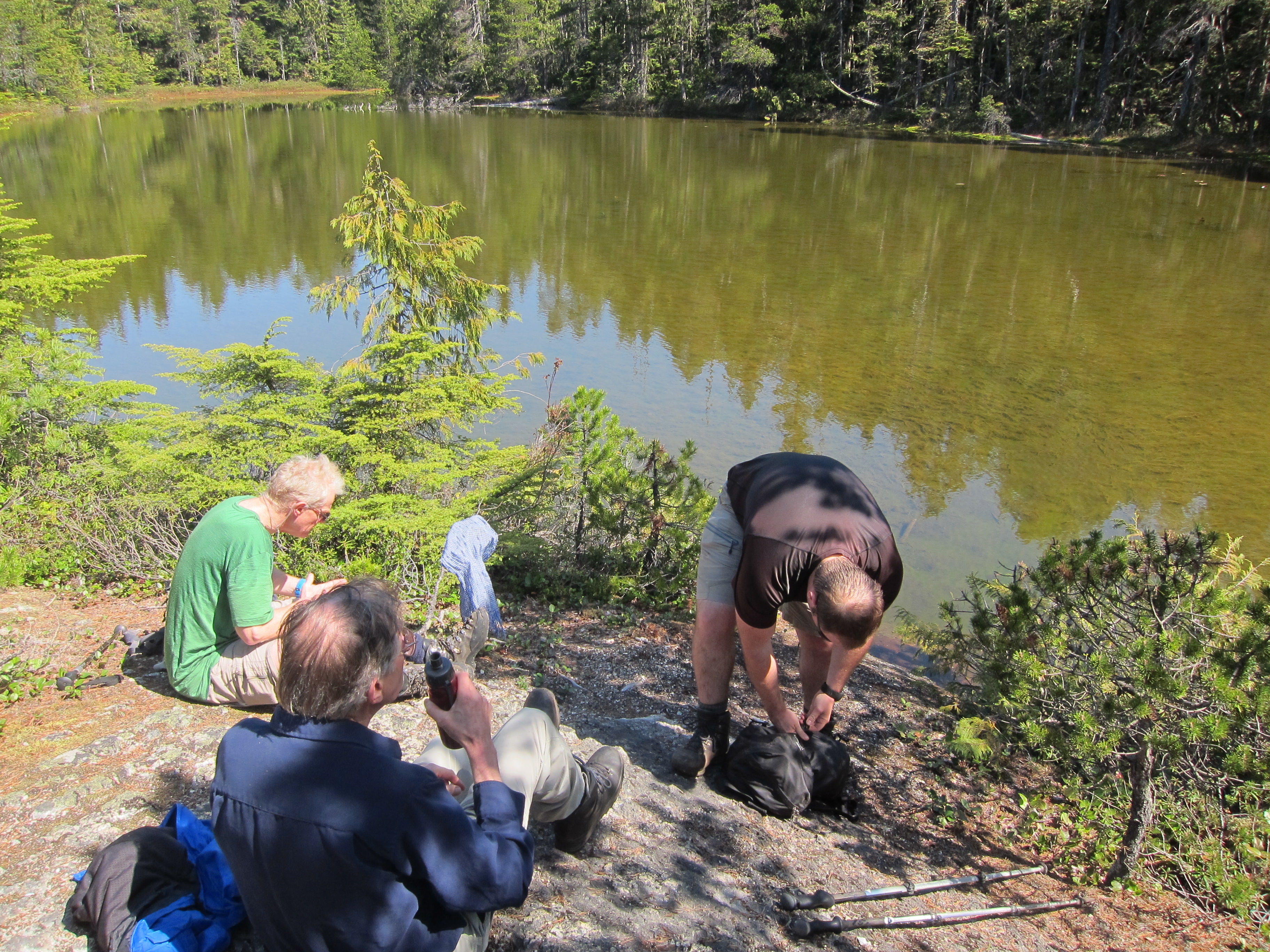
The Tricouni Meadow trail is easy to follow, but ridiculously muddy until near the first lake.  From the first lake, we quickly ascended to the second and third lakes, and from there on up the standard route towards the summit of Tricouni.  The lakes are clear and turquoise, and the flowers in the meadows above the third lake were in full bloom.

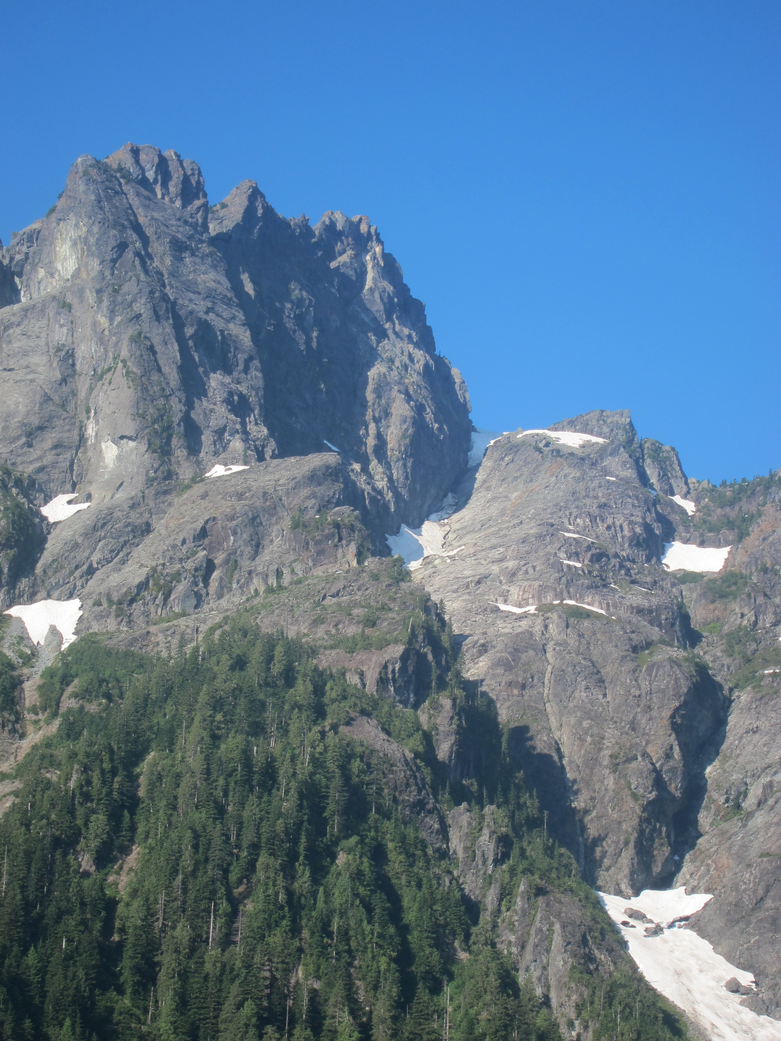
We took our time on the ascent and descent, stopping frequently to enjoy the views and the warm atmosphere, but nonetheless were on the summit about 4 hours 15 minutes from when we started.  The route is primarily a hike, but the there is a short scrambling section about 30 minutes below the summit, and the last 10 minutes up the summit ridge itself are over enjoyable scrambling terrain, with mild exposure.  The summit of Tricouni itself is fantastic, with nice places to sit, and views all around.

We lounged about on the summit for nearly an hour, and departed just past 2.  The descent was quick and easy, and we had the time to stop at the first lake for a while, where Arnold and Andrzej summoned the courage to go for a quick swim.  From the first lake it was back to the mud below, and finally back to the cars.  Including the swim stop, the descent took just a few minutes over 3 hours, completing a great trip to cap the summer.


Continue ReadingTricouni Peak

Golden Ears

Trip Date: August 11, 2012

Participants: Brittany Zenger, Geoff Zenger

Difficulty: 2 (minor 3rd for SW ear)

Report: I last hiked to the summit of Golden Ears almost exactly 10 years ago, in the summer after grade 11, and Britt had never attempted it before, so a mid-summer day with a perfect forecast seemed like a great opportunity to head once again to this popular area.  We arrived in Golden Ears park soon after the gates opened and set off on the West Canyon trail shortly before 7:30am.  The trail is easy to follow and well marked, and we made quick time up to Alder Flats and upwards towards Panorama Ridge, and reached the new emergency shelter (put in just a couple months after I last ascended the peak) just before noon.

We stopped for a quick lunch as the crowds hadn’t yet arrived, and made our way up towards the summit over enjoyable easy scrambling terrain, and reached the main summit at a few minutes before 1.  I quickly made my way over to the lower SW ear (very short section of 3rd class scrambling) to take a few photos, and made it back to the main summit as a couple other parties made it to the main summit.  The day was warm and bug free, and amazingly, while describing the routes up Edge and Blanshard to some of the other people on the summit, I looked over to the ridge of Edge to see somebody (Alexis?) working his way quickly along the ridge, making a solo Blanshard-Golden Ears traverse.  We lounged on the summit for well over an hour before beginning our way down the mountain.

Despite the number of people we saw hiking up the trail to attempt the summit as a day trip, only a handful of parties achieved the summit, as it seems that the majority of day trippers ran out of steam around the emergency shelter.  The route down was pleasant enough down into the forest, after which the mind numbing tedium of the walk out kicked in, eventually leading me to zone out and take a nasty slip on the logging road above Alder Flats.  Nonetheless, we made it out to the car right at 7 o’clock, capping another excellent day in the mountains.

Continue ReadingGolden Ears

Leading Peak (Anvil Island)

Trip Date: May 12, 2012

Participants: Geoff Zenger + a party of 12 BCMC members and guests

Difficulty: 2

Report: For years I’ve been looking out the window on the drive to and from Squamish and gazing at the peak on Anvil Island.  This spring I decided to do something about it, contacted the bible camp on Anvil Island to find a good weekend to land on their property, chartered a water taxi, and posted a trip on the BCMC schedule.  In the end, 12 people signed up for the trip.

To save on parking costs in Horseshoe Bay, we met at St. David’s at 8am, dropped off most of our vehicles, and quickly made our way down to Horseshoe Bay where we caught a chartered water taxi operated by Mercury Launch.  Without any hassle we loaded onto the water taxi and promptly set off for Anvil Island at 9am, arriving there at 9:30.  The water taxi has quite a racket going, with a minimum fee, but no discount per person, and at $25/person each way, they reaped $650 from us for 2 hours of work. At least it’s still cheaper than buying our own boat… Once at the bible camp, we had little difficulty finding the caretaker to pay the $25 fee to use their dock and drop off our signed waivers to cross their property, and set out on the trail proper around 9:45.

The trail up to Leading peak is generally in very good condition, is well marked, and the terrain varied.  On the way up we stopped at the “white spot” (some sort of navigational aid?) viewpoint to take photos and then again at a little lake for lunch. There are a couple short scrambling steps near the summit, but without any exposure, and these were quickly navigated. Despite our relaxed pace on the ascent, the last of our party reached the summit just past 12:30 (with the first people reaching the summit perhaps 45 minutes earlier).  

Our party spread itself wide on the summit rocks and the heli-pad, and we took our time to lounge about in the hot sun.  The views were excellent, with Garibaldi, Sky Pilot, Ledge, the other Howe Sound islands, and the western-most North Shore mountains all visible.  As we had a hard deadline to return to the camp to catch our return water taxi, we couldn’t sleep all day on the summit however, and started making our way down a bit before 1:30.

The descent was straightforward and uneventful, and everyone made it back to the docks by 3:42, just in time to catch the water taxi, which was scheduled to leave at 3:45.  The weather remained fantastic and most of the party lazed on the back of the water taxi as it carried us back to Horseshoe Bay, enjoying the great views all around.

Climbing Leading peak requires more effort than heading to the summits on Bowen or Gambier Island, but the effort is rewarded with a more interesting trail, a nicer summit, and better views.  I think that all of us would agree that was an excellent destination for a sunny spring day.

Thanks to everyone who signed up and came out. It was an excellent day all around!

Continue ReadingLeading Peak (Anvil Island)

Mt. Lincoln

Trip Date: April 22, 2012

Participants: Brittany Zenger, Geoff Zenger

Difficulty: 2

After a hard Saturday of labour on my granddad’s farm, Brittany and I had a free Sunday to work with.  We had originally intended to go ski touring in the Squamish area, but the forecast was significantly better out in the Fraser Valley, and so we decided to head out for one of the low-elevation 103 hikes that we hadn’t done before and set out Sunday morning for Mt. Lincoln.  It was a pleasant drive out to Hope in the morning, and we made our way to Yale, where we had no difficulty finding the proper parking area and setting out from the car at around 10:30am.

At no point was the trail difficult to follow, although the ground was covered by a layer of moss in places and it’s clear that the trail would be in better shape if it saw a bit more traffic.  Except for a few views down to the parking area and to Yale, the ascent is entirely in the trees, and the trees are infested with ticks.  On the way up I found no fewer than 3 ticks on Brittany’s shirt while hiking behind her, and so I highly recommend that anyone hiking this trail carefully inspect themselves for ticks after returning home.

From the summit the only interesting views are of Mt. Breakenridge as well as a broadcast tower situated near the summit (and which is supposedly why the trail exists).  There is a viewpoint a few minutes below the summit that actually has a better view of Yale than can be obtained from the summit area itself.  The ascent took us a bit over an hour (definitely less than 1:15), and due to the steepness of the trail it took us a similar amount of time to descend back to the car.  By the time we reached the car, it was sweltering, with the car thermometer reading 25 degrees.  The trail itself wasn’t very interesting or enjoyable, but at least good weather had arrived!

According to the lists at the back of the 103 hikes book, the Mt. Lincoln trail has the steepest average grade by quite a substantial margin, and having done the trail, it’s easy to see why: the trail goes up, and keeps going up.  The vast majority of the trail is just steep dirt, although there are four places where hand-lines have been installed to give hikers some additional confidence where there is some exposure.  This exposure was the most surprising part of the trail to me:  there are many hikers out there who would feel very uncomfortable descending a trail this steep.

Verdict: 1/3.  It’s there, it can be done, but you probably won’t return.

Continue ReadingMt. Lincoln

High Falls Creek

Trip Date: April 14, 2012

Participants: Brittany Zenger, Geoff Zenger

Difficulty: 1/2.  Mainly hiking, occasional use of hands, mild exposure in places

Report: On a day where we had to be in town by early evening and the snow line lingers low, we decided to head up to try the High Falls Creek trail.  I’ve been up the High Falls Creek FSR quite a few times to ski / hike Cloudburst Mountain, but I’d never previously hiked the trail that actually goes up past the “High Falls” that give the creek its name.

The day was already warm by the time we started up the trail at around 10:15am, and the trail only stays flat for a few minutes before it begins its upwards climb along the north side of the High Falls Creek gorge.  The trail itself is in excellent condition and has frequent excellent viewpoints for both the falls and gorge, as well as to the mountains across the Squamish river.

Maintaining a leisurely pace and stopping at every possible viewpoint, we had made our way out to the road at the top of the trail and finished lunch by 12:15, and so the trail itself took well under 2 hours to ascend.  From here, it was a quick 1 hour hike down the FSR and back to our car.  Surprisingly, it seems that we were the only people to hike the trail on this warm spring day.  In all, a very short day, but well worth it at this time of year if you want to find a beautiful destination while avoiding the snow.

Continue ReadingHigh Falls Creek

Mt. Fromme

Trip Date: Feb 12, 2012

Participants: Ed Zenger, Geoff Zenger

Difficulty: 2

Report: With Britt’s recent back injury, and a rather rotten forecast, I wasn’t going to be heading out of town this weekend, and so the question became one of finding a reasonable trip to go on without driving far, that I had never done before, and that wouldn’t require good weather.  In the end, I managed to convince my dad to head for a quick jaunt up Mt. Fromme from Prospect Road.  We set out in a slight drizzle, ascended up the mountain biking trails to the Peer Jynt trail, and then up Bill’s Trail to the summit.  Remarkably, despite it being early February, our snowshoes stayed on our backs and we made the full ascent and descent without needing to put them on.  We didn’t encounter any snow until around 775m, and the snow wasn’t continuous in the trees until around 850m!

It was snowing slightly at the summit despite the temperature hovering above 0, and at the summit we had no views whatsoever.  From the perspective of wanting an interesting destination or wanting great views, Fromme isn’t a great place to go, but it is somewhere slightly off the beaten track despite its closeness to the city, and at this time of year, there are no crowds whatsoever.  Total return trip was around 4 hours 15 minutes.

Verdict: 1/3.  Go there once, or if you just want some exercise on a rainy day, but there are better options nearby.

Continue ReadingMt. Fromme

Harvey-Brunswick Crossover

Trip Date: October 8, 2011

Participants: Marion Carpent, Natasha Suvorova, George Malburg, Brittany Zenger, Ed Zenger, Geoffrey Zenger

Difficulty: 2.  Steep bush descending down the north east ridge of Harvey.

Elevation Gain: ~1800m

Report: After this year’s short hiking season in August and September, early October brought cool and grey weather, but the forecast for this Saturday was for clear skies until early in the afternoon.   I had previously climbed Brunswick the previous fall with Jeff Ross and James Clarke, and had previously ascended Harvey in winter via its North Face Ramp, but had never previously ascended Harvey in summer conditions, and so a trip to climb both Mt. Harvey and Mt. Brunswick in a day was hastily arranged.  We chose to climb Harvey first and Brunswick second for two reasons: first, we weren’t sure how difficult the Harvey NE ridge would be and wanted to encounter it early in the day, and second, the trail down from Brunswick is more pleasant than the hike down from Harvey.

We met at the Lions Bay trailhead at around 8:15, and set off on the trail a bit past 8:30 under cloudy skies.  Although Brittany wasn’t feel great, the trip up the Harvey trail to Harvey’s SW ridge was fairly quick and uneventful, and we reached the ridge just as the skies were clearing up just past 10:30, and stopped for a snack and to enjoy the sunny heat.  The SW ridge is a straightforward hike with a few short sections of class 2 scrambling, although I was surprised to find that the ridge was substantially more complex than was apparent when we descended it the previous winter.  We summitted Harvey at about 11:45, had a short break, and set out to find the route down the NE ridge into Magnesia Meadows.

In winter conditions, the NE ridge was much steeper than we had expected, with a few sections of 60 degree snow and ice to be negotiated, and it was interesting to descend the same ridge in summer (although damp) conditions.  The trail was fairly rough but easy to follow, and without any serious difficulties.  I wouldn’t recommend that anybody downclimb the NE ridge without having any prior experience downclimbing steep roots and short rock steps using vegetable belays as there are a few sections with exposure, but most coastal hikers/scramblers would be comfortable downclimbing the route.  As with all routes, it would probably be somewhat easier to climb than to downclimb.

We quickly made it down to the base of Harvey’s NE ridge, hit the Howe Sound Crest Trail soon thereafter, and stopped at the Magnesia Meadows emergency shelter for a proper lunch break.  After a lengthy break, we followed the HSCT over to its junction with the Brunswick trail, reaching the intersection at about 2:15.  From here it was just the regular route to the summit of Brunswick, which we reached at about 10 to 3.  By this point, the weather forecasted had moved in, and with the fog and cold wind, it felt like we were getting our first tastes of the upcoming winter.  Nobody wanted to stop for too long, and we soon made our way back down to Lion’s bay.  I reached the base with Brittany at around 4:40 (some jogging involved), and the last of us was down at the cars by 5:30.  In all, an excellent autumn workout for all with lots of varied terrain and eminently suitable for days with questionable forecasts.

Verdict: 3/3.  An excellent late season hike/scramble.  You will find me repeating this route in many autumn’s to come.

Continue ReadingHarvey-Brunswick Crossover