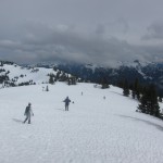
Tenquille Lake Area

Date: Aug 1-2, 2014

Participants: Fatemeh Riahi, Ali Kamali, Devin Erickson, Brittany Zenger, Geoff Zenger

Difficulty: 2

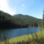
Report: Brittany has been asking to go into Tenquille Lake and do a few of the nearby hikes / scrambles for a few years now, but until last week the time and opportunity had never arisen.  Luckily, we’ve spent the last couple weeks on vacation, and what better way to spend the last couple days of it than taking some friends out for their first ever backpacking experience at a beautiful lake and with a perfect weather forecast.

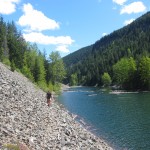
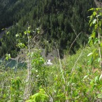
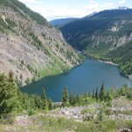
We met up at Mt. Currie coffee Friday morning at 9 o’clock, and drove off towards Birken where we took the Tenquille-Birkenhead FSR to access the area from the east.  Most of the road is in very good shape (probably want a 4×4 all the way from where you leave the Pemberton Portage road), although the last 5km or so has been deactivated and requires a high clearance 4×4.  We departed from the trailhead at about a quarter to 11, and arrived at the cabin at the west end of the lake almost exactly two hours later.  Luckily we were the first to arrive at the lake for the long weekend and had our choice of camping location.  We set up camp perhaps 200 feet from the cabin in a large open area, and sat down in the cabin to enjoy a good lunch.  The lake itself is beautiful and the view to the west is dominated by Sun God (which we ascended a few years ago, it’s easy from this angle to see how the peak got its name).

On our way we were passed by a large party of 18 mountain bikers, all on 2015 Giant Reign’s (disclaimer: I own a 2014 Giant Reign).  Apparently the group was press junket of sorts, a mix of bike company employees and journalists flown in to review the new bikes in a beautiful environment.  They had been dropped off at the head of Barbour’s valley and were making their way by Tenquille Lake in order to descend the trail down to the Pemberton Valley.  It’d be a wonderful place to bike, although I couldn’t help but notice that it would be better to bike there later in the season when it was a bit drier… some of the muddier areas near the lake looked like a war zone after all the bikes had pass through.

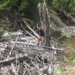
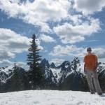
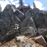
After a hearty lunch and setting up camp, we headed up to Copper Mound.  We misread the directions in Gunn’s book and thought that there would be a trail heading up to Fossil Pass from Tenquille Pass, but after hiking up to Tenquille Pass and descending a fair ways down the other side, we realized that that was not the case, and made our way up the open slopes to Fossil Pass and from there up the easy scree and talus fields to the summit of Copper Mound.  The views from the summit were excellent!  There were a couple of paragliders flying overhead, the Pemberton Valley long below on one side, and views of Goat, Tenquille, the Sampson area, Currie, Ipsoot, Rhododendron, and the peaks at the northern end of the Pemberton Icefield.  While the rest of our party wanted to lounge about on top, I wanted to bag another peak, and set off for a quick ascent of Mt. McLeod.  I moved quick and made it summit to summit in 45 minutes, took a few quick pictures, and scurried back to Fossil Pass where I arrived just a few minutes before everyone else.  From here it was an easy descent back down to the lake where we hung out and had a great dinner.  Devin tried out the plastic kayak under the cabin while dinner was being cooked, and while it made for great photos, the kayak turned out to have holes in its bottom and he ended up unexpectedly wet and joined us back in the cabin much sooner than we expected.

On the Saturday we had a slow morning eating breakfast, packing up our tents, and talking to some of the people who had arrived in the area the previous evening.  We set off with all our gear again at about a quarter to 11, and dropped all of our bags except for two small day bags just past the turn off to Barbour’s valley.  The trail up into the valley is in great shape, and following Gunn’s directions we made our way up Mt. Barbour.  The route is mostly hiking, but has a 5-10 minute section of moderate scrambling just below the summit that added to the fun and epicness of the ascent.  Just like Copper Mound, the views from the top were great, but the summit has a much more aesthetic atmosphere than Copper Mound, and there was unanimous agreement that it was our favourite peak of the trip.  We left the summit at about 2:45 and headed down to our bags and from their to the Jeep, arriving at the Jeep just past 6:30.

Two full days of hiking, but everyone survived and at least claimed to have fun 🙂  We were even down early enough to enjoy a dinner at the Wood in Pemberton before saying goodbye and bringing our vacation to an end.  Tenquille Lake exceeded my expectations with regards to beauty and ease of access and I can see why it’s so popular these days.  The only downside of the area was the massive number of biting horseflies.  I can’t wait to get back up there and ascent the peaks on the north side of the lake!  Thanks to all for the great trip!


Continue ReadingTenquille Lake Area

Lone Mountain

Date: June 7, 2014

Participants: Sergii Bogomolov, Geoff Zenger

Difficulty: 2/3 (Short sections of moderate scrambling)

Report: Hiking the Lightning Lakes trail in Manning Park out to Thunder Lake has been on my list for some time, but Manning Park always seemed like a long ways to go for just a lake hike… Luckily, a couple years ago I noticed a peak called “Lone Mountain” in Beckey’s guidebook to the north Cascades, and I decided that any trek I did out to Thunder Lake should include an ascent of Lone Mountain, located on the SW side of the lake.  I posted a trip a while ago on the BCMC schedule and had some interest from a few people, but by the date of the trip, everyone had bailed except for Sergii, and on a nice Saturday morning we met up near my place in New West and drove out to Manning Park.  In the end I’m glad that there were only a couple of us and not a larger group because the trip would prove significantly more strenuous than expected.

We started out from the Spruce Bay parking area around 9:45am, and moved quickly along the lakes trail, reaching Strike Lake camp at about 11 o’clock.  After a quick snack break we continued on towards Thunder Lake.  There was some snow on the trail in sections here, but the going was quick and we reached the end of the official trail at Thunder Lake a bit past 11:30.  We followed a little used path around the northern side of the lake up towards some waterfalls coming down from Snow Camp Mountain above the outflow of the lake.  From here we bushwhacked down the little creek to the outflow from Thunder Lake where we were happy to find a thick logjam in the river that was easily crossed, and on the other side at a quarter to 1 we stopped for a full lunch break.

There is a large talus field perhaps 100m along the lake shore from the outflow of Thunder Lake that we wanted to take up towards the ridge, and so we trekked diagonally upwards through the bush to hit it.  The dirt slopes and bush are ridiculously steep on this section, but we found our way to the talus slope and followed it upwards until it became a steep and exhausting scree gully.  The heat and scree made ascent slow, and we eventually bailed out of the scree gully to the right (north), which in retrospect was a great decision because it brought us back to a firm, open talus field that led up to the ridge.  From the topo map and Google Earth I had expected the ridge to be an easy walk, but it proved to be an alternating sequence of bushy thrashing and steep dirt, with a couple short scrambling moves thrown in.  Luckily there isn’t any serious exposure, and we eventually made our way up to where we hit snow, perhaps 100m below the summit.  The snow line was surprisingly high, but I guess it’s a big cooking bowl around Thunder Lake that traps heat.

We reached the summit of Lone Mountain around 2:45, and sat down for a long break.  The view of Hozomeen from the top is amazing.  There is probably no better vantage point possible of the group and all three peaks are visible.  There are also good views over to the Skyline trail that crosses from Lightning Lake to the Skagit River, but otherwise the summit is quite unremarkable as it is lower than almost everything else in the area.  Tired and out of water, we departed the summit a bit before 3:30 to thrash back down to the lake.

We were back down at the lake at about 4:50, and after a quick break, decided to bushwhack horizontally along the lake edge to take the lower trail along Thunder Lake back to the main trail.  Big mistake!  It took us 40+ minutes to thrash through the thick alder and other foliage.  We really should’ve just followed the creekbed back up to the upper trail.  Nonetheless, we persevered and made our way back to the main trail, where we eventually found a good creek that we could refill our water from, and made the long trudge back to the car, which we finally reached at 8:20.  10.5 hours round trip!

In the end, am I glad I went to Lone Mountain?  Yes, I am.  But I am definitely never going back there again.  After doing the trip it’s clear why it’s rarely done… it’s a long ways with a lot of bush, scree, and sheer exertion to reach a very minor summit.  Regardless, it was a great trip and I have to thank Sergii for his great companionship on this mountain trek!

Continue ReadingLone Mountain

Coquitlam Mountain

Date: May 30 to June 1, 2014

Participants: Geoff Mumford, Brittany Zenger, Ed Zenger, Geoff Zenger

Difficulty: 2 (with class 5 bush!)

Report: Coquitlam Mountain is a peak that you can see from much of the Lower Mainland, but is seldom climbed.  Why is that?  Could it be that an ascent requires over 2700m elevation gain?  The worst bushwhacking I’ve ever encountered with tricky routefinding?  Has to be timed just right for conditions to be any good?  Or all of the above?

Aware that we’d be in for a long and strenuous trip, but unaware of just how long and difficult the trip would be, we met up late Friday afternoon and started the trudge up Burke Mountain around 5pm.  We had a bit of difficulty finding the right turnoff to take to find the Burke ridge trail and wasted about 15 minutes by turning off too early only to find ourselves at an old abandoned cabin and having to go back to the main road to find the correct trail higher up (see photo below for what the correct trail looks like).  Nonetheless, by a few minutes past 7 we had found the correct trail and headed up towards the ridge.  We first hit snow about 40 minutes from the start of the trail, and although in places the flagging was hard to follow, we persevered and just before 9 o’clock stopped to set up camp on a flat open section of ridge, perhaps 750m short of the summit of Burke.

Saturday morning we woke up a bit past 6, had a slow breakfast, got our acts together, and started moving around 7:20, quickly reaching the summit of Burke.  From Burke summit it was fairly easy to descend a rib and then a gully to its left down to the creek in the basin down to the N/NW, bypassing a number of cliff bands on the way.  We were lucky to hit the creek right where a large log crossed it, and we were soon across and making our way up to the low point in the ridge above (this appears as the col just below 1000m according to the topo map).  Up to here there hadn’t been much bush, and the going fairly easy, but from here we made a routefinding blunder and decided to descend straight through the old clearcut down towards Or Creek.  The top hundred metres or so had some snow and were no problem, but below was the worst bush I’ve encountered.  No joke: the worst.  Devil’s club, devil’s club, other small prickly bushes, and more devil’s club.  It would’ve been much smarter to traverse right until we hit mature forest and to descend through it down to the road below (we would later ascend via this route).  Nonetheless, we eventually made it down to an old logging road at about 11:15, perhaps 100m upstream from where an old bridge used to cross Or Creek, and sat down for lunch.

At this point we realized we were travelling significantly slower than expected, largely due to there being much less snow than expected, and soon got moving.  We quickly transitioned into our water shoes and waded across Or Creek (never more than shin deep, also Geoff M found a log across somewhere downstream to avoid wading), and travelled up the old Or Creek road to its headwaters below Coquitlam Mountain and Widgeon Peak.  By the end of the road, it was clear that there was going to be a lot more devil’s club to go through to reach the mature forest and/or snow on the ridge and Brittany wisely elected to stay put and sleep rather than wade through more bush.  Starting around noon, we headed diagonally upwards to the ridge (it would be better to stay low and traverse horizontally to the mature forest as quickly as possible), up the ridge to the left of the main creek, until it reached a large open basin to the right, and traversed left to avoid a cliff band and continue up the ridge.   It took us well over an hour to ascend the roughly 200m until we finally hit snow.  In a good snow year this would’ve taken perhaps 20 minutes.  Note that at one point someone flagged a good route up the ridge to the alpine, but the flagging has largely disintegrated and is useful only to the extent that when it is occasionally seen it can be used to affirm your routefinding decisions to that point.

From where we hit snow to the summit was quick and straightforward, and we finally reached the summit at 2:20pm.  7 hours from leaving camp.  The views from the summit were much better than I anticipated, as Coquitlam Mountain is actually quite prominent.  There are great views of Judge Howay, Robbie Reid, the Five Fingers area, Golden Ears, and the Lower Mainland!  Unfortunately, we realized we had a long ways back to camp and didn’t wait long on the summit.  Luckily, descending on snow is quick, and we made it back to the end of the Or Creek road by 4pm.  It’s really too bad that there’s no vehicle access up Or Creek because if you could convince someone to let you drive up there, from where the bridge is out to the summit and back would be an excellent 4 to 5 hour long round trip hike if done early season on snow or if someone brushed out a route through the bush.

With our learning in hand from the mistakes made on the approach to the mountain, the return to camp was slow, but slightly less bushy than our trek in the other direction.  We ascended through the trees climber’s left of the clearcut back to the intermediate ridge between Or Creek and Burke Summit, reaching the ridge approximately 60m higher than necessary, but with significantly fewer scratches than we would’ve otherwise incurred.  From here it was a bushy descent down to the basin below Burke, and a long slog back up again.  We finally reached Burke summit again around 8:30 where we ran into some other campers who were surprised to see us appear up the ridge so late in the day, and after a brief chat with them finally made it back to camp at 9.  What a long day!  Between 1700m and 1800m elevation gain (on the day),  a good amount of cross country travel, and by far the worst bush I’ve ever encountered.  I was exhausted and had little appetite so after a bit of soup went straight to sleep.

We rose late Sunday, enjoyed the beautiful sunny morning, and slowly packed up camp to get moving a bit past 9am to descend back down to our car parked near the gun club below.  The descent was easy and uneventful, and to make things a bit quicker rather than trudge down the road we descended down some bike trails like Sandinista and Deliverance to shorten our descent.  We reached the car again right at noon, fully exhausted from a long trek.  It was a good trip, but I’m never doing it again.

Lessons Learned:

  • Go when there’s snow.  With snow cover down to Or Creek (~800m, sheltered), the trip to and from Burke summit would probably be around 3 hours quicker and substantially less painful.  Some people have found ideal conditions in early June in high snow years but this year we were probably 3-4 weeks too late for good travel conditions.
  • When descending from the low point in the ridge in between Burke Summit and Or Creek, head into the mature forest to skiiers right.  Horrible, horrible bush is to be found by descending straight down.
  • If you do happen to hit bush and not snow at the end of Or Creek, stay low and travel to the mature forest to the north as quickly as possible to minimize bush.  The forest nearer the creek is reasonably open in comparison to the surrounding bush.
Continue ReadingCoquitlam Mountain

Mt. Outram

Date: May 24, 2014

Participants: Brittany Zenger (organizer), Paul Ng, Doug Bull, Maria Poechaker, John Blair, Britt van Rooij, Gusta van Zwieten, Rob Janousek, Geoff Zenger

Difficulty: 2 (trail and snow-walking, very long)

Report: After our unsuccessful attempt on Mt. Outram in early May a couple years ago, Brittany had unfinished business with the mountain, and posted a trip on the BCMC schedule to make another attempt.  The forecast for the day was only so-so but 9 of us were undaunted and made our way out to the western edge of Manning Park to march up towards the summit.

We started out on the trail at around 9:40am, and I was pleasantly surprised to find that someone has done substantial work on the trail in the past couple years.  The trail is in good shape and was easy to follow until we hit snow, just before the crossing of 17-mile creek (perhaps 150 metres higher than where we hit snow two years ago).  There are still a few good snow bridges over the creek, and so we had no difficulty getting over despite the rushing torrent below.  We crossed the creek right at noon, and once across the creek, we lost the markers, but as the trail just switchbacks up the ridge, we chose to ascend straight up, and popped out into the open (snow-covered) meadows just metres from where the trail does so.  We stopped here for a lunch break as the 4 hour mark of our trip ticked by, and then proceeded up the snow covered ridge to the main summit.  Generally the snow quality was good for foot travel, but in places was simply terrible, and the party members who had lugged snowshoes up were glad to have done so.  Even from the meadows it’s a surprisingly long ways up the ridge, but we finally made it to the summit a bit before 3:30, for a total ascent time of about 5:45.  Success!

Unfortunately, the views from the summit were very limited due to cloud and occasional fog, and so we couldn’t see much of anything, but we were all happy nonetheless to have made it all the way up (more than 1800m elevation gain!) and after a quick break started the long trek down.  The snow quality was even worse on the way down, and in people were postholing all over the place until we descended far enough to reach firmer snow.  This wouldn’t have been too much of a problem except that it resulted in a couple tweaked knees, which would lead to the rest of the descent being much slower than anticipated.  Lower down there were great glissading opportunities until we picked up the trail again just a bit above 17-mile creek, and from there it was a long slow journey down the trail as knees were nursed and the long grind of the day took its toll.  The last of us made it back to the parking lot a bit before 8:30pm, and we packed up as quick as we could to go enjoy some food and drink in Hope.

Thank you everyone for coming out!  It was a great trip, both long and rewarding with great company.  Thank you to Brittany for organizing!


Continue ReadingMt. Outram

Victoria Day Weekend Hikes

Dates: May 17 & 19, 2014

Participants: Brittany Zenger, Geoff Zenger

Difficulty: 1

Report: With a poor weather forecast, we decided to stay in town this long weekend, but all three days ended up having great weather, and so we ended up doing two hikes on the Saturday and the Monday, with an intense day of mountain biking in between.

On Saturday, we hiked the Tikwalus Heritage Trail, formerly known as the First Brigade Trail or 1848 Trail (103 hikes #82).  It turned out to be a really nice hike for this time of year.  We left the car at around 12:30pm, and made our way up the recently improved trail.  The trail has seen extensive work done in recent years and now features excellent signage, good viewpoints, and many informational sign boards along the trail teaching the history of the trail and the people who built it and used it.  The campground at the far end of the trail is in great shape as well for anyone wanting to camp up there.  We took it slow, had a nice lunch break, and wandered out on the bluffs trail past the normal turnaround point (the campground), and still made it back to the car before 5, for a total round trip time of 4.5 hours.  Recommended!

On Monday, it was pouring rain all morning so it didn’t look like we’d be likely to get out, but around noon it started to clear up and we decided to check out the old Ford Mountain trail in the Chilliwack valley.  We were able to drive up to just a couple hundred metres before the uppermost trailhead (you need some aggressive 4×4 driving to make it up the last little bit), and headed up the trail.  The trail is in really good shape right now with just a little bit of snow right near the summit, and although the higher peaks were socked in the clouds, the views from the summit should be marvellous on a sunny day.  Total round trip time from where we parked was 2 hours, 20 minutes, with an approximately 30 minute break on the summit.  It’d be a fine little hike to introduce people to hiking in the valley.


Continue ReadingVictoria Day Weekend Hikes

Anif Peak & Mt. Mulligan

Trip Date: March 23, 2014

Participants: Ed Zenger, Geoff Zenger

Difficulty: 2/3 (steep near the top of Anif)

Report: With a few trips to Alpen Mountain under my belt in the last few years, the time finally came last Sunday for a trip to nearby Anif Peak and Mt. Mulligan, both just SE of Squamish.  A small storm had rolled through town on Saturday and so we were hoping to do a short day trip to explore a new area and get some good turns.  All requirements would be satisfied.

We left New Westminster around 8:30 and made our way up towards Squamish and turned at the apron parking lot to head up the Mamquam FSR.  The turn off for Mt. Mulligan is about 6.8km from the highway, and can be identified by some concrete blocks from an old gate on either side about 10m up the road along with a small sign saying that the road is deactivated (note: there is another turn off to the right a couple hundred metres earlier on the Mamquam FSR.  Ignore this one).  We were able to drive about 1.8km up this road to a branch in the road where active logging is under way and where there was too much snow for us to continue.  We parked here and headed up the left hand branch, which would in turn lead us up towards Anif and Mulligan.

Not more than 10m up the road, however, we encountered a young couple putting chains on their 4-runner who offered to give us a lift up as far as their truck could make it!  We helped them sort out their chains, get them on the tires, loaded everything into the truck, and drove up the road another 100m before the road became impassible due to deep snow, thus saving us approximately 30m of climbing in exchange for only 45 minutes of effort.  Not quite worth it, but we appreciated the thought nonetheless.

We started up the road at 11am, and by sticking to the main road and not taking any branches, an hour and a half later found ourselves heading into the valley that divides Mt. Mulligan (to the north / left) and Anif Peak (to the south / right).  The snow in here was really sticky from the sun and I had forgot my skin wax at home.  There are some great looking runs off of the shoulder of Anif Peak back into the valley, but we wouldn’t be tackling them today.  At the end of the valley we zig-zagged up to the col between Anif and Mulligan and turned to the right to ascend Anif Peak.  The ridge up Anif Peak consists of a number of benches with surprisingly steep steps (45 degree+) in between.  They aren’t particularly long, and there isn’t any significant exposure, but it is something to keep in mind.  Finally, just a few minutes after 2 we climbed to the top of the last step and made the quick jaunt over to the true peak, just a minute or two south of the false summit.

The views from the summit of Anif were great for the first few minutes, with excellent views of Habrich, Alpen, the Sky Pilot group, Watersprite and Mamquam areas, and so on.  Unfortunately, a few minutes later clouds rolled in over Sky Pilot and Garibaldi and the views disappeared.  So, after a break for lunch, it was time to ski back down to the Anif-Mulligan col and head up Mulligan as well.  The skiing on the ridge was just fantastic!  Great powder, great angle (unfortunately not very long).

We found ourselves putting our skins back on just before 3 o’clock and headed up the south ridge of Mulligan.  The ridge has quite dense trees low down which made trail breaking tiring, and it was here that the fact that I was out at a friend’s stag the previous night hit me… the ridge seemed to go on forever even though the total elevation gain is less than 200m.  We finally reached the summit of Mulligan a bit before 4 o’clock and both agreed that we were really happy that we went up Anif first because the summit of Mulligan isn’t much more than a rounded forested bump.  Luckily, it has a good ski run down its Northwest ridge, which we followed to a large clearing (with mega sun crust) that led us back down to the road.  The road was fast and we made it down in one piece for a total round trip time of 5:45.  Not bad for two peaks and around 1200-1300m total elevation gain!

The route ended up being a lot more interesting than I imagined it would be ahead of time and would definitely recommend it for people looking for a good day out not far from Vancouver.  You won’t see many crowds, and there are enough runs off of the side of Anif to keep someone with sufficient energy interested for a few laps.


Continue ReadingAnif Peak & Mt. Mulligan

Alpen Mountain 2013

Trip Date: Dec 7, 2013

Participants: Chris Barton, Michele Cohen, Alison Coolican, Jaine Hnik, Rob Kay, Jana Kralikova, Alex Le, Dave Robertson, Pavel Stech, Goran Vranic, Geoff Zenger

Difficulty: 2

Report: Another December, another trip to Alpen Mountain.  Alpen is one of my favourite early season trips due to the first part being entirely on logging road and so you can always drive right to the point where you can start skinning.  For a detailed description of the route, please see one of my trip report from 2011 here.

The Whistler alpine forecast for the date of the trip was for temperatures down to -21 in the alpine and it hadn’t snowed in weeks, so we were all a bit nervous about we would encounter on the route but headed up towards the mountain nonetheless.  I went to Alpen in December 2011 and December 2012 and in those years we were able to start skinning from around 550m and 450m, respectively.  This year however, we were able to drive up to 1050m, shaving at least 4.5km off of the distance that I had to cover in previous years.  This would make for a short day.

The ascent took us just a bit over 3 hours, including a snack break at the snowmobile hut.  Up to the hut there was very little snow and in a few places there weren’t any great lines to ascend through the trees, but not far above the hut the snow became deeper and to our pleasant surprise, it was remarkably light powder!  No ice to be found at all despite how long it’d been since it last snowed.  Even better, the sun was beating down all day and there was no wind, and so even though it was around -10 degrees on the summit, everyone was happy to spend the better part of an hour on top before starting down.

Once we were down to where we left our skis below the summit, the next part of the descent was through really nice powder, and we found a route through the trees back to the road that only involved a couple minutes of bush-bashing.  The road was quick to descend as always, and we were packed up and heading back down the road before 3pm.  In all, it was a surprisingly good day of touring and skiing!  Thanks to everyone who came out!

Continue ReadingAlpen Mountain 2013

Mt. Artaban & Burt’s Bluff

Trip Date: Nov 11, 2013

Participants: Geoff Zenger, Brittany Zenger, Ed Zenger + a BCMC party of another 12 people

Difficulty: 1

Report: A few weeks ago I chose to roll the dice on Vancouver’s November weather and put a trip on the BCMC schedule a traverse hike up and over Mt. Artaban on Gambier Island.  At an elevation of only 615m and requiring a water taxi to get to, Mt. Artaban isn’t the kind of place I’d be likely to head on a summer weekend, but it seemed like it could be a great place to head for an off-season hike.  I was right 🙂

We departed Sunset Marina just after 9am on Rembrance Day, and by 9:30 were standing on the Halkett Bay dock.  This wasn’t where we expected to be dropped off (it turned out that we actually thought we were going to Halkett Bay Marine Provincial Park, not just Halkett Bay), but after a few wrong turns and with the friendly assistance of a woman working at Camp Fircom, we found the trail heading towards Mt. Artaban and headed up.  The trail up Mt. Artaban is well marked and in good condition, never too steep and generally very pleasant.  Despite having 15 people in the party we didn’t have any trouble getting up, and were all on the summit by 11:15 enjoying the great views of the peaks above Lions Bay while enduring the blustery summit winds.

Although we had originally thought of spending a long time on the summit, the wind was too much for us and at a quarter to noon we decided to descend towards Brigade Bay to the north of Mt. Artaban.  This trail isn’t in as good shape as the trail up from Halkett Bay, but it is still easy to follow and in an hour we found ourselves back down at the water.

At this point it was only nearing 1 o’clock and we still had 3 hours to make our way over to Camp Artaban where we were scheduled to be picked up at 4pm, and so the group consensus was to try and also hike up the trail to Burt’s Bluff.  On the Gambier Island trail map the Burt’s Bluff trail looks like it’s about 250m long with 100m elevation gain and marked with green markers.  In reality, the green markers are only green on the backside and have been sun-bleached to blue/teal on the front and the trail ascends over a couple kilometres to about 450m.  That said, the view from the top is great and if you’re doing this trip I highly recommend heading up there as well.  We reached the top just before 2:30 and after a very quick break turned around to make our way down and to Camp Artaban.

Down on the main trail connecting Brigade Bay to Camp Artaban, we headed towards Camp Artaban and despite some confusion over where exactly Camp Artaban was that could have easily been avoided by looking at Google Earth before the trip, we eventually found our way to the dock at the camp with a comfortable 10 minutes to spare before our scheduled departure time from the island.  In all, a great day and a great off-season trip.  Thank you to everyone who came along!

Disclaimer: Leading Peak on Anvil Island remains my favourite Howe Sound Island hike by a significant margin.

Continue ReadingMt. Artaban & Burt’s Bluff

Mt. Brew (Sea-to-Sky)

Trip Date: Oct 5, 2013

Participants: Wayne Pattern, Christian Molgat, Steve Pollack, Alison Coolican, David Puddicombe, James Lamers, Brittany Zenger, Geoff Zenger

Difficulty: 1/2

Report: Our original plans to head up Cypress Peak scuttered due to a large amount of fresh snow falling in the days before this trip, I looked at a map and changed destination to Mt. Brew, which we ascended via the “winter route” trail and whose trailhead lies only a couple km away from the Cypress Peak trailhead up the Roe Creek main.  The last 1.5 km or so to the trailhead require a 4wd vehicle due to the steepness and looseness of the road, but was otherwise drivable by one of our party member’s Honda Accord.

We departed the trailhead just past 10am under low overcast skies, and after about 30 minutes hit both snow and fog.  Up to Brew Lake the snow was firm enough to be easily traversable without snowshoes, but past the lake those of us who brought snowshoes were very grateful to have them as the rest of the party spent much time postholing in the boulder fields on the route towards the Brew Hut.  On the way up we caught up to a VOC work party led by Roland Burton heading in to replace some windows in the hut, and after this, eventually reached the hut at about 12:40, where we stopped to enjoy a nice lunch in the fog.

We departed the hut for the summit of Mt. Brew at 1:10, and made it to the summit in no time as we were standing on the top at 1:30, once again in total fog and without any views whatsoever.  Bored by the whiteness, we didn’t stay long and soon started on our way down to the cars, which we arrived at before 4pm, making for a very relaxed trip of less than 6 hours.  The terrain in general is very mellow and the trail is pleasant enough, it’s just too bad that we couldn’t see a thing at all for the entire day.

Continue ReadingMt. Brew (Sea-to-Sky)

July Mountain

Trip Date: Oct 14, 2013

Participants: Brittany Zenger, Ed Zenger, Leslie Zenger, Nancy Zenger, Geoff Zenger

Difficulty: 2

Report: How better to celebrate Thanksgiving than to climb a beautiful mountain with your family?  Thanksgiving Monday 2013 saw my mom, dad, and sister come out with Brittany and I to the Coquihalla to head up July Mountain.  We met up in New Westminster a bit past 7 and headed out towards the Coquihalla, and after breakfast in Hope and a mixup where we missed our turnoff on the highway and had to turn around to go back to the road up Juliet creek, we eventually made our way up the road and left the Jeep where we first hit snow, a 20 minute walk from the normal trailhead, starting up the the road at 10:30.

That we hit snow so low surprised us slightly given how warm the temperatures had been lately, but snow lingers easily down in the valleys and north facing slopes that this hike ascends.  It wasn’t contiguous immediately, but soon became reasonably deep and we had no footbed to follow most of the way up to Drum Lake, which we reached just before 1pm.  Here we stopped for lunch and then headed up the slopes to the right (West) of the lake, hitting the col due north of the summit of July Mountain and here made our only real routefinding error of the day.  Rather than heading up the easy snow slopes to the right of the ridge (which we would later descend), we instead scrambled up and left through an icy rock band to hit the ridge a good 10m earlier than we would have had we just followed the easy route.  Nonetheless, we persevered and made it up onto the ridge, upon which the travel is easy and we quickly made our way to the true summit of July Mountain, reaching it before 2pm, only around 45 minutes from the lake.

The views on the summit were fantastic and it was great to see the snowy wonderland all around us despite the temperatures hovering in the t-shirt range.  July Mountain is the highest peak for quite some distance and there were great views of the Anderson River Group, the area around Coquihalla Mountain, and even as far away as the Old Settler and Mt. Urquhart.

We lingered on the summit for half an hour before starting our descent, which was quick (only 30 minutes) down to the lake, and less than 2 hours from there down to the car.  Total round trip time was just over 6 hours, so the 103 hikes time estimate of “allow 6 hours” would be easy to achieve by any party moving at a moderate pace provided that they were able to drive to the trailhead.  In the end, I was very impressed by this hike.  The setting is fantastic, and the route varied and interesting.  In fact, it may well be one of my favourite hikes from 103 hikes.

Continue ReadingJuly Mountain