Blanshard Needle

Trip Date: July 7, 2012

Participants: Jeff Ross (organizer), Brittany Zenger, Geoff Zenger + 6 more BCMC members

Difficulty: 4.  Mostly a stiff 3rd class, with one short pitch of low-5th climbing.

Report: Easily visible and prominent from many parts of the Lower Mainland, including from the river shore in front of my place in New Westminster, Blanshard Needle has been on my to-do list for a couple years now, but until just a couple days before this trip was scheduled to run I still had no idea when I’d have an opportunity to tackle it.  However, a fortuitous series of events led to Brittany and I signing up for the trip at the last minute and on a beautiful warm Saturday morning we found ourselves driving out to the Golden Ears West Canyon trailhead.

Our party gathered at the trailhead and departed around 8:30.  The first couple km of the route follow the regular west canyon trail towards Alder Flats, but just before the crossing of Evans Creek, there is a trail that heads off into the trees on the left.  The Evans Creek trail is in great shape and was easy to follow, and we made quick time following the trail to its end where it dumped us out onto the creek bed at the bottom of the basin below Blanshard and Edge.  From here, we proceeded to take the wrong route as we followed the obvious, wide creek bed up towards Edge.  Luckily, Jeff didn’t take too long to realize that the route didn’t feel right, and we backtracked right back to where the trail ended at the creek, and found the correct route to follow.  Immediately after making it to the creek, you have to turn left to follow another (smaller) creek bed (there is flagging if you look carefully) up towards Fly’s Gully.

Even in early July, Fly’s Gully was snow filled right down to the bottom, and most of us put on our crampons (even with the summer heat, the gully faces NE and doesn’t see much sun) to ascend the 35 degree gully.  We topped out of the gully at around 12:30, dumped our crampons and ice axes, and followed the easy ridge from the Alouette-Blanshard col up to the base of the needle itself.

At the base of the needle, there is one short pitch (perhaps 12m?) of low 5th climbing that I’m sure some people would be willing to climb unroped, but not me.  Jeff led the pitch in fine style, and by having a few people top rope on the same rope at the same time, it didn’t take long for everyone to make it up the pitch.  From the top of the pitch, it is generally straightforward to find the route up to the false summit, although some of the flagging has fallen away.  From the false summit, we made a very short descent into the notch between the two summits, and although some reports have mentioned the exposure of crossing the notch, I thought it was less bothersome than on other parts of the route due to the ease of crossing the notch (similar to the summit ridge of Mt. Brunswick).  Once across the notch, it is only another few minutes of scrambling up to the main summit.  In all, the route has one pitch of low-5th climbing, followed by a consistently steep (and in places exposed) 3rd class scramble right up to the summit.  It was some of the most enjoyable scrambling that I’ve ever done.

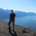
We arrived on the summit around 2:30, and the views were amazing in all directions.  The local peaks such as Golden Ears, Edge, Robie Reid, Judge Howay, and Crickmer were all clear, as was Alouette just to the south of us where we could see a few hikers arriving on its summit.  Further away, we could make out details on Sky Pilot, Baker, and Slesse through the clear air above the haze below.

We departed the summit a bit past 3, and downclimbed the same route that we ascended to the 5th class pitch, which most of us rappelled.  Putting the crampons back on it was a quick and easy descent down Fly’s Gully, with a few of us having some accidental self arrest practice sessions on the softening snow. We did have a scary incident near the bottom where a couple of bowling ball sized rocks came loose from above and careened down the steep gully, narrowly missing some of our party members! From the base of the gully we made good time down the Evans Creek and West Canyon trails, and reached our cars at about 6:45.  A truly fantastic trip!  Thank you Jeff for organizing!

Continue ReadingBlanshard Needle

Leading Peak (Anvil Island)

Trip Date: May 12, 2012

Participants: Geoff Zenger + a party of 12 BCMC members and guests

Difficulty: 2

Report: For years I’ve been looking out the window on the drive to and from Squamish and gazing at the peak on Anvil Island.  This spring I decided to do something about it, contacted the bible camp on Anvil Island to find a good weekend to land on their property, chartered a water taxi, and posted a trip on the BCMC schedule.  In the end, 12 people signed up for the trip.

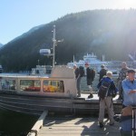
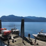
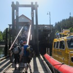
To save on parking costs in Horseshoe Bay, we met at St. David’s at 8am, dropped off most of our vehicles, and quickly made our way down to Horseshoe Bay where we caught a chartered water taxi operated by Mercury Launch.  Without any hassle we loaded onto the water taxi and promptly set off for Anvil Island at 9am, arriving there at 9:30.  The water taxi has quite a racket going, with a minimum fee, but no discount per person, and at $25/person each way, they reaped $650 from us for 2 hours of work. At least it’s still cheaper than buying our own boat… Once at the bible camp, we had little difficulty finding the caretaker to pay the $25 fee to use their dock and drop off our signed waivers to cross their property, and set out on the trail proper around 9:45.

The trail up to Leading peak is generally in very good condition, is well marked, and the terrain varied.  On the way up we stopped at the “white spot” (some sort of navigational aid?) viewpoint to take photos and then again at a little lake for lunch. There are a couple short scrambling steps near the summit, but without any exposure, and these were quickly navigated. Despite our relaxed pace on the ascent, the last of our party reached the summit just past 12:30 (with the first people reaching the summit perhaps 45 minutes earlier).  

Our party spread itself wide on the summit rocks and the heli-pad, and we took our time to lounge about in the hot sun.  The views were excellent, with Garibaldi, Sky Pilot, Ledge, the other Howe Sound islands, and the western-most North Shore mountains all visible.  As we had a hard deadline to return to the camp to catch our return water taxi, we couldn’t sleep all day on the summit however, and started making our way down a bit before 1:30.

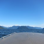
The descent was straightforward and uneventful, and everyone made it back to the docks by 3:42, just in time to catch the water taxi, which was scheduled to leave at 3:45.  The weather remained fantastic and most of the party lazed on the back of the water taxi as it carried us back to Horseshoe Bay, enjoying the great views all around.

Climbing Leading peak requires more effort than heading to the summits on Bowen or Gambier Island, but the effort is rewarded with a more interesting trail, a nicer summit, and better views.  I think that all of us would agree that was an excellent destination for a sunny spring day.

Thanks to everyone who signed up and came out. It was an excellent day all around!

Continue ReadingLeading Peak (Anvil Island)

Charles Mann’s 1493

I read Charles Mann‘s fantastic book 1491 a few months ago, and was greatly impressed by its description of the deep cultural diversity of the American peoples and civilizations before their first encounters with European explorers.  From this experience, I was excited to have the opportunity recently to read his follow up work, 1493: Uncovering the New World Columbus Created. While not at the same level of quality as 1491, it is still an eminently worthwhile read.

The two concepts key to 1493 are the “Columbian Exchange” (the extensive worldwide trade networks that quickly grew following the discovery of the New World) and the “Homogenocene” (the era of history in which humanity has connected the biological world).  Through a series of in-depth looks into examples of these concepts, from how Spanish silver became the currency of the Chinese economy, to how the importation of potatoes from South America to Europe helped end centuries of malnutrition among Europe’s peasants, Mann uncovers interesting insights into how rapidly the discovery of the new world affected humanity around the world.

Unfortunately for Mann there are so many examples of the Columbian Exchange possible that it is impossible to cover them all.  In the end, I was left feeling like I’d learned about a number of interesting and insightful examples of the exchange but didn’t feel like I’d learned much that substantially deepened either my understanding of the modern world or of humanity itself.  It is in this way that 1493 fails to live up to the standard of 1491.  In no way does that imply that this isn’t a book worth reading.  It simply means that this book can only be considered interesting rather than essential.

Continue ReadingCharles Mann’s 1493

Mt. Lincoln

Trip Date: April 22, 2012

Participants: Brittany Zenger, Geoff Zenger

Difficulty: 2

After a hard Saturday of labour on my granddad’s farm, Brittany and I had a free Sunday to work with.  We had originally intended to go ski touring in the Squamish area, but the forecast was significantly better out in the Fraser Valley, and so we decided to head out for one of the low-elevation 103 hikes that we hadn’t done before and set out Sunday morning for Mt. Lincoln.  It was a pleasant drive out to Hope in the morning, and we made our way to Yale, where we had no difficulty finding the proper parking area and setting out from the car at around 10:30am.

At no point was the trail difficult to follow, although the ground was covered by a layer of moss in places and it’s clear that the trail would be in better shape if it saw a bit more traffic.  Except for a few views down to the parking area and to Yale, the ascent is entirely in the trees, and the trees are infested with ticks.  On the way up I found no fewer than 3 ticks on Brittany’s shirt while hiking behind her, and so I highly recommend that anyone hiking this trail carefully inspect themselves for ticks after returning home.

From the summit the only interesting views are of Mt. Breakenridge as well as a broadcast tower situated near the summit (and which is supposedly why the trail exists).  There is a viewpoint a few minutes below the summit that actually has a better view of Yale than can be obtained from the summit area itself.  The ascent took us a bit over an hour (definitely less than 1:15), and due to the steepness of the trail it took us a similar amount of time to descend back to the car.  By the time we reached the car, it was sweltering, with the car thermometer reading 25 degrees.  The trail itself wasn’t very interesting or enjoyable, but at least good weather had arrived!

According to the lists at the back of the 103 hikes book, the Mt. Lincoln trail has the steepest average grade by quite a substantial margin, and having done the trail, it’s easy to see why: the trail goes up, and keeps going up.  The vast majority of the trail is just steep dirt, although there are four places where hand-lines have been installed to give hikers some additional confidence where there is some exposure.  This exposure was the most surprising part of the trail to me:  there are many hikers out there who would feel very uncomfortable descending a trail this steep.

Verdict: 1/3.  It’s there, it can be done, but you probably won’t return.

Continue ReadingMt. Lincoln

Annapurna

Continuing my recent kick of reading the classics of mountaineering literature, a few weeks ago I had the pleasure of reading Maurice Herzog‘s account of the first successful expedition to the summit of an 8000m peak, the titular Annapurna.  Written in language both vivid and straightforward, Herzog details the trials, challenges, and eventual successes of a trip that set out to climb two of the world’s tallest peaks without knowing even how to travel to the base of the mountains.

After having given up on attempting Dhaulagiri, Herzog and company dedicated all of their efforts towards Annapurna, where against all odds they succeeded in climbing (eventually in near alpine-style) the mountain now known as the deadliest of the 8000m peaks and that has claimed half as many lives as have successfully reached its summit.  Although the language is occasionally stilted, Herzog has no difficulty in revealing either the deep personal motivation of the mountaineer or the great sacrifices of body and soul made in search of beauty and conquest.

It has been said that mountaineering is the art of overcoming, and Herzog makes it clear that that is what these men did, day after day, until they reached the summit and miraculously made their descent losing limbs but not life.  Nonetheless, climbing is not the only means of testing oneself and overcoming, for as he so famously concludes, “there are other Annapurnas in the lives of men”.

Continue ReadingAnnapurna

High Falls Creek

Trip Date: April 14, 2012

Participants: Brittany Zenger, Geoff Zenger

Difficulty: 1/2.  Mainly hiking, occasional use of hands, mild exposure in places

Report: On a day where we had to be in town by early evening and the snow line lingers low, we decided to head up to try the High Falls Creek trail.  I’ve been up the High Falls Creek FSR quite a few times to ski / hike Cloudburst Mountain, but I’d never previously hiked the trail that actually goes up past the “High Falls” that give the creek its name.

The day was already warm by the time we started up the trail at around 10:15am, and the trail only stays flat for a few minutes before it begins its upwards climb along the north side of the High Falls Creek gorge.  The trail itself is in excellent condition and has frequent excellent viewpoints for both the falls and gorge, as well as to the mountains across the Squamish river.

Maintaining a leisurely pace and stopping at every possible viewpoint, we had made our way out to the road at the top of the trail and finished lunch by 12:15, and so the trail itself took well under 2 hours to ascend.  From here, it was a quick 1 hour hike down the FSR and back to our car.  Surprisingly, it seems that we were the only people to hike the trail on this warm spring day.  In all, a very short day, but well worth it at this time of year if you want to find a beautiful destination while avoiding the snow.

Continue ReadingHigh Falls Creek

Garibaldi Neve

Trip Date: April 5-7, 2012

Participants: Brittany Zenger, Ed Zenger, Geoff Zenger

Difficulty: 2

After a couple years of ideas and cancellations, the weather and conditions aligned with our free time, and Brittany and I finally completed the classic Garibaldi Neve traverse from the Diamond Head parking lot to Rubble Creek.  As we only started making plans a couple days before the weekend, we had some difficulty in finding someone else with a vehicle to come with us, but in the end my dad decided he’d come with us as he had last done the traverse around 35 years previously.

We had family obligations on Easter Sunday and consequently did the traverse from Thursday evening to Saturday, and in retrospect I’m glad we were forced to this schedule.  We were the only party to cross the neve on the Friday (more on this later), but from other reports it seems that 40+ people followed in our track on the Saturday, and although the traverse would be great with any number of others around, it was that much more special to have nobody else around for much of the trip.

Thursday

Under thick overcast, my dad picked me up from work shortly after 2pm, and we made our way up to the Rubble Creek parking lot to pick up Brittany where she had dropped off our car.  At the Rubble Creek parking lot the skies were dark and it was hailing heavily.  By the time we reached the Diamond Head parking lot the precipitation had stopped, but the dark skies gave us some initial doubts as to whether we would be able to cross the neve on the following day.

We finally started skinning up the trail at around 5:30, and travelling at a relaxed pace so as to not tire ourselves out, we reached the high point on Paul Ridge just as the sun set.  Luckily for us, as we ascended Paul Ridge, the clouds had finally parted and the moon had risen, and we made it to the Elfin shelter by 9:30 without ever needing to put on our headlamps.

On the evening before the long weekend, the shelter was modestly busy, but there were still numerous beds free and after a quick snack we quickly settled in for the night with the intention of getting an early start in the morning.

Friday

We woke up well rested at the reasonable hour of 7:30, and got ready to set off.  A quick test of the snowpack outside the shelter revealed that there was over 1m of soft powder over the base, although it seemed that we weren’t going to sink in too far with our skis on.  Nonetheless, we decided to wait for a little while as another party in the shelter was intending to set off a bit later that morning to camp early on the neve, just above the Opal Cone.  We finally set off at around 9:30am.  The weather had closed in somewhat since the previous evening, with Garibaldi firmly ensconced in thick cloud, but the cloud was high enough for us to be fairly confident of making it across the neve without having to travel in a white out.

The first few hundred metres from the shelter were quick going as there was an established track heading up towards the Gargoyles, but as soon as we left the existing track, the going became tough.  Extremely tough.  With each step, whoever was breaking trail was sinking in 20-30cm in most places, and occasionally even a little more.  After an hour we had cleared a couple of the gullies on the traverse into Ring Creek, but really hadn’t made it very far, and the legs were already burning.  Consequently we stopped, waited, and after about 30 minutes of not seeing anybody else, made the decision to abandon our attempt on the neve, turn around, do some skiing above the shelter, and head back out to the car later in the day!

Not two minutes after turning around we saw the other party from the shelter following in our tracks, and when we met them, they were optimistic about their abilities to break a trail up to the start of the neve.  Another long discussion ensued between me, my dad, and Brittany, and we eventually concluded that it wouldn’t hurt to follow in their tracks for a while, team up with them to make it up towards the neve, and push off our decision as to whether to abandon our attempt until a bit later in the day.  By the time we got going again to head down into Ring Creek it was already around 11:30, and we knew that given the conditions it would be a long day still if we wanted to make it down to Garibaldi Lake that day.

Following the other party of 4 (and for a short while, a snowshoer who originally intended to head up to Opal Cone, before realizing that he had left his camera’s memory card at home), and occasionally helping break trail for them, it was a long slow journey down into and then up Ring Creek in very flat lighting that made terrain evaluation and routefinding difficult.  We reached the start of the neve well past 3 o’clock and sat down to have lunch.  The clouds had dissipated and we had a fantastic view of Garibaldi, Pyramid, and Mamquam.

The neve glistened in beautiful light as I set out in the late afternoon to break a trail up to the upper neve, and although from some route descriptions it sounds like you don’t have much further up to go once you reach the neve, the climbing seemed relentless.  We finally reached our high point at around 5:30pm, at which point we noticed that we had climbed about 100m higher than necessary and that we could have traversed a relatively flat bench lower down over towards the Sharkfin.  On the plus side, we had a short enjoyable run down the glacier that we otherwise wouldn’t have had the opportunity to ski.

The glacier near the Sharkfin had some large crevasses exposed but we were able to navigate a fairly direct route through them without any major difficulty and were quickly down in the saddle between the Sharkfin and Glacier Pikes.  Here we had a quick discussion of whether we should set up camp or continue on to see if we could stay in the Glaciology huts.  In the end, we figured we still had well over an hour before sun set, and it didn’t look like it would take long to climb up to the saddle next to Glacier Pikes and ski down to Garibaldi Lake.  The skin up to the saddle proved to be both much less steep than it looked and much longer than it looked.  Fortunately, as evening fell, the snow had crusted up significantly and I was no longer sinking much as a broke trail.  We reached the saddle in low evening light and had a gorgeous view of Guard mountain in front of us, and Garibaldi behind.

The ski down to the glaciology huts was easy and uneventful, and we were happy to see that although the smaller hut was somewhat buried and in need of being dug out, the larger hut was accessible and unoccupied.  We spent the remaining daylight and the early hours of darkness melting snow, rehydrating, and cooking some hot food in the hut.  We were all completely spent, but were extremely happy to have made it across the neve that day and with the knowledge that on the Sunday we would only have to ski across the lake and head down to the car.

Saturday

We woke up rested Saturday morning after a comfortable night in the shelter, and set out across the lake in the mid-late morning.  Rather than make a track straight towards the Battleship Islands campground, we instead broke a trail across the lake with the intention of hitting the the track leading to the Burton (Sphinx Bay) hut, which we eventually did.  From this point we would be on a well trodden trail all the way out to our car.

After a break at the end of Garibaldi Lake, we set out for our car in the early afternoon, and although I found the trail to the 6km junction quite annoying with all of the up and down, it didn’t take too long.  Due to the intense solar effect and clear evidence of solar induced avalanche activity we elected to ski down the trail rather than the barrier.  The air was warm and the first few km of the barrier trail were slushy and easy to ski.  It was only from the 3km marker onwards that the skiing became a bit sketchy, but we were able to ski right to the 1km marker, at which point we had to take our skis off and carry them down to the trailhead as the snow was extremely patchy.

At the Rubble Creek trailhead, the air was warm, the skies sunny, and the road completely covered in snow, and we were once again able to put our skis back on.  I felt sorry for the snowshoers who had to trudge another few km out to their cars, but on skis it took only a few minutes of standing (essentially no turning required) in a track to make it down to the end of the plowed road.  We had all made it down in good spirits and without any injuries, and after changing out of our ski equipment, began our journey back to the Diamond Head parking lot to pick up my dad’s car, and then to make our way back to Vancouver.

Conclusion

It is easy to see why the Garibaldi Neve is considered a classic ski traverse.  The terrain is for the most part quite easy to navigate, it is easily accessible, and the views are simply phenomenal.  By doing the neve a day before everyone else, the going was much harder than it would have been had we travelled with the hordes on the following day, but the extra effort was worth it to find ourselves in such extraordinary places without others around.  You probably already know this, but every ski mountaineer in south western BC should do this trip at least once.

Continue ReadingGaribaldi Neve

The Gargoyles

Trip Date: March 24, 2012

Participants: Brittany Zenger, Alex Le, Ed Zenger, Geoff Zenger

Difficulty: 2

Report: Obligations to friends and family kept me in town Friday and Sunday, which left us with a wonderful Saturday to make the most of.  Although we had been planning to go to Mt. Frosty (as I did on the last weekend of March last year) we made a late change of plans Friday evening after realizing that over 50cm of new snow was reported to have fallen in the Manning Park area.  Keeping things simple, we decided to head up to the Diamond Head area and just go as far as we felt like.

A reasonably early start got us up in Ed’s X-Trail to the Diamond Head parking lot at around 9am, and we were out on the trail at about 9:20, and with firm yet non-icy snow on the road, we made quick work up past the Red Heather Shelter to Paul Ridge on a well beaten track.  It was an absolutely blue bird day with not a cloud in the sky and I couldn’t help but be slightly envious of Jeff, Petr, and my other friends who were ahead of us doing a neve traverse.  Nonetheless, we had fantastic views in all directions on our way along Paul Ridge, ranging from Atwell and Pyramid to the north, the Mamquam massif to the east, and Alpen and the Sky Pilot group to our south.

Three of us reached the Elfin Lakes hut at around 12:30 (somehow my dad managed to beat us there by 30 minutes even though he was with us as we came around Round mountain…), and after eating all of my meagre supply of food (much of my lunch was left in the car) and sharing my skin wax with the grateful throng at the hut, we set out for the saddle between Columnar and the Gargoyles a bit before 1.  Within minutes of leaving the hut, the ski tracks ended, and we had to begin breaking trail.  Although the temperature was hovering around 0, the intense solar radiation was melting the snow, leaving it heavy and a real slog to break trail through.  Alex and I alternated breaking trail, which served to exhaust both of us, and we were all grateful when three locals caught up with us and broke trail for the last leg up to the saddle and from there onto the main peak of the Gargoyles, which we reached some time around 2:40.  After a short break, we descended wonderfully consistent slush and corn down to the low point below the Elfin hut, and began our skin back up Paul Ridge.

The return skin was uneventful, even with a brief detour over the sub-summits/bumps of Round mountain, but a severe lack of calories consumed left me completely exhausted by the time we came around Round mountain and were able to take off our skins for the ski down.  Luckily, Britt had half of a mushed up former sandwich in her pack that served to fuel me just enough to make it down to the car.  The road was surprisingly soft for the evening and we made a quick run down the road, reaching the car in the vicinity of 5:45pm.

In all, it was an amazing day trip with perfect weather, great views, and just enough distance and vertical to leave everybody satisfied with their accomplishments.

Rating: 3/3

(Photos by Alex Le)

Continue ReadingThe Gargoyles

Minus 148

The introduction to Art Davidson‘s Minus 148° claims that it is “one of the few true classics in the literature of mountaineering”, and having recently read it, I would happen to agree.  Tight and vivid in its description of the first winter ascent of Mt. McKinley (Denali), the book details both the varied and colourful personalities of the expedition members as well as the events of the climb itself.

Few of us could imagine the situation that Davidson, Johnston, and “Pirate” Genet found themselves in, holed up for days in a snow cave for days on end, with the windchill outside below 148 degrees, and the other expedition members below slowing being persuaded that the climbers above must be dead.  Yet despite the unimaginable suffering endured after the success of reaching the summit and the tragedies that unfolded weeks earlier on the climb, the trio managed to persevere and endure until a break in the storm let them descend.

This is a remarkable tale of human survival and victory as well as a glimpse into the mind of the climber, and why he chooses to place himself into such hardship.  This may not be a long book, but you will be gripped from beginning to end.

Verdict: 5/5

Continue ReadingMinus 148

Fischer Black

Fischer Black was an eccentric, a genius, and consistently far ahead of his time in terms of his insights and understanding of finance and the markets.  At least, that’s what I know I’m supposed to believe after having read Perry Merhling‘s biography of Fischer Black, Fischer Black and the Revolutionary Idea of Finance.  In reality, however, after reading this book I understand that he was an eccentric, but in this book, Fischer’s (he’s always referred to by his first name) genius fails to shine through.

This book does a decent job of walking the reader through Fischer’s life and describing the intellectual debates that he engaged in during his time in academia and industry.  Mehrling does a fairly good job at helping the reader understand the various sides of each debate and how Fischer’s influences parleyed their way into his beliefs.  However, he fails at revealing why Fischer’s ideas amounted to genius or revolutionary except in the vaguest sense.  Despite the apparent richness of the subject, this book unfortunately fails to rise above the level of mediocre.

Verdict: 2/5.

Continue ReadingFischer Black